XXXII. Lima, Peru


Lima, Peru
Lima, Peru — Yugal Solanki & Sonam AgarwalLima is the capital and largest city of Peru located in the country’s central coastal region. The city is a major economic and cultural center in South America and is known for its colonial architecture, museums, and historical sites. Lima is also a popular tourist destination, attracting visitors for its food, nightlife, and nearby attractions such as Machu Picchu. The official language is Spanish and the currency is the Nuevo Sol.


Population:
Urban: 10,140,000 people
Metro: 25,620,000 people
Area:
Urban: 1,846.40 km2 (712.90 sq mi)
Metro: 825.88 km2 (318.87 sq mi)
Population Density:
Urban Average: 16,754.51 people/km2
Metro Average: 11,844.7 people/km2
Politics:
Peru operates under a presidential representative democratic republic system of government. The President is elected every five years and can serve up to two consecutive terms. The President is assisted by a Council of Ministers, and the legislative branch is represented by the Congress of the Republic of Peru, which is made up of 130 members. The judiciary branch is independent and composed of a Supreme Court, Provincial Courts and Judges, and Magistrates. Lima also has an elected mayor and city council responsible for managing the city’s affairs.


Top-left: La Victoria Residential Density // Top-right: La Victoria Commercial Density
Bottom-left: Barranco Tourism Density // Bottom-right: Surquillo Street & Transportation
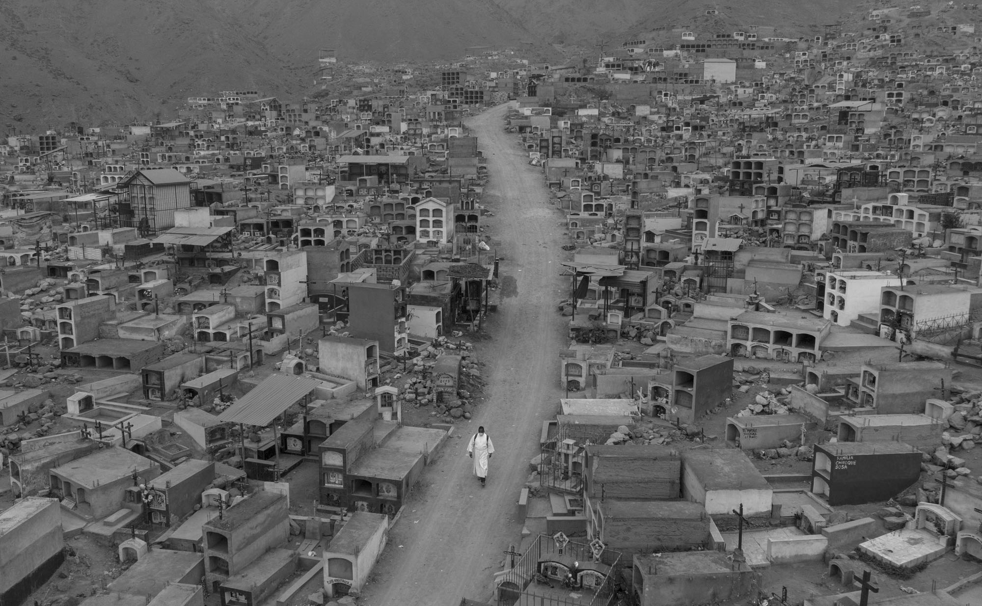
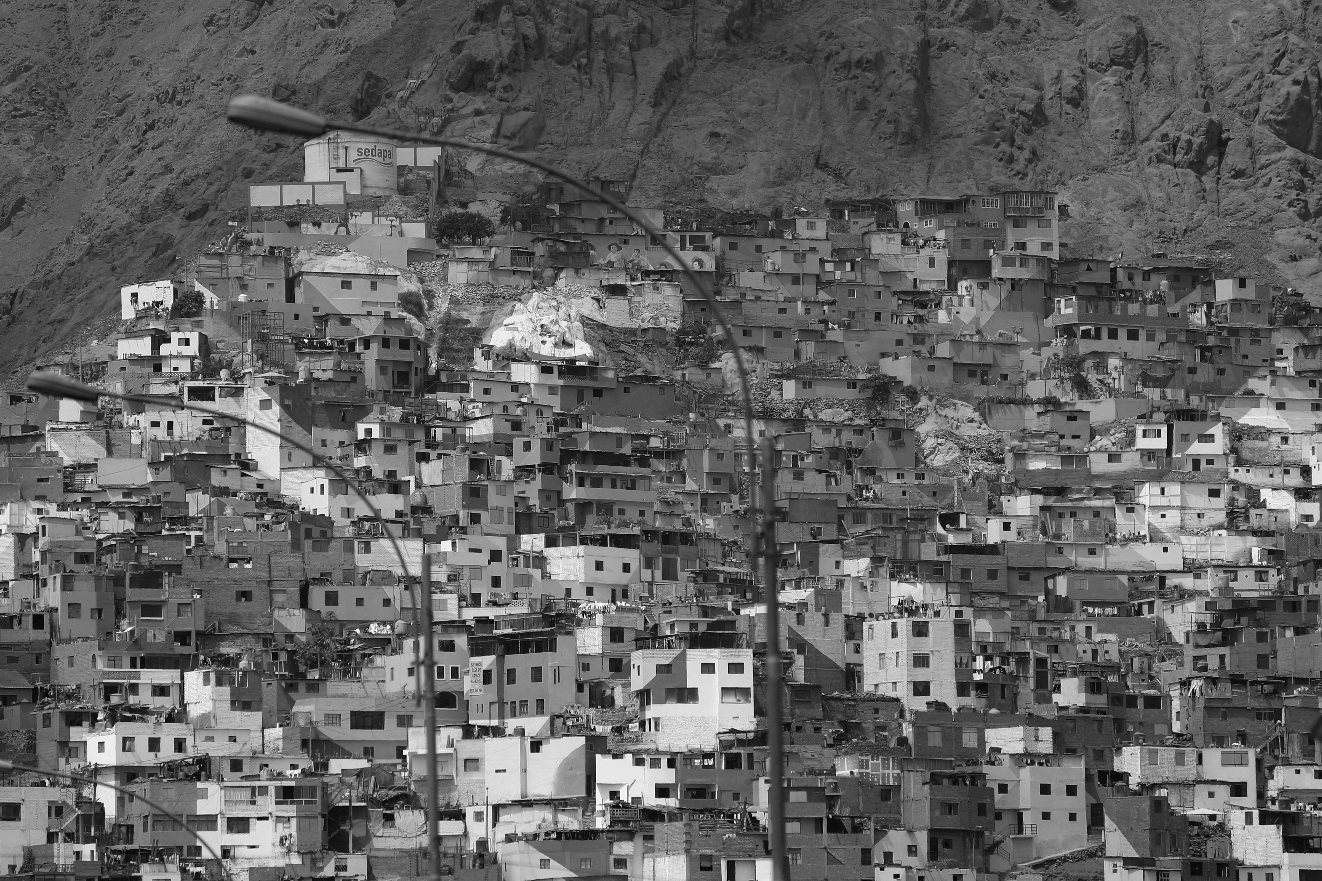
The land of Lima, Peru covers an urban area of approximately 800 km2. The terrain here is mostly flat except near the shores of the Pacific Ocean where the city slopes into steep mountains located as high as 1550 meters above sea level. In terms of its expanse, the city runs 60km from North to South and 30km from West to East. The climate here is mild, and the city of Lima is ranked as the world’s third-largest desert city after Cairo, Karachi, and Pakistan.
The city is a collage of different architectural styles having European, African, and Asian influences. Being famous for its beaches, the city is a hot spot for tourism during the summer. The city itself is divided significantly into three periods - Pre Columbian, Colonial, and Vernacular/Contemporary. The density of the city was high in the Pre Columbian and Colonial periods in terms of population. However, it was only in the Contemporary period that saw high rises with growing skylines. The transition of architecture, culture, and society through these periods is deeply rooted in the Peruvian style.
Sources:
https://perureports.com/meet-first-venezuelan-neighborhood-lima/6000/
https://andina.pe/ingles/noticia-undp-perus-human-development-index-up-60-in-16-years-775784.aspx
https://peruvias.pe/tag/surquillo/
https://www.munijesusmaria.gob.pe/jesus-maria-cumple-58-anos-de-creacion-politica/

Lima, Peru // High Density Buildig Typologies (Informal)
![]()
Lima, Peru // High Density Buildig Typologies (Formal)![]() Lima, Peru //
Means of transportation (Informal)
Lima, Peru //
Means of transportation (Informal)
![]()
Lima, Peru // Means of transportation (Formal)![]() Lima, Peru //
Traffic hubs and nodes (Informal)
Lima, Peru //
Traffic hubs and nodes (Informal)
![]()
Lima, Peru // Traffic hubs and nodes (Formal)
![]() Lima, Peru //
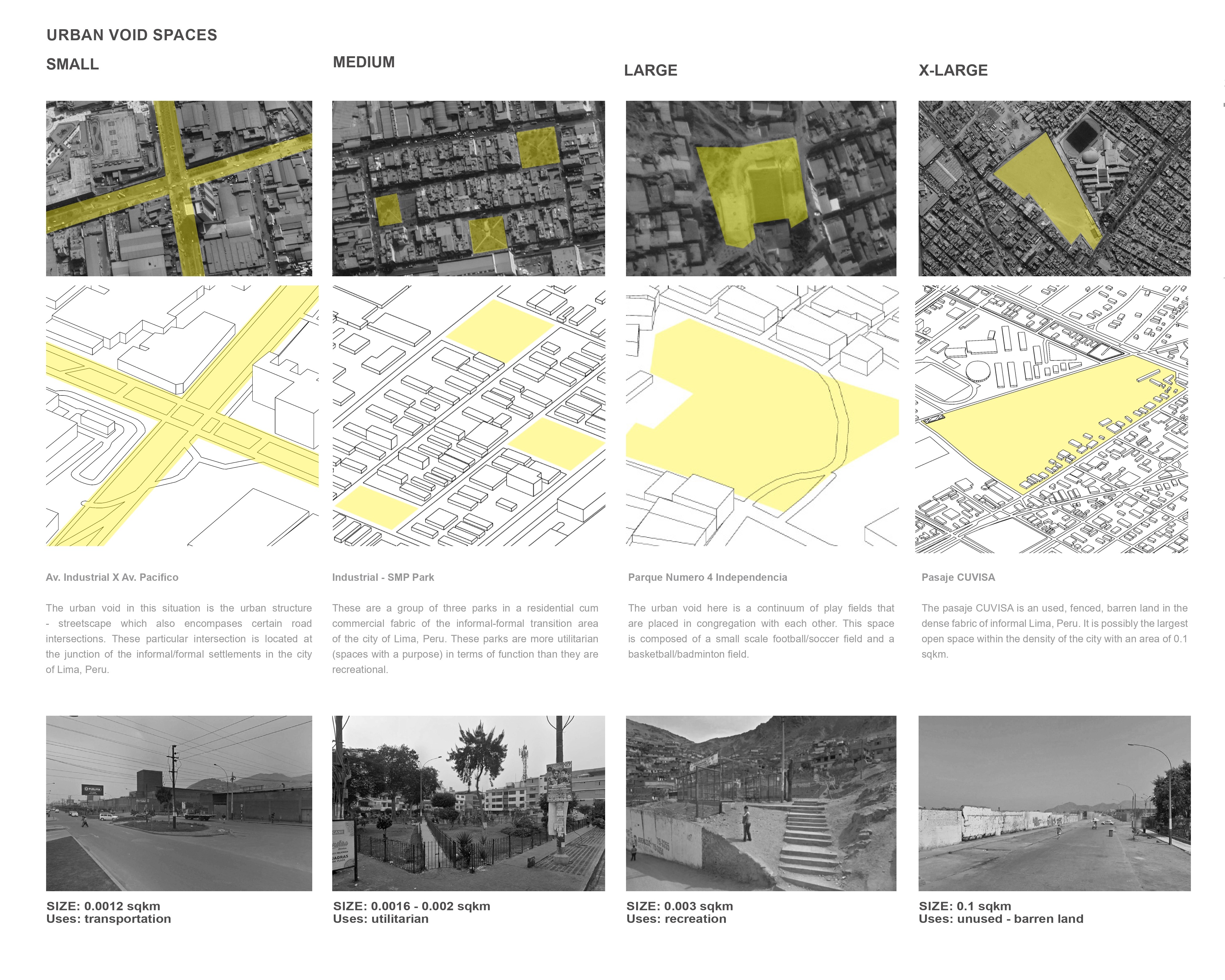
Urban Void Spaces (Informal)
Lima, Peru //
Urban Void Spaces (Informal)

Lima, Peru // High Density Buildig Typologies (Formal)
 Lima, Peru //
Means of transportation (Informal)
Lima, Peru //
Means of transportation (Informal)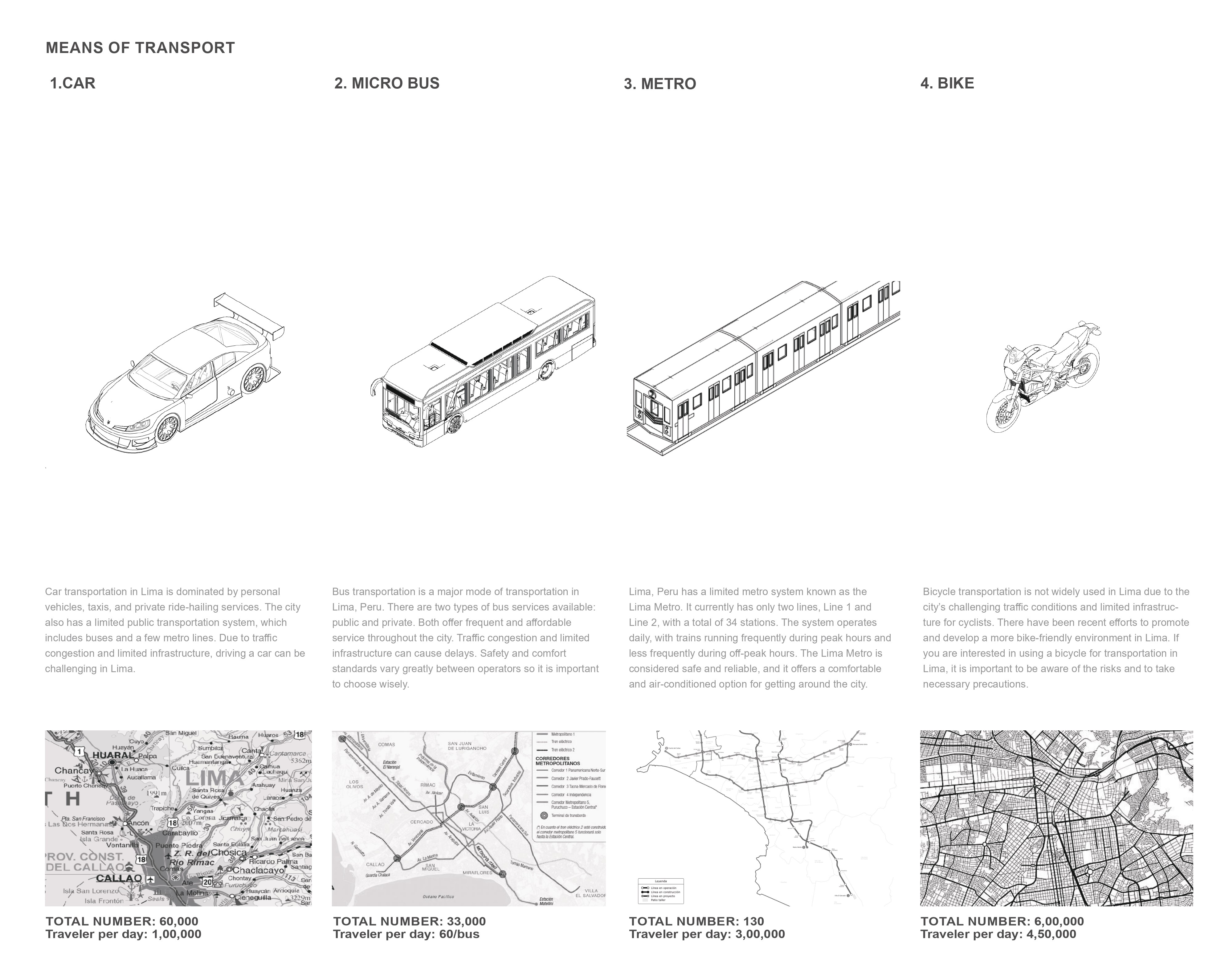
Lima, Peru // Means of transportation (Formal)
 Lima, Peru //
Traffic hubs and nodes (Informal)
Lima, Peru //
Traffic hubs and nodes (Informal)
Lima, Peru // Traffic hubs and nodes (Formal)
 Lima, Peru //
Urban Void Spaces (Informal)
Lima, Peru //
Urban Void Spaces (Informal)

Lima, Peru //
Urban Void Spaces (Formal)
Lima, Peru - Centro Histórico, Lima
Area: 0.15 km2
Population: 1800 people
Population Density: 12,000 people/km2


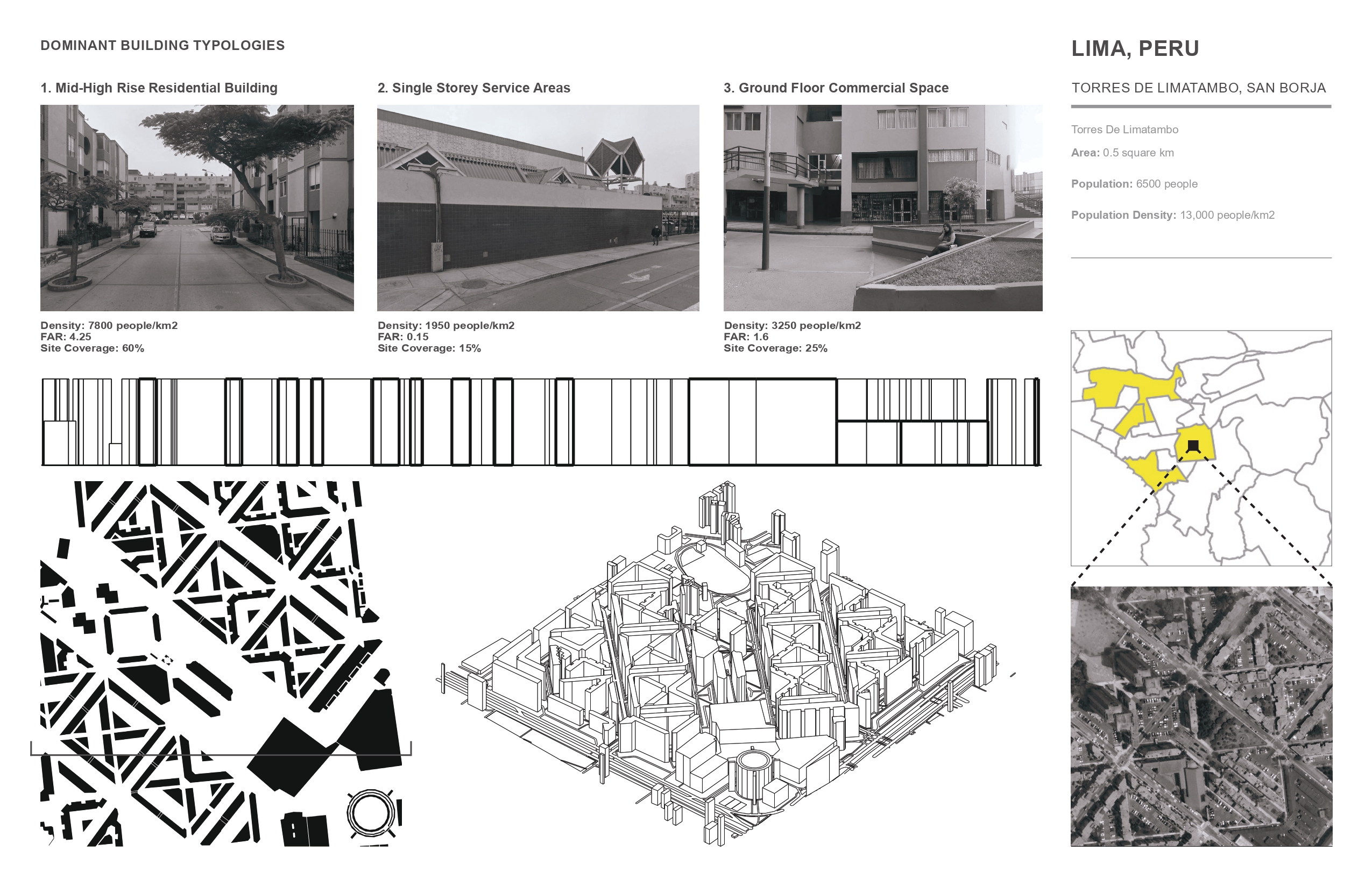
Lima, Peru - Torres De Limatambo, San Borja
Area: 0.5 km2
Population: 6500 people
Population Density: 13,000 people/km2

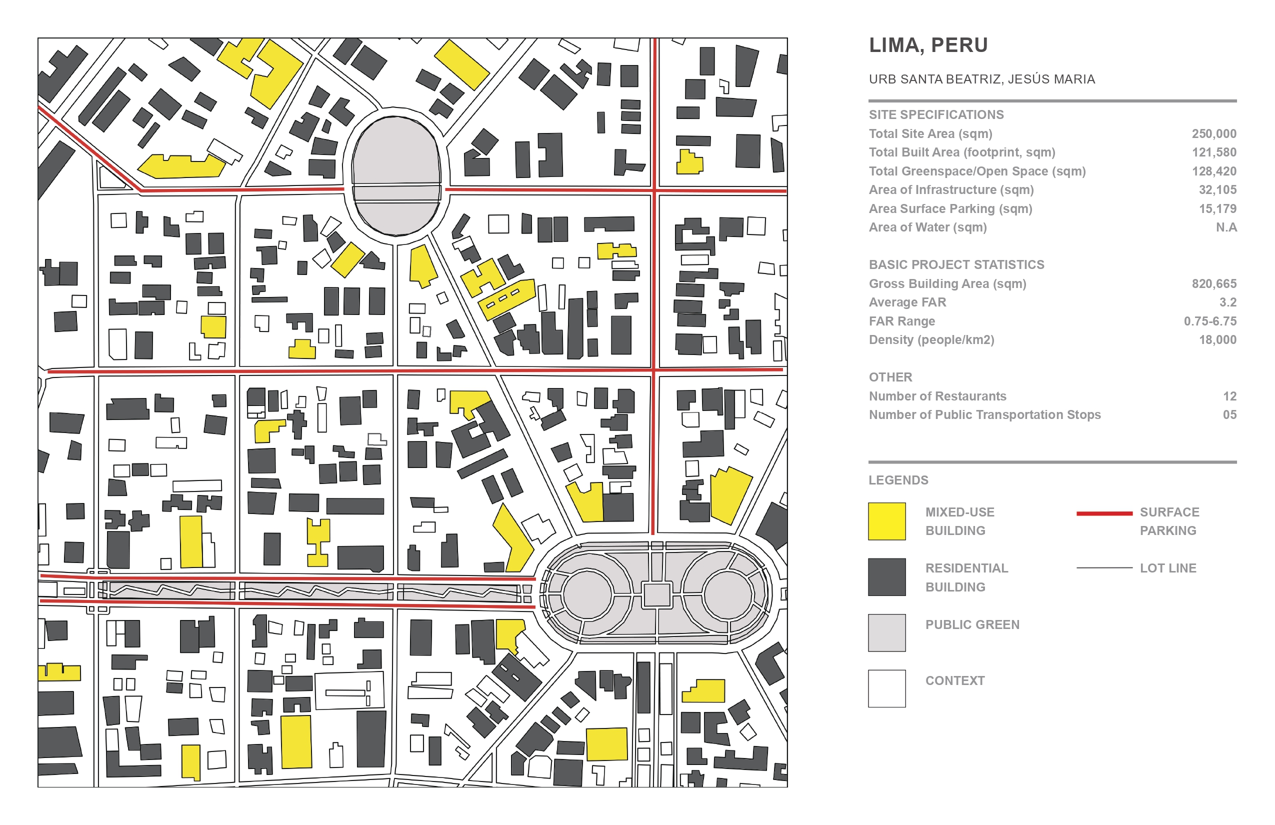
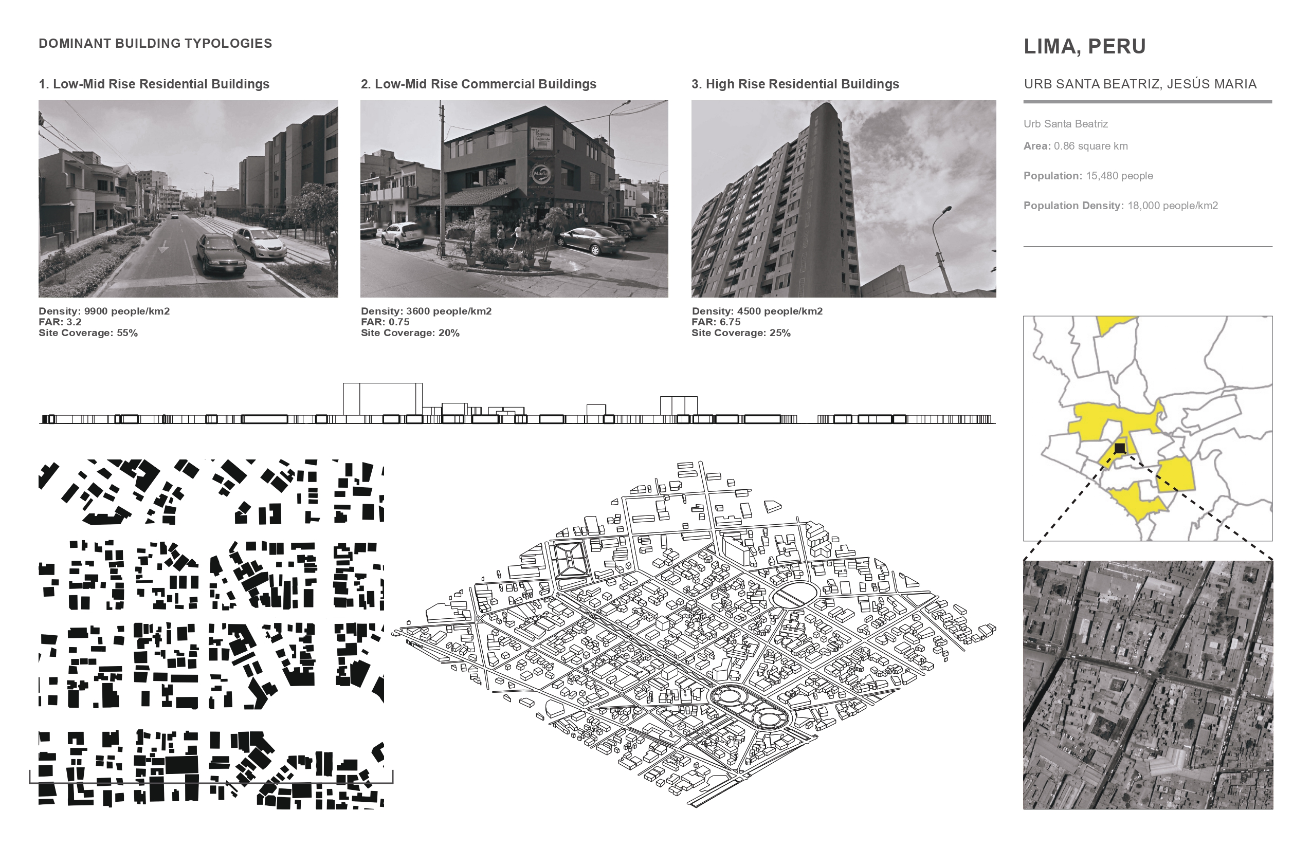
Lima, Peru - Urb Santa Beatriz, Jesus Maria
Area: 0.86 km2
Population: 15,480 people
Population Density: 18,000 people/km2
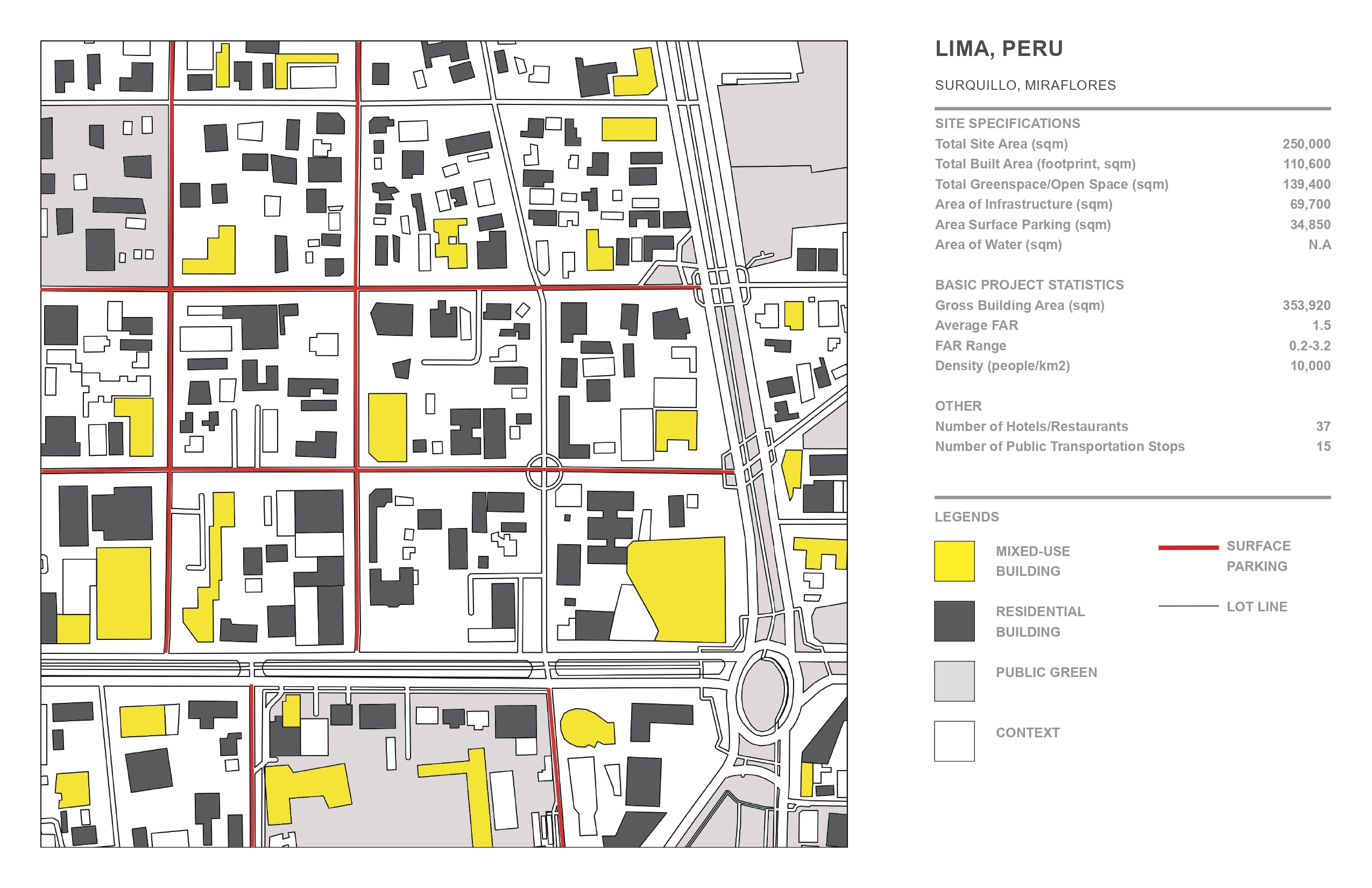
Lima, Peru - Surquillo, Miraflores
Area: 1.64 km2
Population: 16,400 people
Population Density: 10,000 people/km2

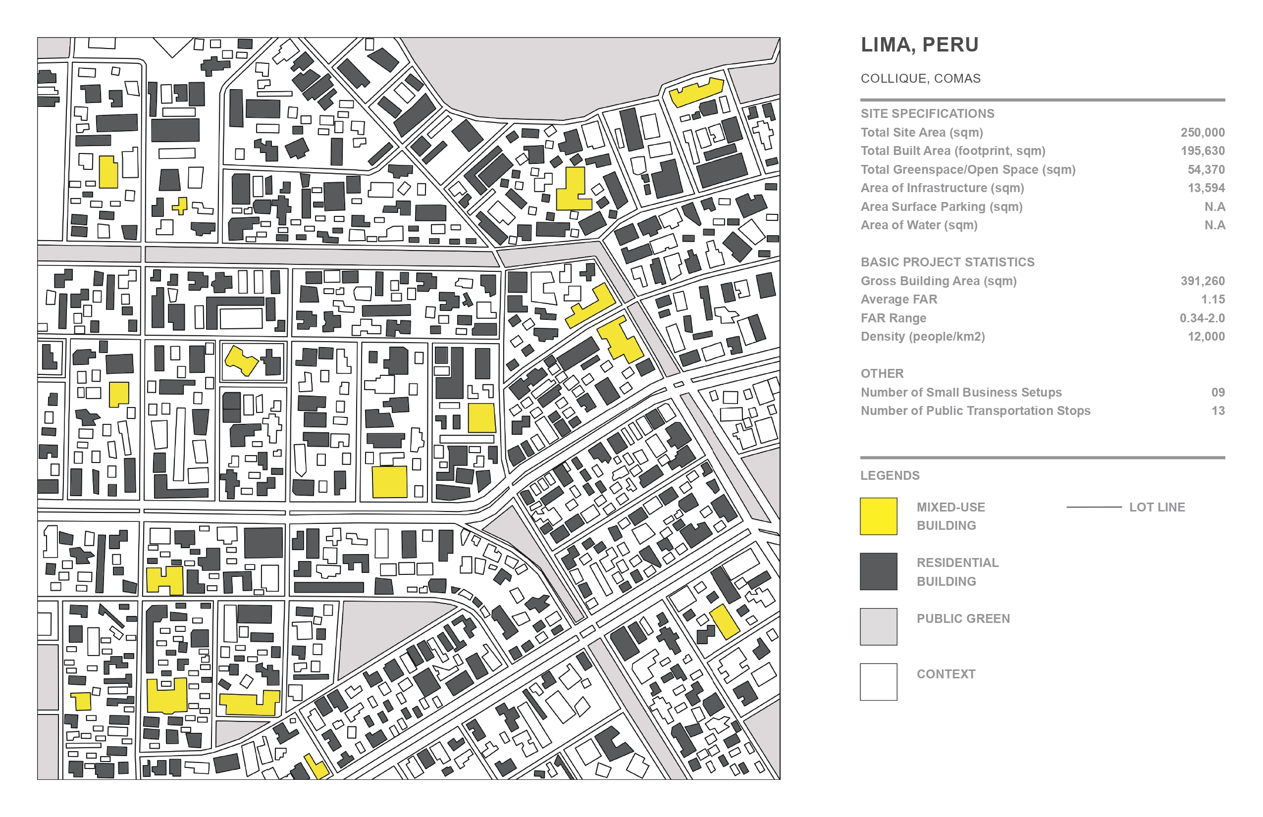
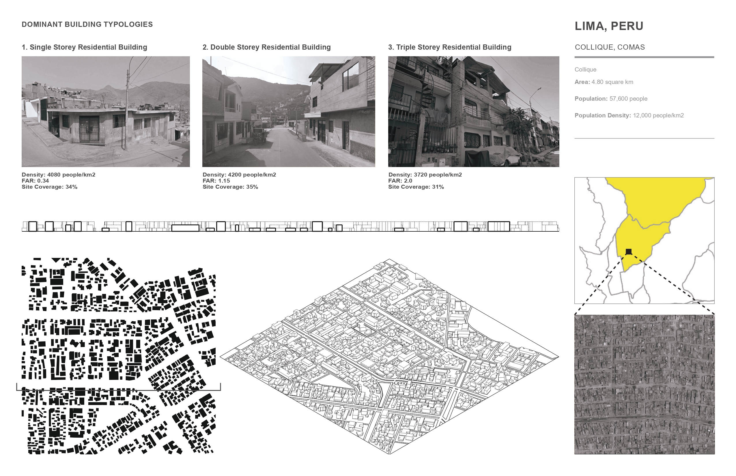
Lima, Peru - Collique, Comas
Area: 4.80 km2
Population: 57,600 people
Population Density: 12,000 people/km2
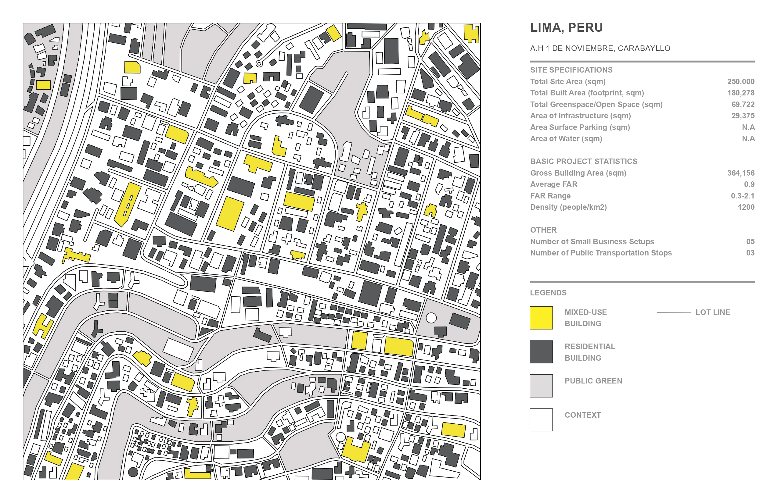
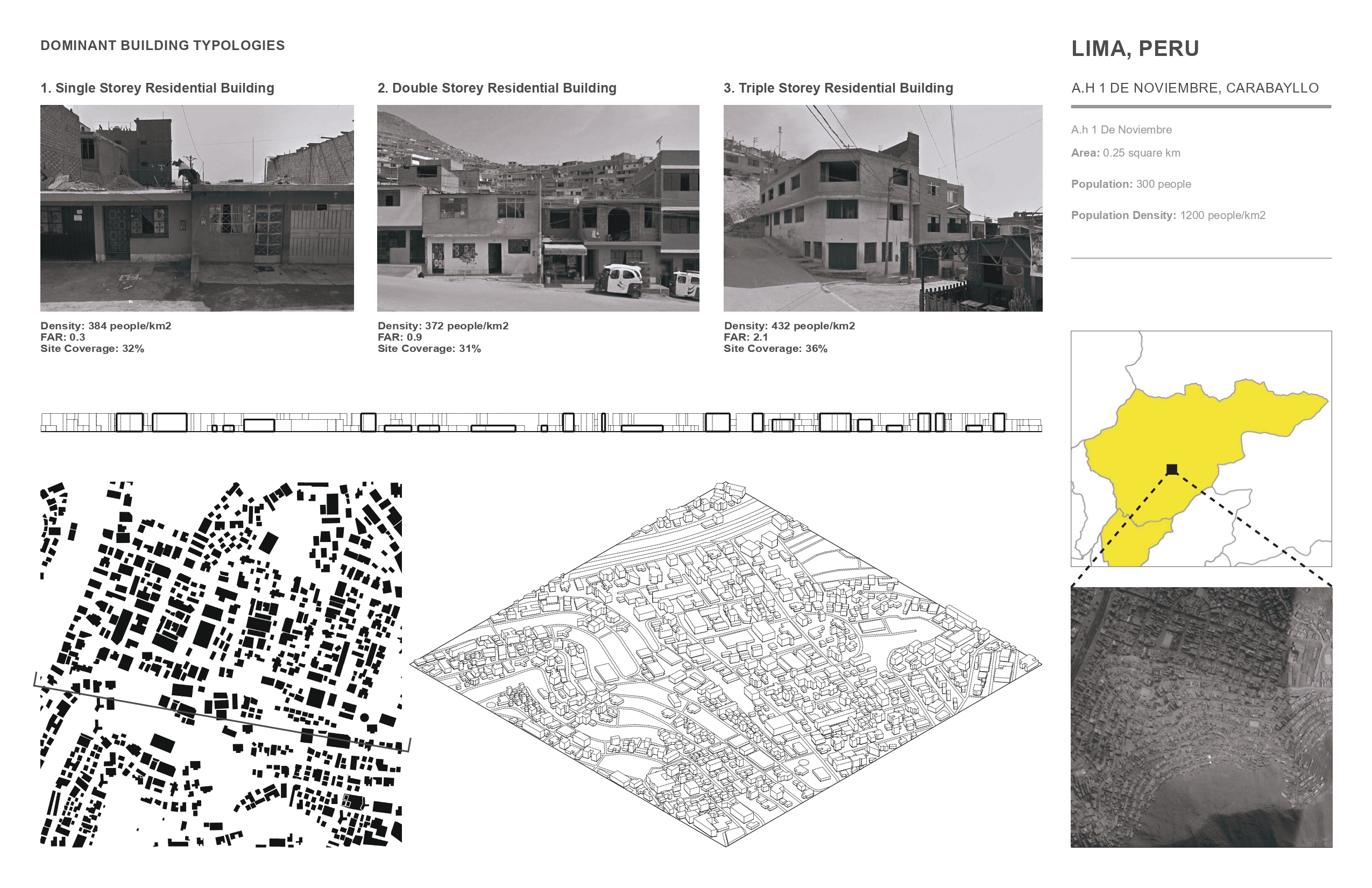
Lima, Peru - A.H De Noviembre, Carabayllo
Area: 0.25 km2
Population: 300 people
Population Density: 1200 people/km2
CAP & TRADE UPZONING | Surquillo - Lima, Peru
Surquillo (average within the Socio-Economic framework) is a district in Lima, Peru surrounded by the wealthy counterparts of San Borja and San Isidro on the North, Santiago de Surco on the East, and Miraflores on the South and West. Intervening with this aspect the idea of the proposal is to help this socio-economically ‘islanded’ district overpower its history of semi-formality and recreate its identity amidst the fabric of the city.
Incorporating the concept of Cap & Trade Upzoning (extensively researched by Vishaan Chakrabarti in his publication “A Country of Cities: A Manifesto for an Urban America”), an attempt has been made to create a dynamic skyline of privatization, favoring the needs of the existing habitants at the same time opening up economically notched-up opportunities for potential migration of people from the neighboring districts.
The framework has been worked in a way that allows the transfer of ‘air rights’ from the government to a variety of private developers allowing them to commodify certain parts of the district, indirectly promoting a wealthy lifestyle, high density, and an anti-gentrification re-population model. Within this transfer of ownership, ecological aspects of pollution credit are also taken into account leading up to a speculative economic uplift of not just the ‘chosen site’ but the neighborhood as a whole.
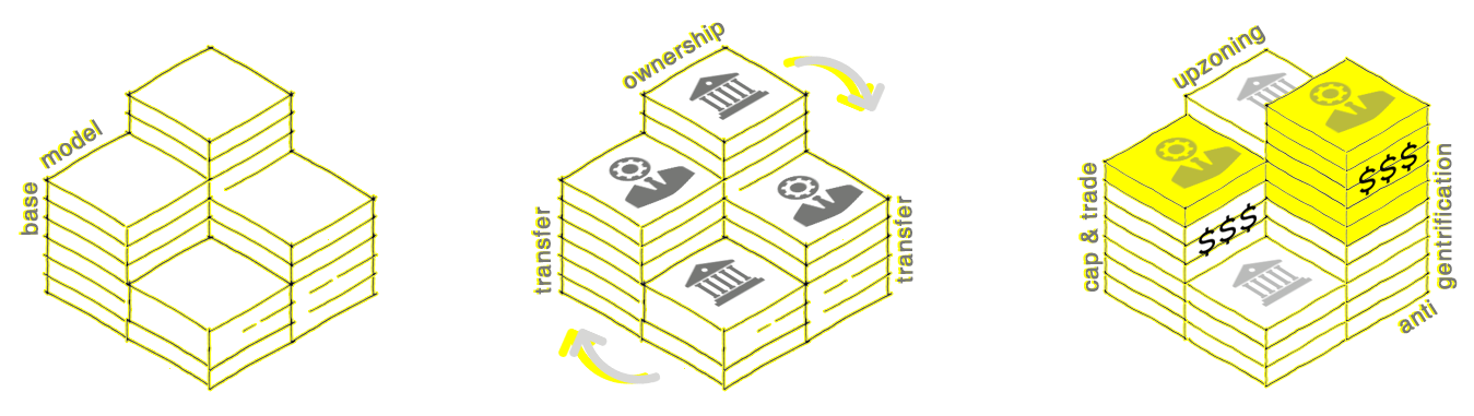
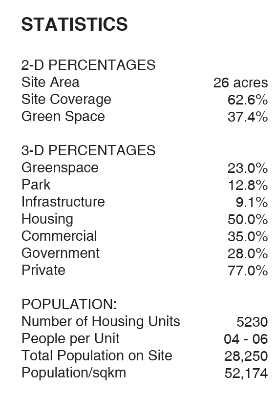
Left to Right: Incorporation of the Cap & Trade Upzoning Model on the traditional framework (Program)
![]() Speculative Design Proposal (Axonometric View)
Speculative Design Proposal (Axonometric View)
![]()
![]()
Speculative Design Proposal (Axonometric View)
![]() Site Section
Site Section
![]()
Site Axonometric With Context (Cap and Trade Upzoning)
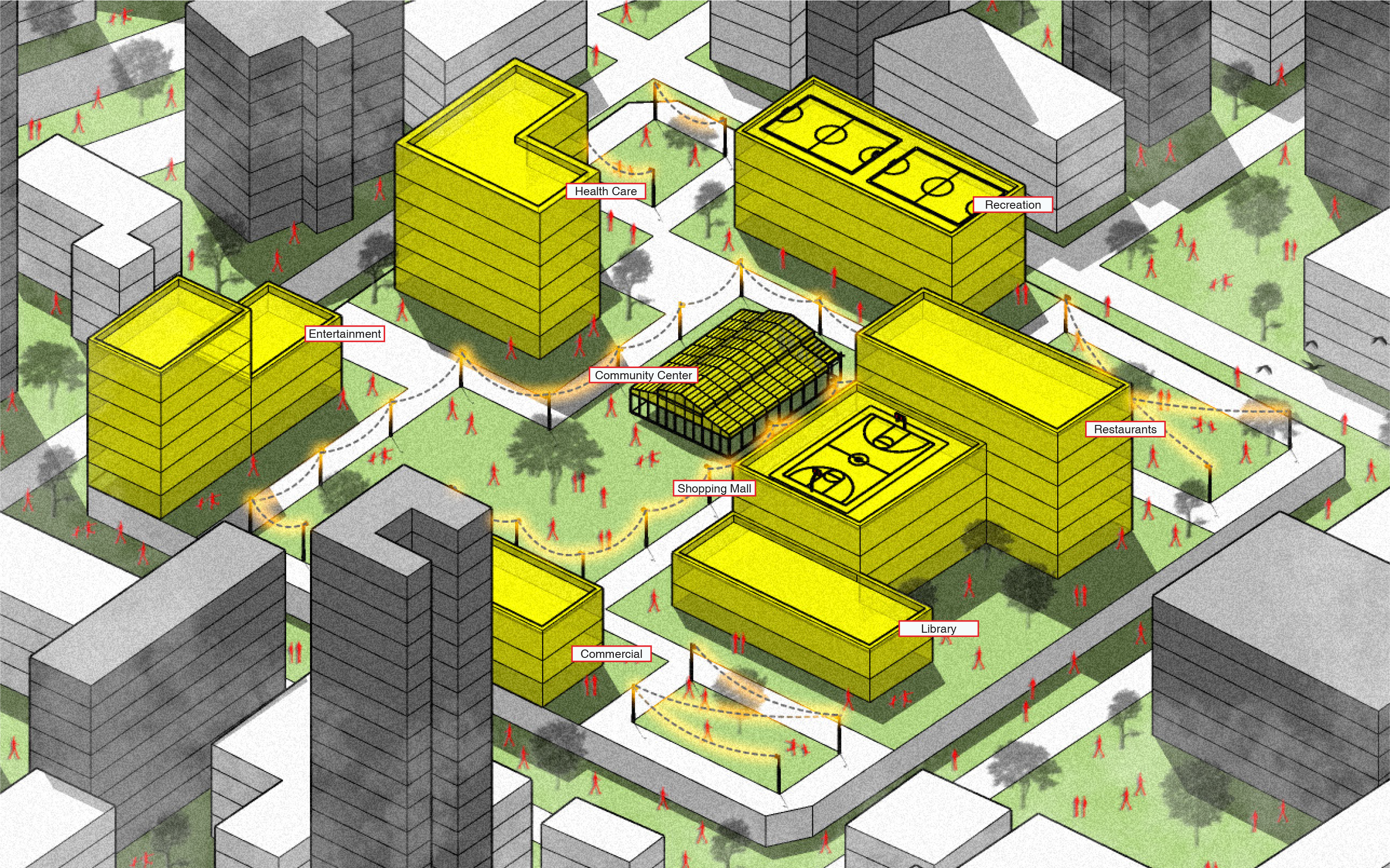 Speculative Design Proposal (Axonometric View)
Speculative Design Proposal (Axonometric View)
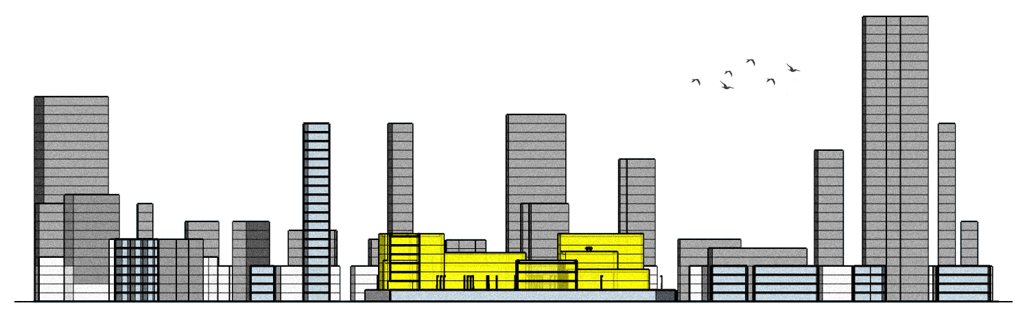 Site Section
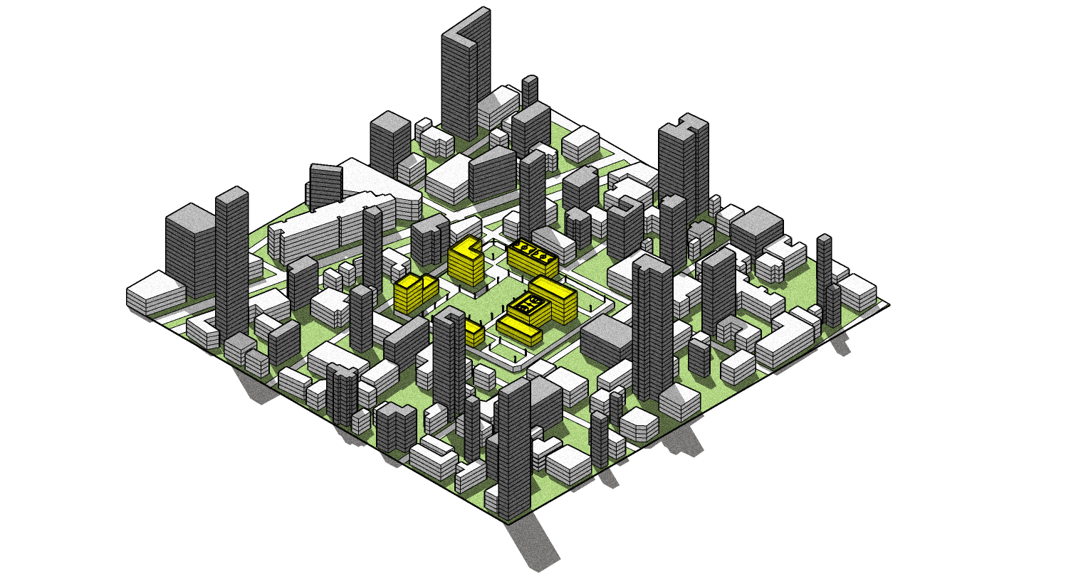
Site Axonometric With Context (Cap and Trade Upzoning)
Sources:
- https://cadmapper.com/pro/login/?next=/pro/home
- https://earth.google.com/web/
- https://www.google.com/maps
- https://wikipedia.org/wiki/Demographics_of_Lima
- https://www.dreamstime.com/stock-photo-lima-administrative-map-administration-areas-peruvian-capital-image47556629