IIXXX. Singapore, Republic of Singapore


Singapore, Republic of Singapore
Singapore, Republic of Singapore — Lauren Jenkins + Zione Grosshuesch
Singapore is the capital city of Singapore, and has the largest population. The Singapore strights seprate the country from Malaysia. Singapore is the largest port in the Southeast Asia and is one of the busiest in the world. The city itself is divided into 7 regions (north, northeast, east, west, prime, city fringe, and downtown core) With 31 districts with in these regions.
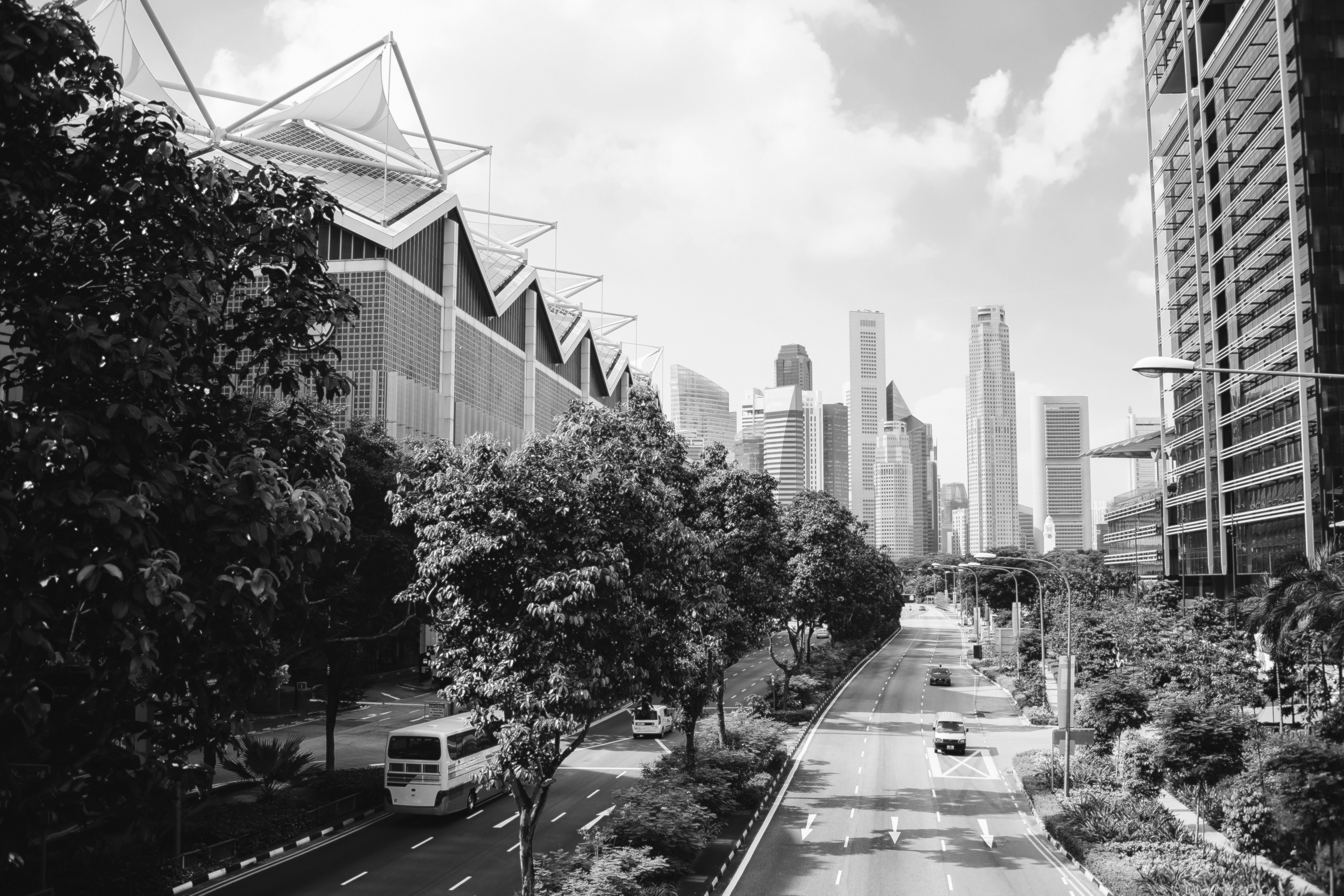

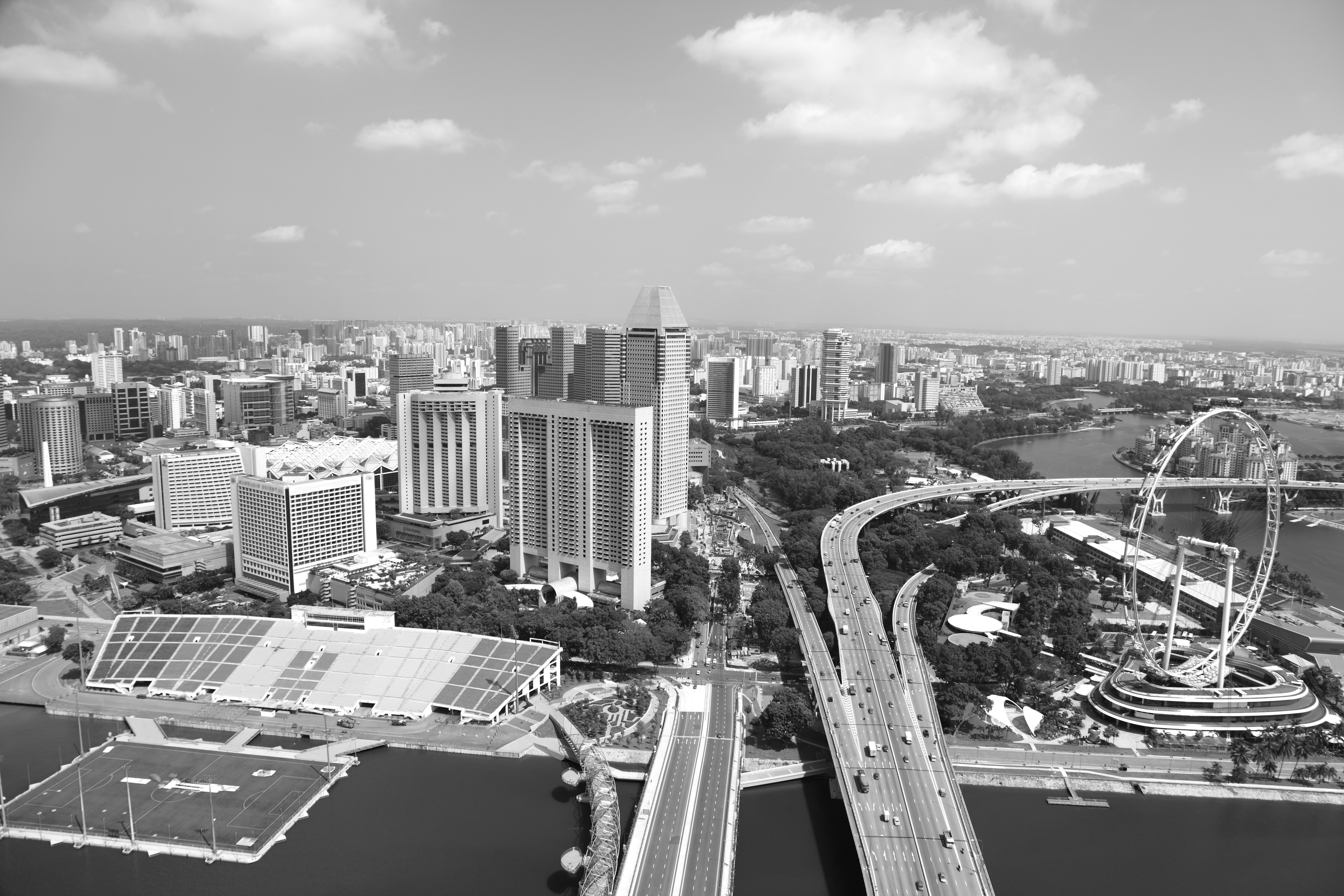
Left: View Singapore Downtown Core Street Design // Right: Singapore Bay Area, Extension of Life on Water
Population:
Total Population: 5,637,000
Singapore Residense: 4,073,200
Citzens: 3,553,700
Permanet: 519,500
Area:
Urban: 710 km2
Metro: 710km2
Population Density:
Urban Average: 7,688 people/km2
Metro Average: 7,688 people/km2
Politics:
Singapore’s electorate includes every adult citizen who is a registered voter, and voting is compulsory. A number of parties contest elections, but since 1959 Singaporean politics have been dominated by the People’s Action Party. he PAP’s ability to maintain its control largely has been attributable to Singapore’s rapideconomic growth and improved social welfare. The emphasis of this ideology has been a rigid publicmorality focused on personal appearance and cleanliness, political loyalit, and family planning.


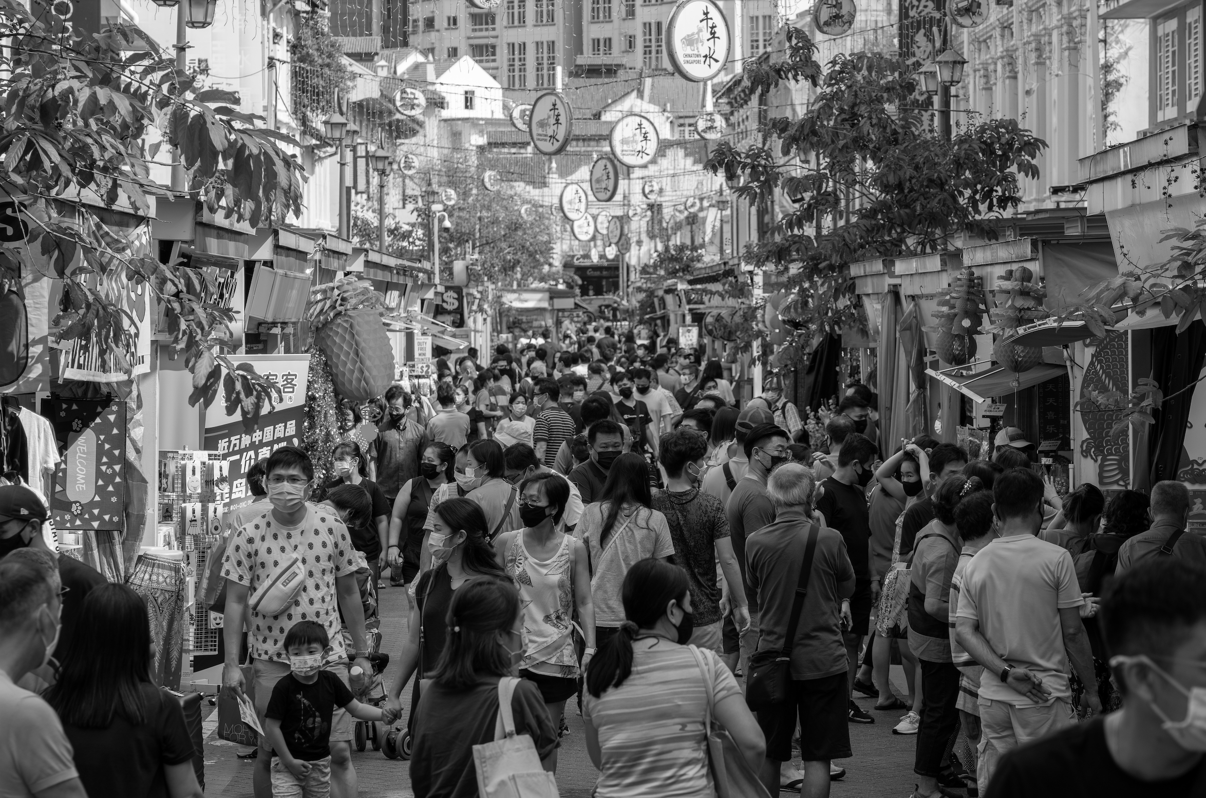
Slide 01 Top-left: Singapore Mass Transit (MRT) Metro System // Top-right: Streetscape in Chinatown of Singapore City
Bottom-left: Lowrise Density Adjacent to Business District // Bottom-right: Singapore City, Extension of Urban Life on Bay
Historically, Singapore island originated as a habitable place for fishermen and pirates in the 14th century. Moving towards modern times came the demand of the industrial West for items such as tin and rubber, which attracted Singapore as one of the greatest ports in the world. Singapore currently wades as the largest port in Southeast Asia and also the densest traffic.
Singapore currently sits as the third most densely populated country in the world. Due to the city’s rapid growth and emissions rate, Singapore has been incorporating a green initiative since 2008. The Housing and Development Board (HDB) is an important part of the green initiative. It acts to replace 100% of the greenery lost in city development which appears in high-rise terraces and gardens. This is also primarily due to the land constraints, but it also creates an illusion of space and to reduce the feeling of high density.
Bugis has transformed from the port for pirates and the prostitution to a classy art district. Its colorful atmosphere provides contrast to the skyscrapers that loom over the neighborhood. With cobblestone relatively wide avenues the neighborhood is frequented by locals with a low density.
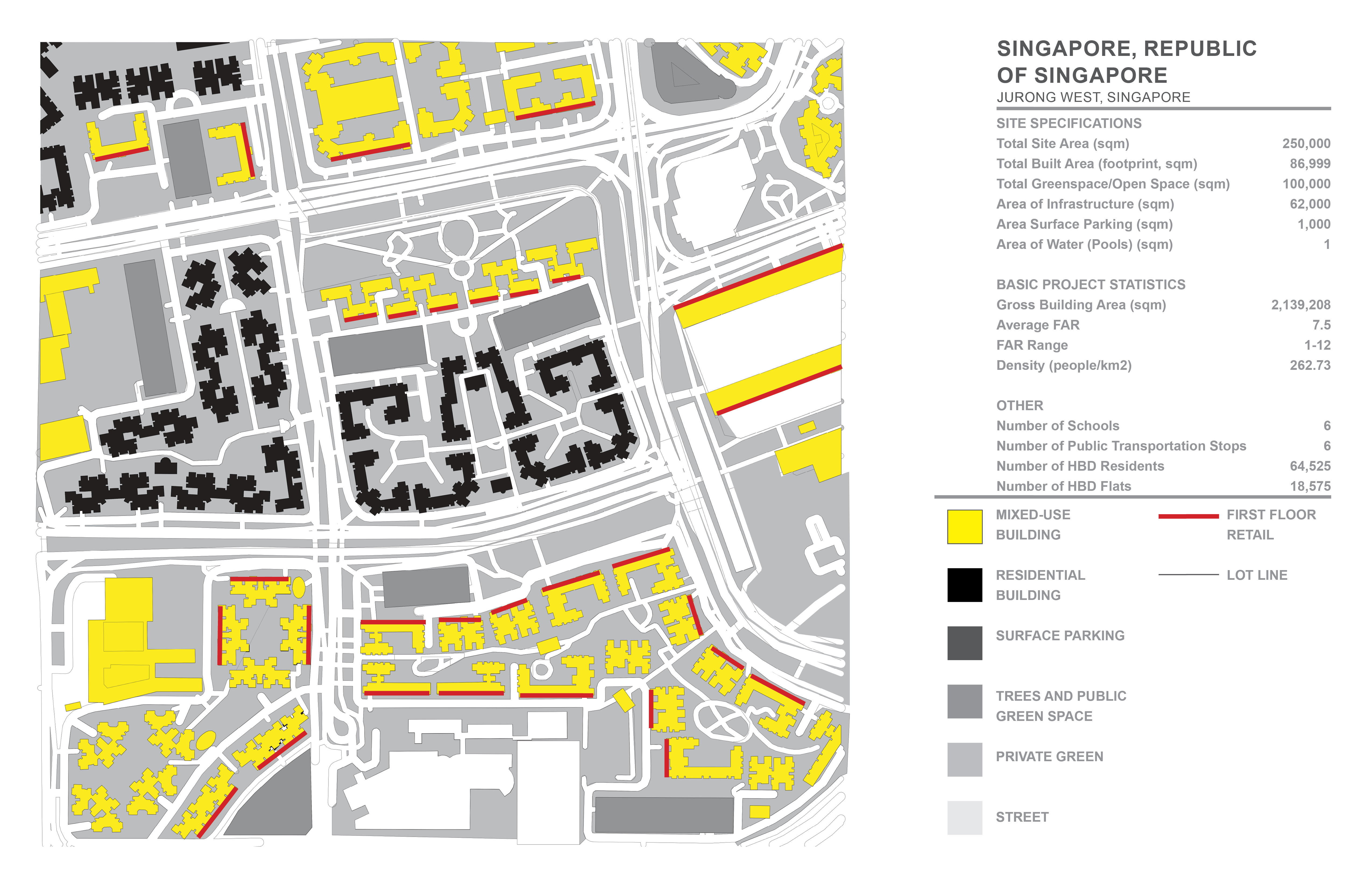
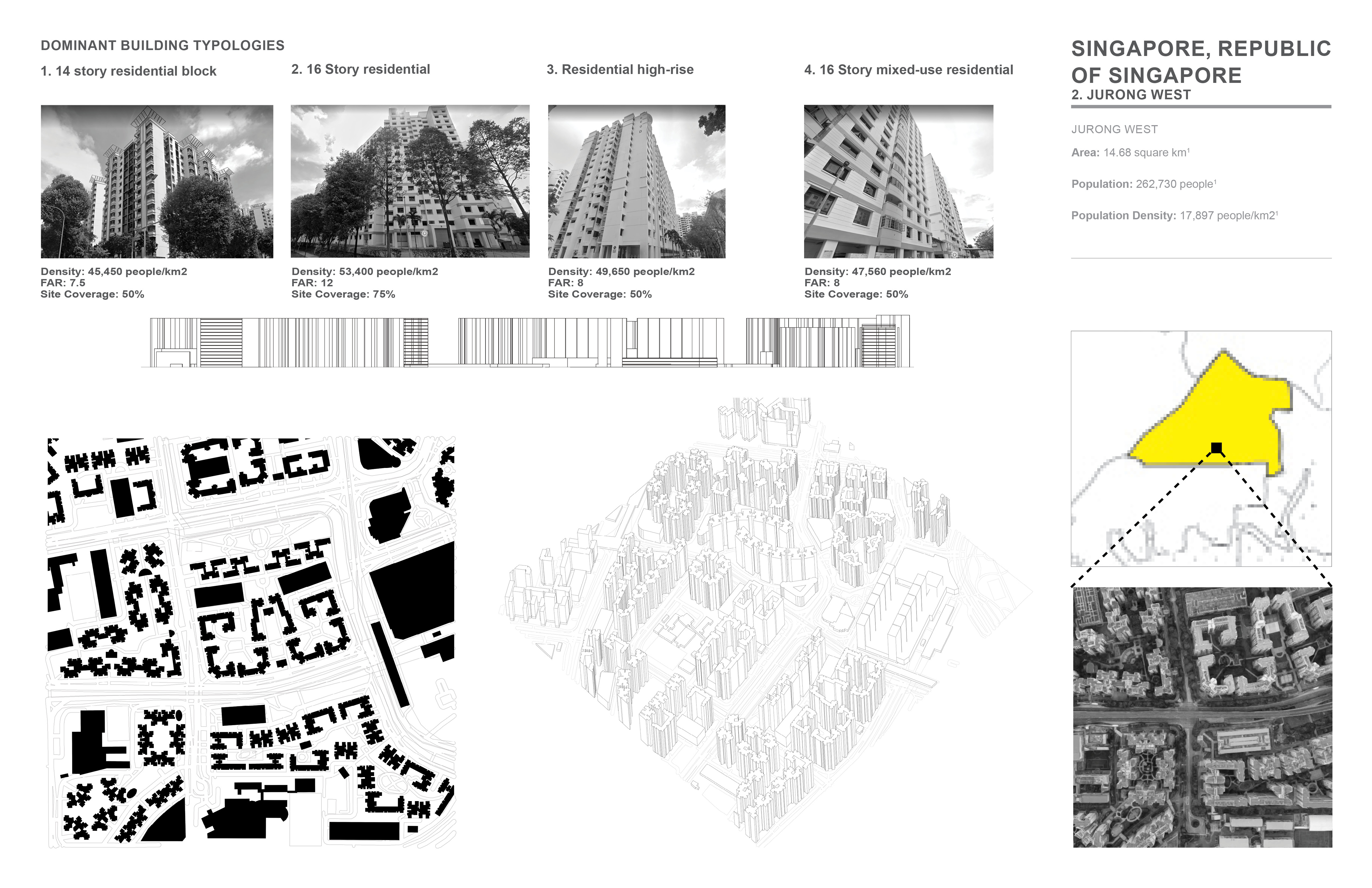
Jurong West Central is a residential neighborhood in Singapore with one of the densest populations in the city. It is located near parks, schools shopping it is part of the subzone and is the neighborhood center of Jurong West. This is more of a local area with establishments catering to locals.
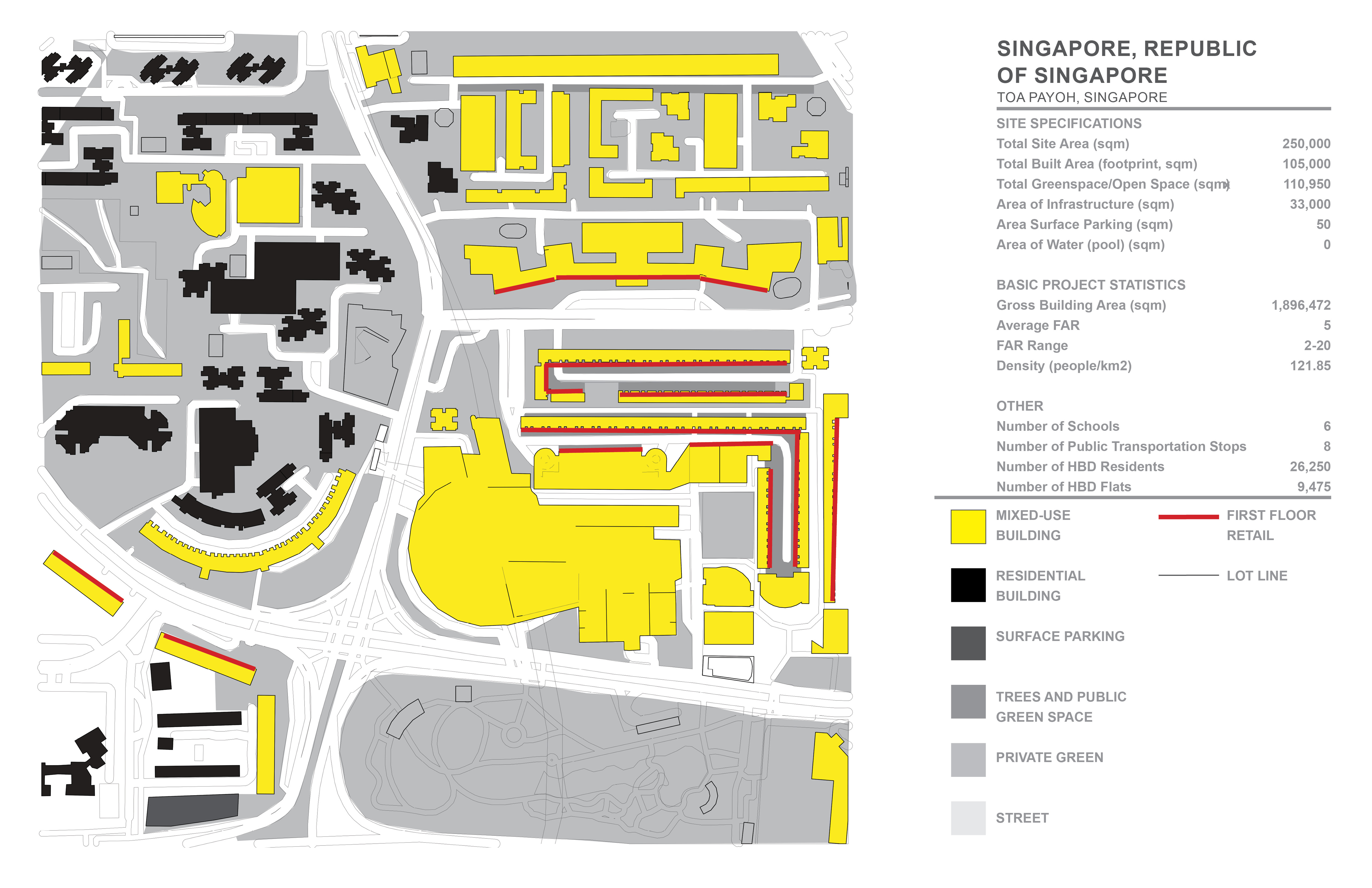
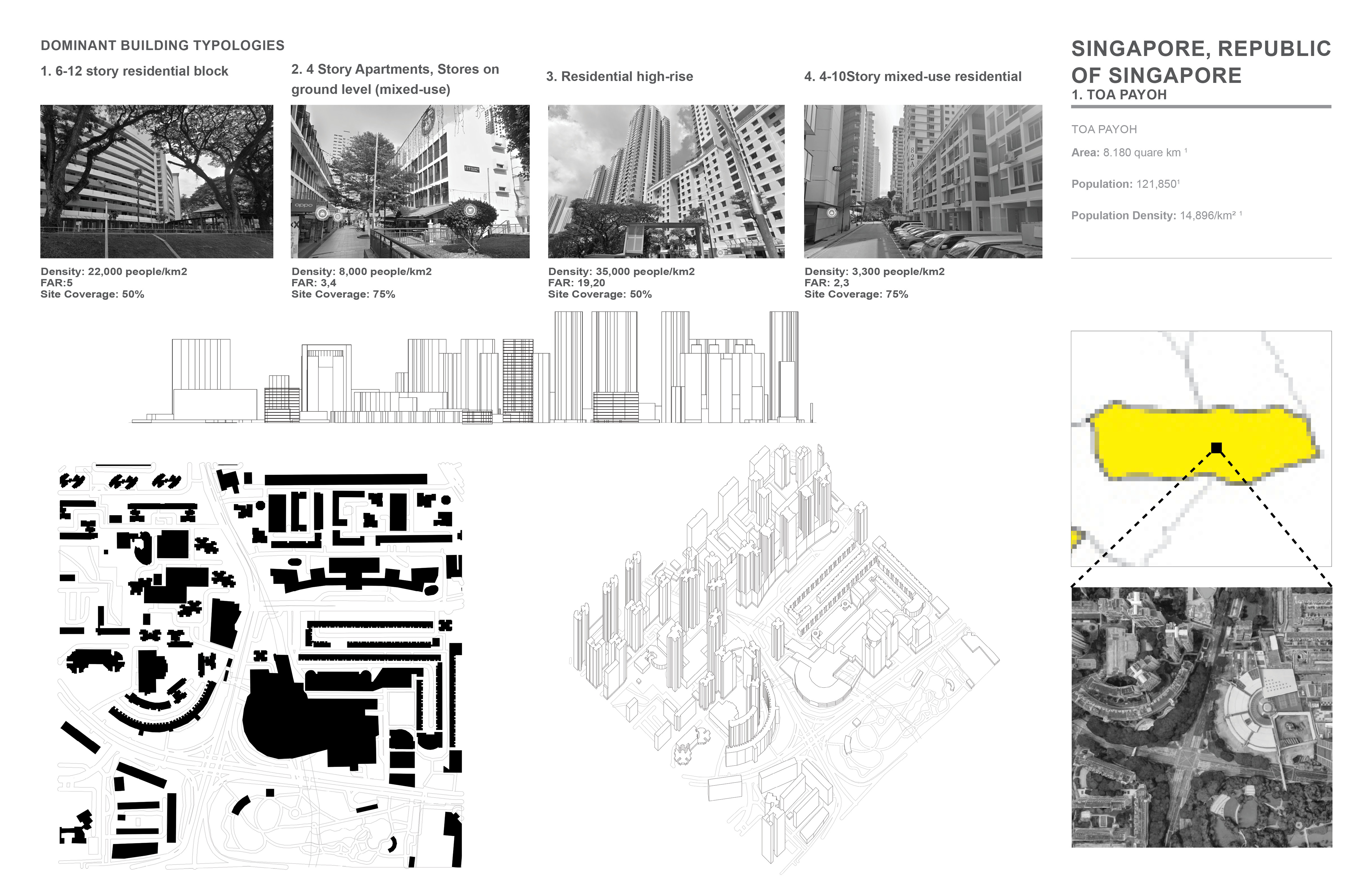
With Singapore’s every growing population a need for more space arises Tao Payoh is used to be a swamp before they drained it. It used to be home to “squatters” until the Housing and Development Board removed them for their planed city. Tao Payoh was the first town to be designed by entirely by the HDB.
Surrounded by a untouched park on one end Redhill also known as Bukit Merah the neighborhood has a urban farm running through it. The origin of the name derives from a tale of a cleaver boy who was murdered out of jealousy after saving his village from a swordfish. His blood flowed down the hill staining it.
Sources:
| 1. https://www.singstat.gov.sg/find-data/search-by-theme/population/population-and-population-structure/latest-data |
| 2. https://www.mfa.gov.sg/Overseas-Mission/Xiamen/About-Singapore |
| 3. https://www.flickr.com/photos/lezlie-neo/50275125661 |
| 4. https://www.singaporetravelhub.com/suburbs/jurong-west-central/ |
| 5.https://www.hdb.gov.sg/about-us/history/hdb-towns-your-home/toa-payoh |
| 6. https://en.wikipedia.org/wiki/Redhill_MRT_station |
| 7. https://www.timeout.com/singapore/things-to-do/what-to-eat-drink-see-do-at-bugis |
| 8. https://www.timeout.com/singapore/things-to-do/the-ultimate-guide-to-toa-payoh |
| 9. https://www.singaporetravelhub.com/suburbs/jurong-west-central/ |
| 10. https://www.timeout.com/singapore/things-to-do/the-ultimate-guide-to-redhill |
| 11. https://www.citypopulation.de/en/singapore/admin/ |
| 12. https://futurism.com/one-of-the-densest-countries-in-the-world-is-going-green |
| 13. https://www.britannica.com/place/Singapore |
| 14. https://www.ura.gov.sg/Conservation-Portal/Explore/History?bldgid=BLPL |
| 15. https://www.washingtonpost.com/travel/singapore/tiong-bahru-neighborhood-singapore |
| 16. https://en.wikipedia.org/wiki/Light_Rail_Transit_(Singapore) |
| 17. https://www.lta.gov.sg/content/ltagov/en/getting_around.html |
| 18. https://plannerbee.co/learn-personal-finance/guide-to-car-sharing-singapore/ |
| 19. https://www.statista.com/markets/419/transportation-logistics/ |
| 20. https://www.bluesg.com.sg/about-us |
| 21. https://en.wikipedia.org/wiki/Bedok_Bus_Interchange |
| 22. https://en.wikipedia.org/wiki/Bukit_Panjang_LRT_line |
| 23. https://www.statista.com/markets/419/transportation-logistics/ |
| 24. https://capitolsingapore.com/ |
| 25. https://www.visitsingapore.com/see-do-singapore/arts/performance-arts/esplanade-theatres-on-the-bay/ |
| 26. https://stateofbuildings.sg/places/fountain-of-wealth |
| 27. https://www.arup.com/projects/marina-bay-waterfront-promenade |

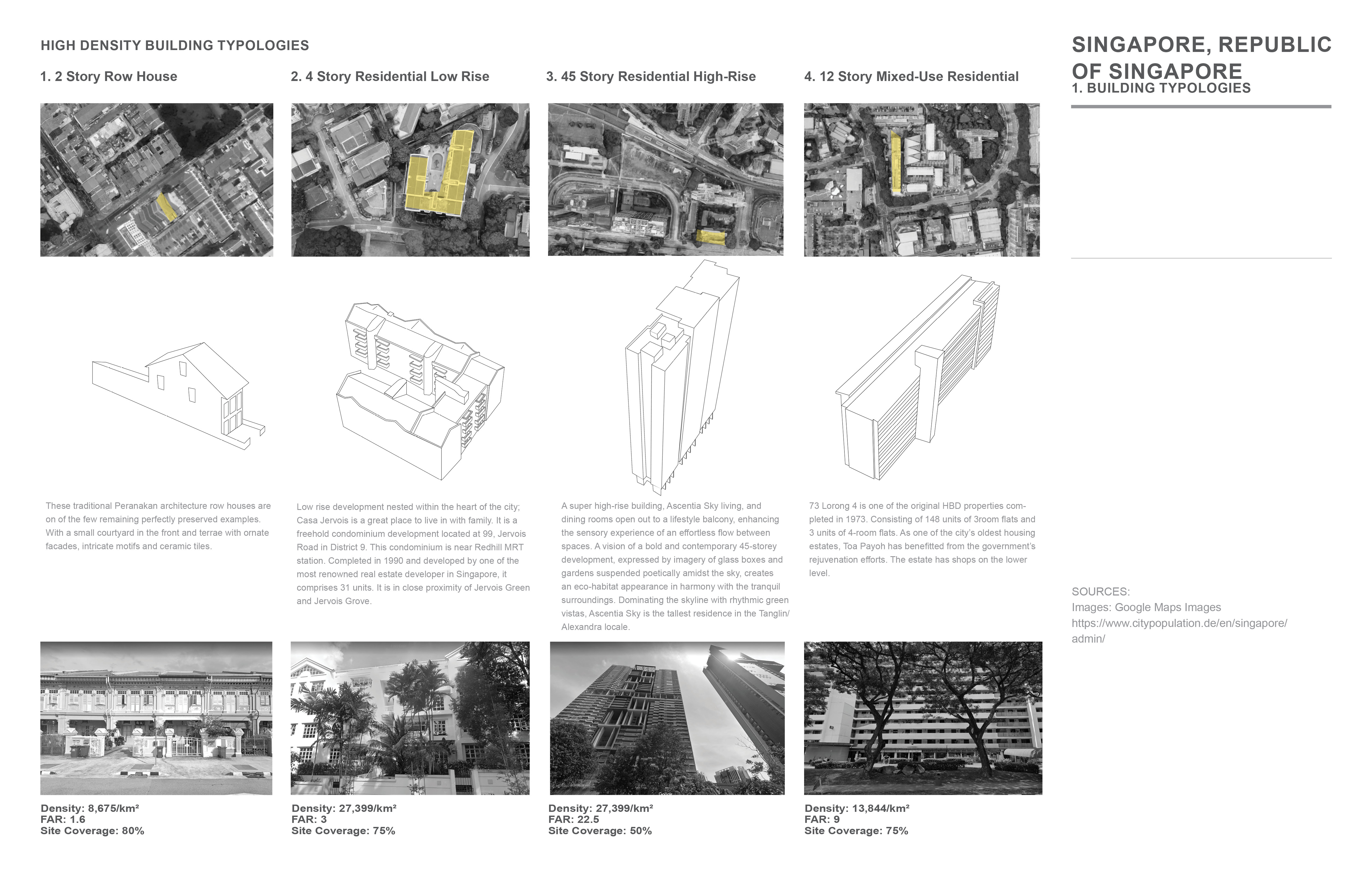
Singapore, Republic of Singapore // High Density Buildig Typologies
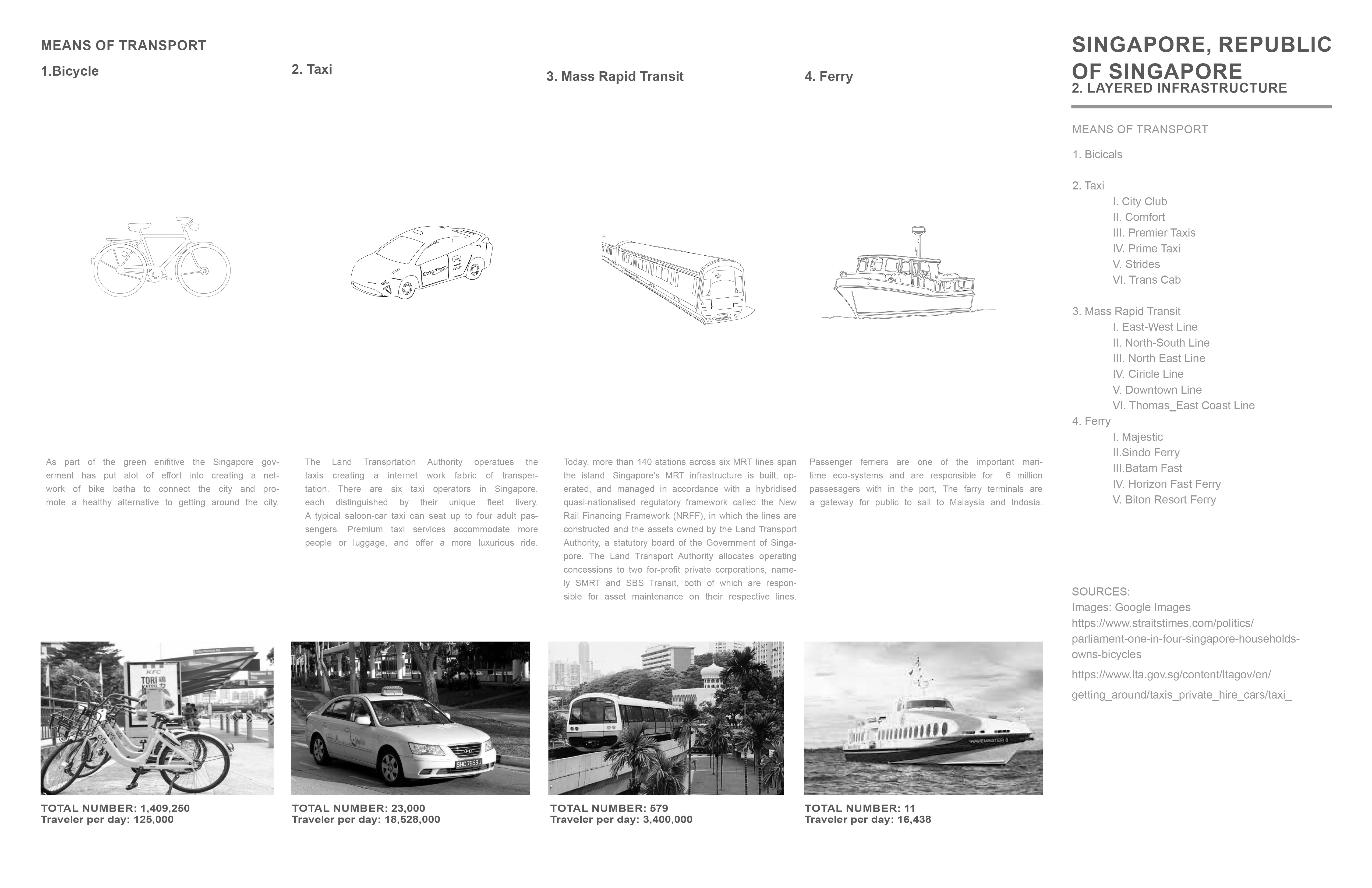
Singapore, Republic of Singapore // Means of transportation
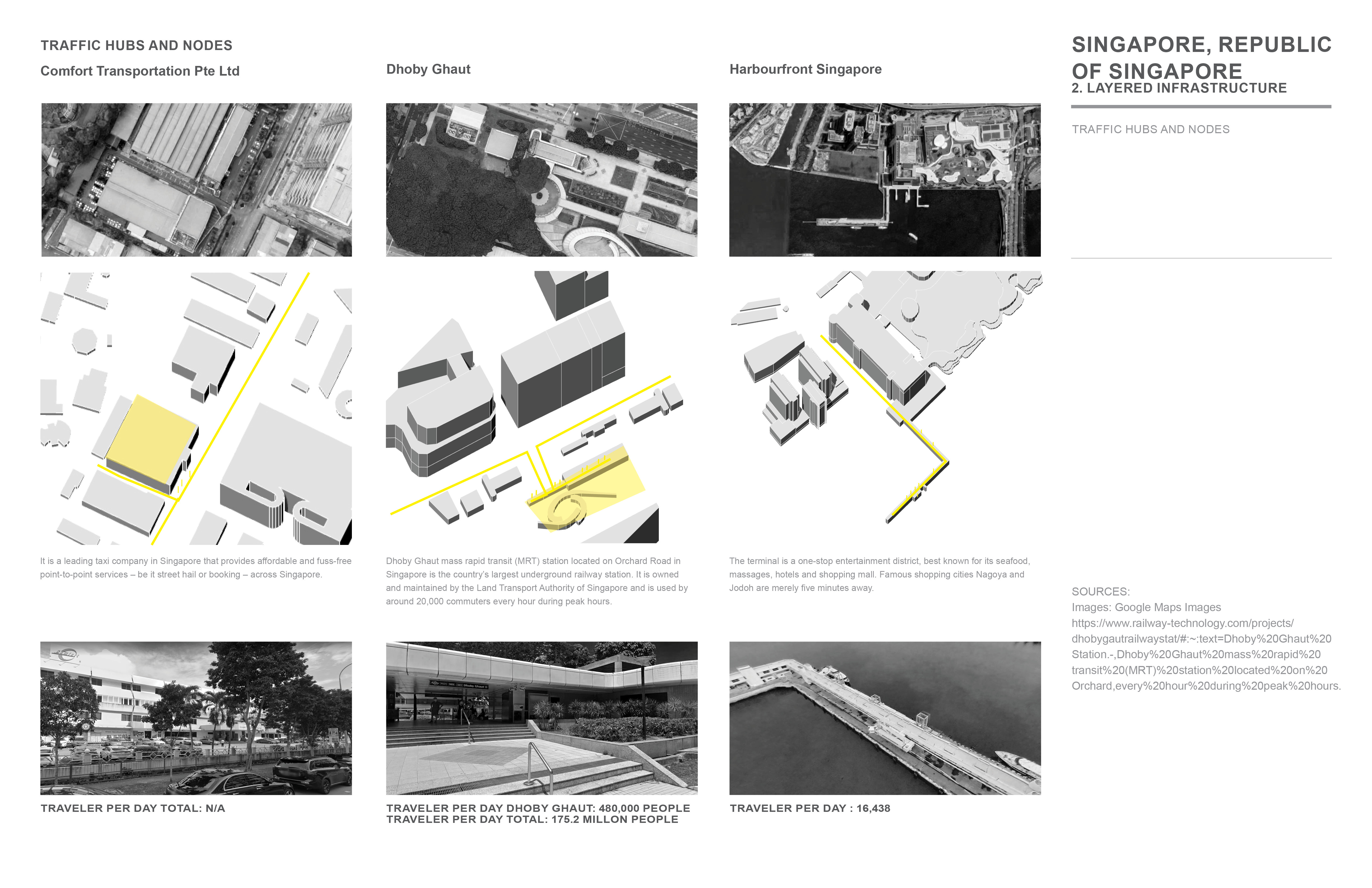

Singapore, Republic of Singapore // Traffic hubs and nodes
Singapore, Republic of Singapore
//
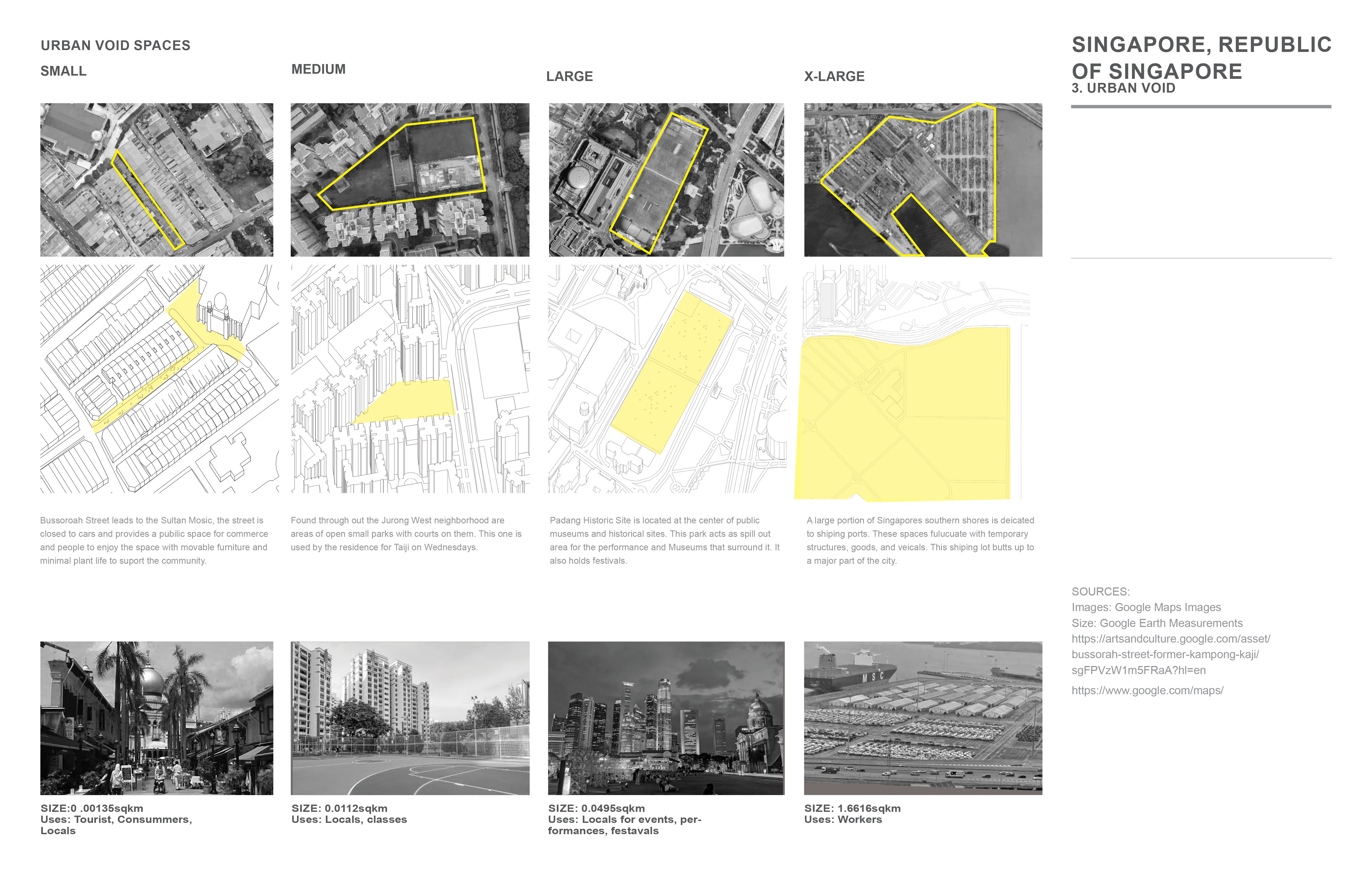
Urban Void Spaces
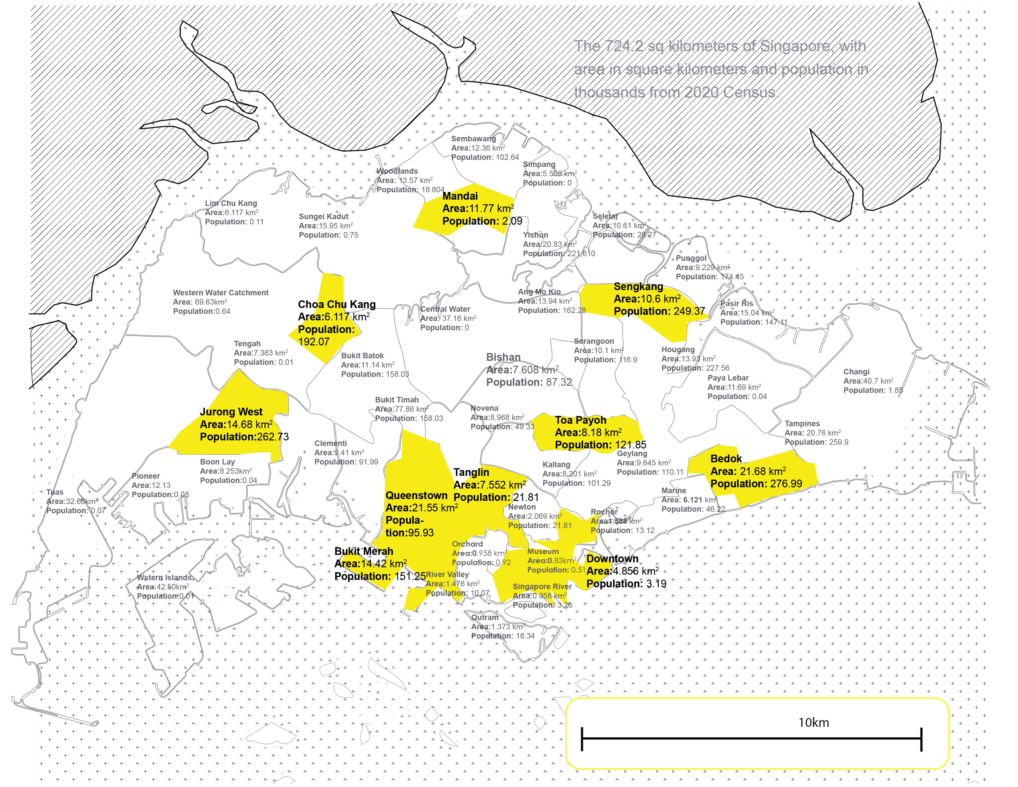
Sources:Singapore, Republic of Singapore - TOA PAYOH
Area: 8.180 km2
Population: 121,850 people
Population Density: 14,896 people/km2
Singapore, Republic of Singapore -JURONG WEST
Area: 14.68 km2
Population: 262,730 people
Population Density: 17,897 people/km2
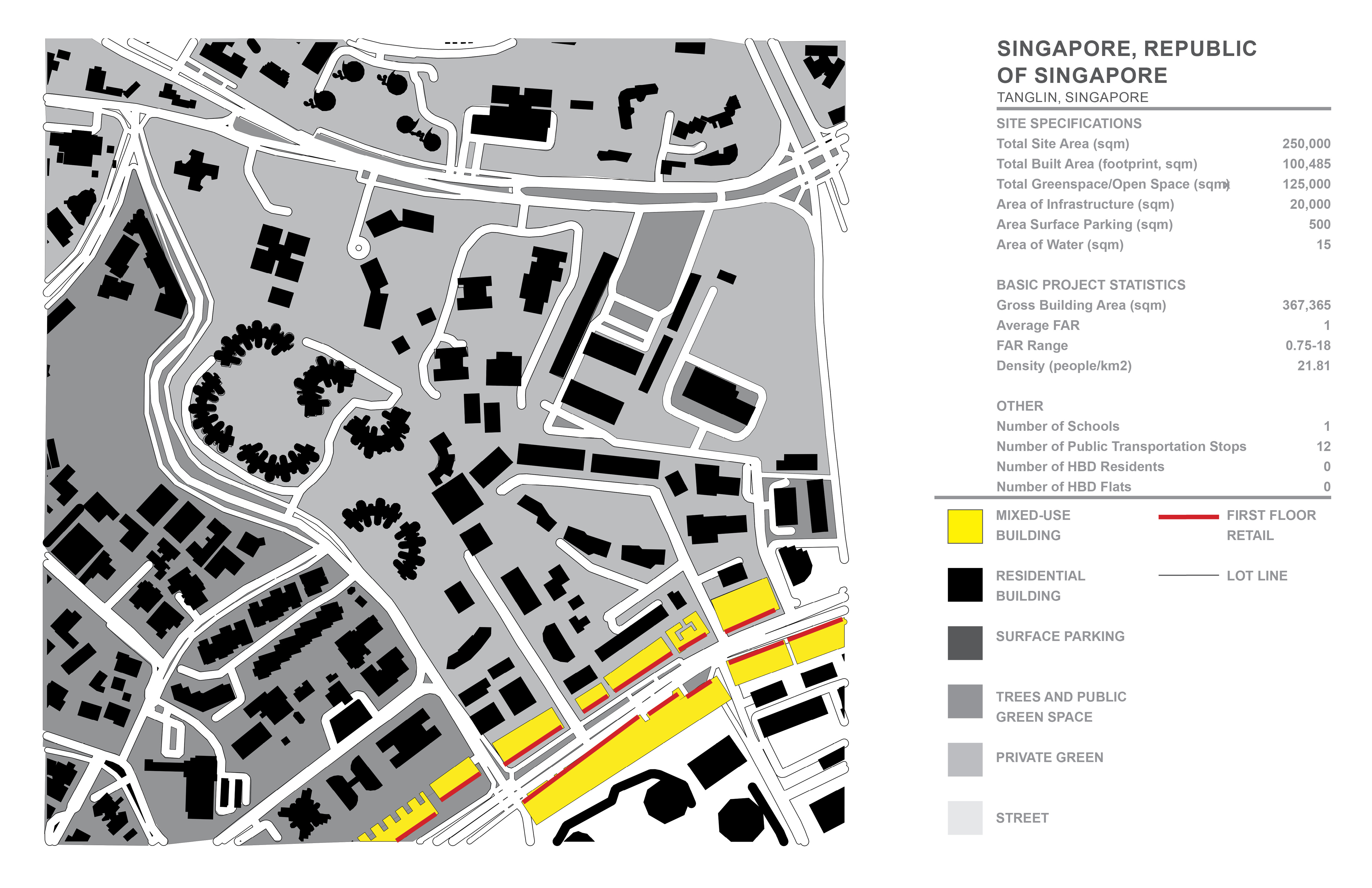
Singapore, Republic of Singapore - TANGLIN
Area: 7.552km2
Population: 21,810 people
Population Density: 2,888 people/km2

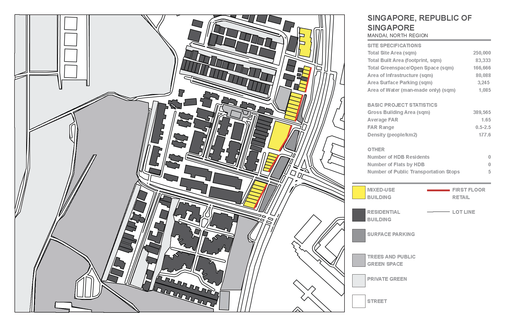
Singapore, Republic of Singapore - MANDAI
Area: 11.7 km2
Population: 2,090 people
Population Density: 177.6 people/km2
Singapore, Republic of Singapore - BUKIT MERAH
Area: 3.53 km2
Population: 86,644 people
Population Density: 24,545 people/km2


Singapore, Republic of Singapore - CHOA CHU KANG
Area: 6.117 km2
Population: 192,070 people
Population Density: 31,399 people/km2
Sources:
Toa Payoh
1. https://www.citypopulation.de/en/singapore/admin/
2. https://earth.google.com/web/search/
3. https://cadmapper.com/pro/extracts/b27b3187-09cf-4d57-9243-304f40e06645/copy
4. https://www.google.com/maps/search/
5. https://en.wikipedia.org/wiki/Public_housing_in_Singapore#CITEREFPhang2007
6. https://www.fraxtor.com/most-expensive-districts-in-singapore/#:~:text=Known%20
7. https://blog.seedly.sg/monthly-household-income-singapore-comparison-district-where-you-stay/
8. https://www.alloverthemaphousing.com/singapore/
9. https://www.hdb.gov.sg/cs/infoweb/about-us/history
10. https://www.hdb.gov.sg/cs/infoweb/about-us/history/hdb-towns-your-home/toa-payoh
Jurong West
1. https://www.citypopulation.de/en/singapore/admin/
2. https://earth.google.com/web/search/.
3. https://cadmapper.com/pro/extracts/b27b3187-09cf-4d57-9243-304f40e06645/copy
4. https://www.google.com/maps/search/
5. https://en.wikipedia.org/wiki/Public_housing_in_Singapore#CITEREFPhang2007
6. https://www.fraxtor.com/most-expensive-districts-in-singapore/#:~:text=Known%20
7. https://blog.seedly.sg/monthly-household-income-singapore-comparison-district-where-you-stay/
8. https://www.alloverthemaphousing.com/singapore/
9. https://www.hdb.gov.sg/cs/infoweb/about-us/history
10. https://www.hdb.gov.sg/cs/infoweb/about-us/history/hdb-towns-your-home/jurong-west
Tanglin
1. https://www.citypopulation.de/en/singapore/admin/
2. https://earth.google.com/web/search/
3. https://cadmapper.com/pro/extracts/b27b3187-09cf-4d57-9243-304f40e06645/copy
4. https://www.google.com/maps/search/
5. https://en.wikipedia.org/wiki/Public_housing_in_Singapore#CITEREFPhang2007
6. https://www.fraxtor.com/most-expensive-districts-in-singapore/#:~:text=Known%20
7. https://blog.seedly.sg/monthly-household-income-singapore-comparison-district-where-you-stay/
8. https://www.alloverthemaphousing.com/singapore/
9. https://www.hdb.gov.sg/cs/infoweb/about-us/history>
PARK LINE| Singapore, Republic of Singapore
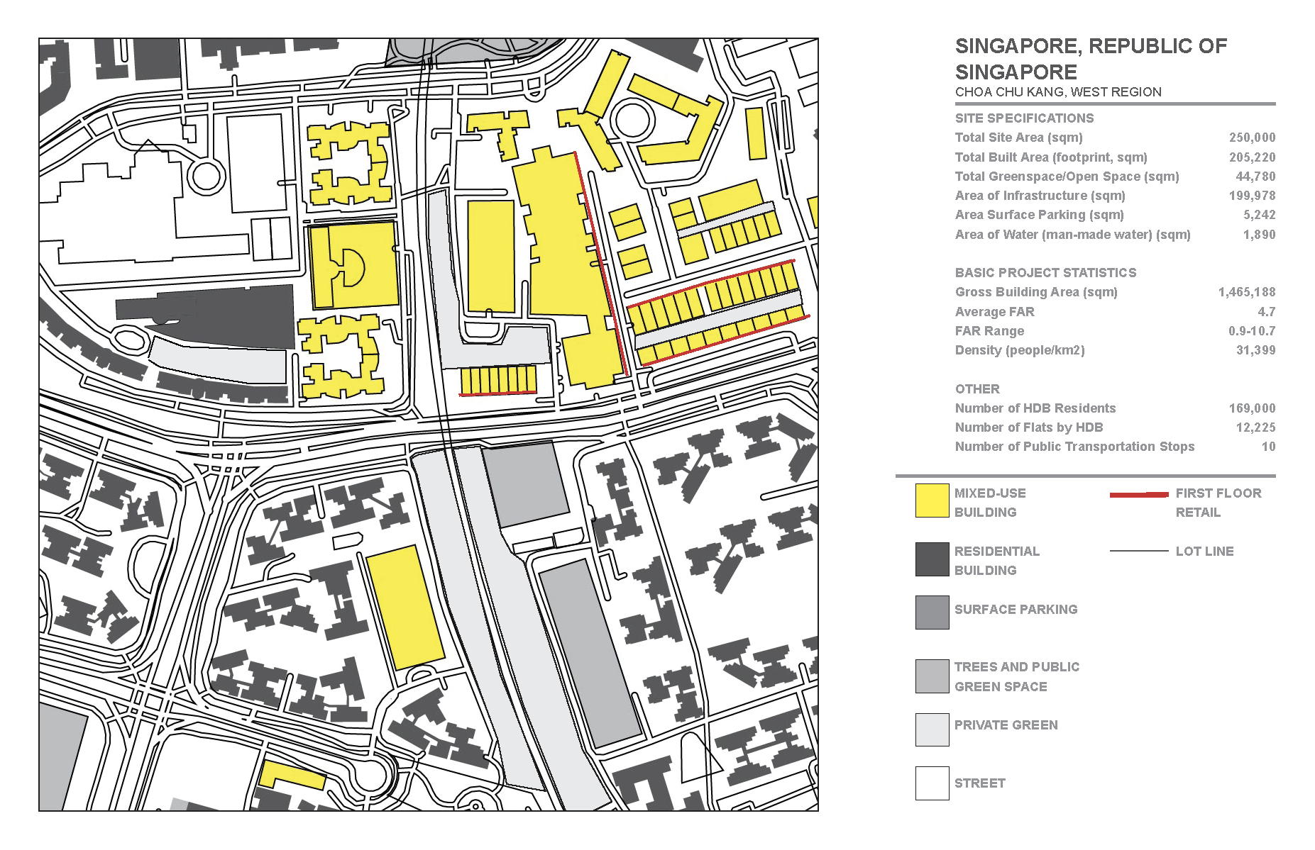
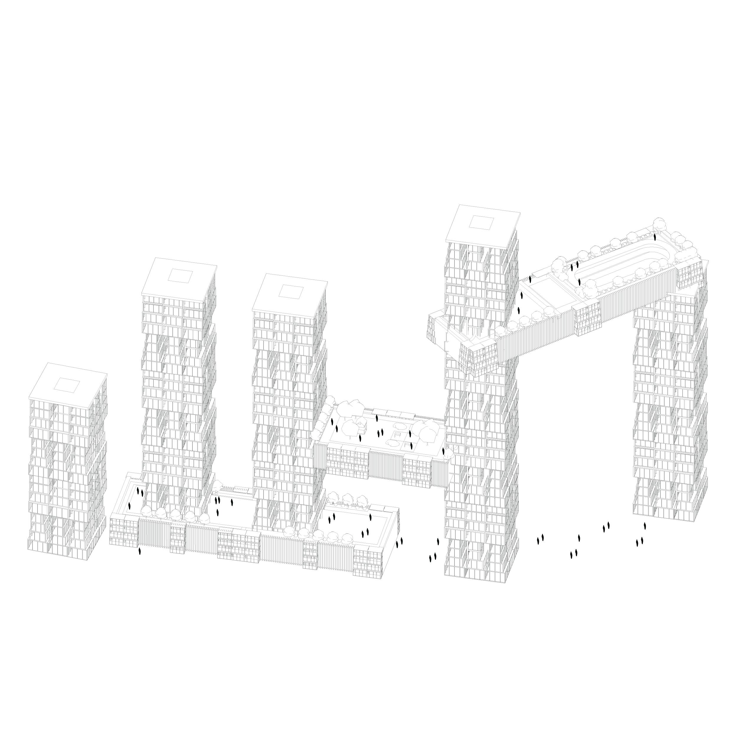
‘Park Line’ is an alternative for HDB planning to involve an individual approach to the future neighborhoods of Singapore’s current HDB planning towns in Tengah, Singapore. Historically, Singapore is known for its repetitive housing developments specific to each neighborhood, which assist the increasing population due to the quick turnaround. The city also is known for highly controlled design execution due to its landlocked region and high population density. The proposal considers the freedom of design individuality, the flexibility of program choice in communal areas, and the opportunity to express individuality through smaller programs such as workshops, lending libraries, and co-working spaces.
The design is inspired by Kwong Von Glinow’s idea of a Tower within a Tower. This approach helps to maintain individually owned apartment space that has the capability to be altered on the exterior as well as the interior. The tower provides a grid of 8 units on each level that consist of single units, couple units, and group units to accommodate all types of users with an accessible center core. Communal attachments are arranged on the ground level, mid-sections, and tops of towers to ease accessibility to essential and leisure activities. Each cluster of towers and communal attachments is arranged in three types of engagements for community wellness: market/nature for mental wellbeing, playground/recreation for physical wellbeing, and outdoor events/gathering space for social wellbeing. Each communal attachment internally allows for various programs, such as polyclinics, primary schools, supermarkets, cafes with a co-working spaces, art galleries, and community centers.
The incentive behind individually designed HDB housing is to establish a more diverse neighborhood that caters to the users to live comfortably with the freedom of expressing their needs as a resident and as a community. The green initiative is also incorporated into the design by consideration of ground level and the tops of the communal attachments, which interact as a super park inside Tengah. The vast amount of personal incentives and communal engagement create new growth in Singapore’s HDB neighborhoods while maintaining a high-density for the city’s future urban fabric.
Left: Residential Tower with Single, Family, and Group Units // Center: Progrmaing happening on the site
![]()
Three Teirs of Mixed Use Space
![]()
Design Axonometric
![]()
Site Section
![]()
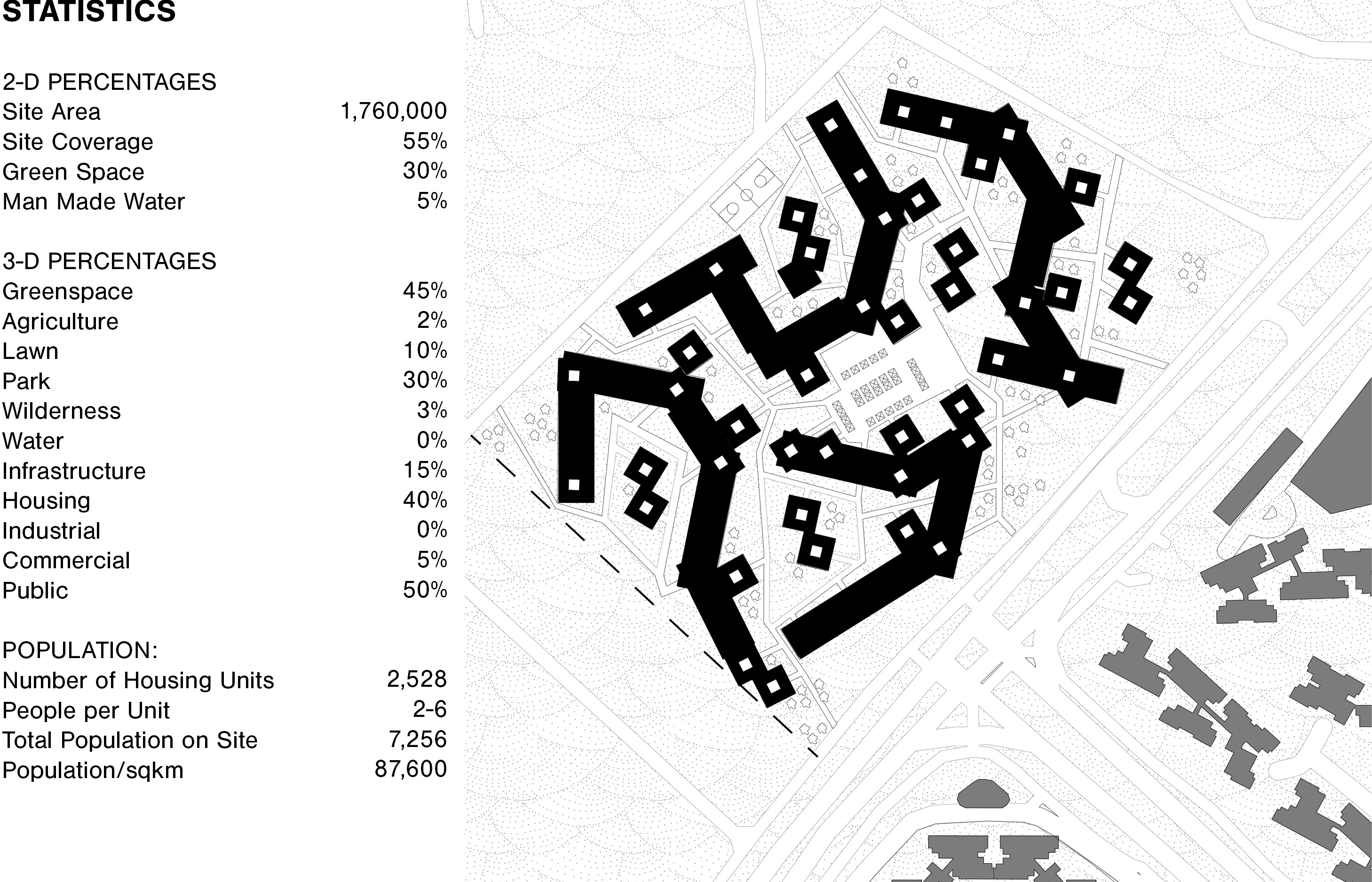
Statistics and Site Plan

Design Axonometric
Site Section
Statistics and Site Plan
Sources:
Googles Maps
Cadmapper
https://www.citypopulation.de/en/peru/lima
https://www-amigosdevilla-it.translate.goog/historia/antecedentes03.html?_x_tr_sch=http&_x_tr_sl=es&_x_tr_tl=en&_x_tr_hl=en&_x_tr_pto=sc
https://www.multiplecities.org/home/2017/12/28/exploring-brt-in-lima-peru
https://www.limaeasy.com/peru-guide/safety-security-travel-advice-series-peru/safety-advice-for-taking-a-taxi-in-lima-and-other-peruvian-cities
http://limacitykings.com/punta-callao/