XXXXV. Delhi, India
 Delhi, India
Delhi, India — Akshita Mandhyan
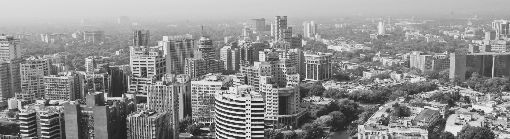
Delhi, the capital city of India, is situated on the banks of Yamuna and extends over an area of 1483 sq. km. The city is bordered by Haryana on its north, west and south and Uttar Pradesh on its east. Within the walls is a maze of congested narrow streets, alleys, busy bazaars, and some of the nation’s most spectacular Indo-Muslim architectural features.
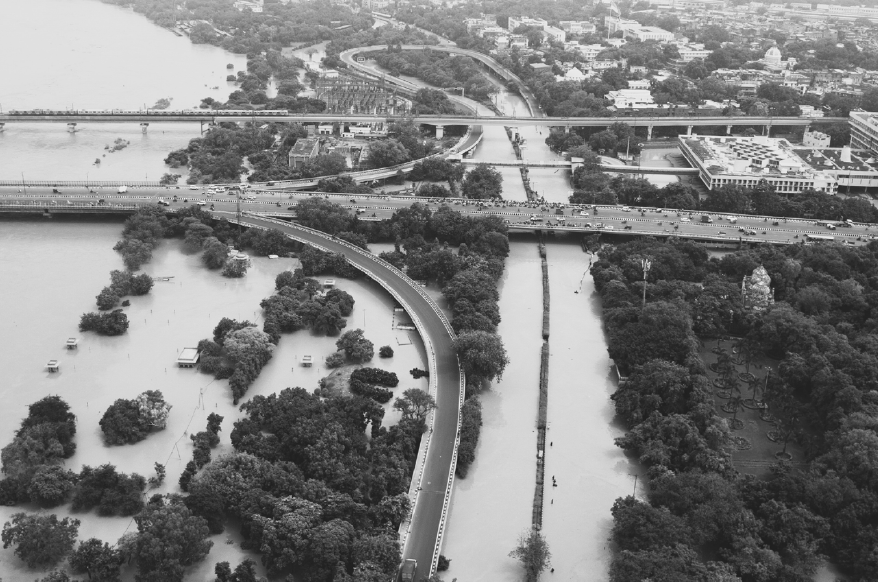
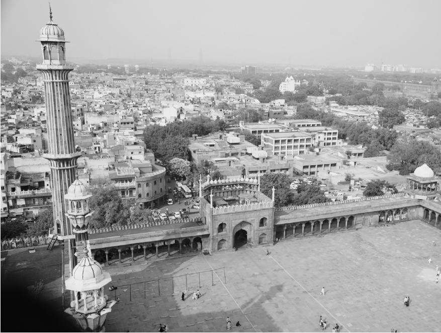
Left: Yamuna Expressway Right: Jama Masjid
Delhi, India
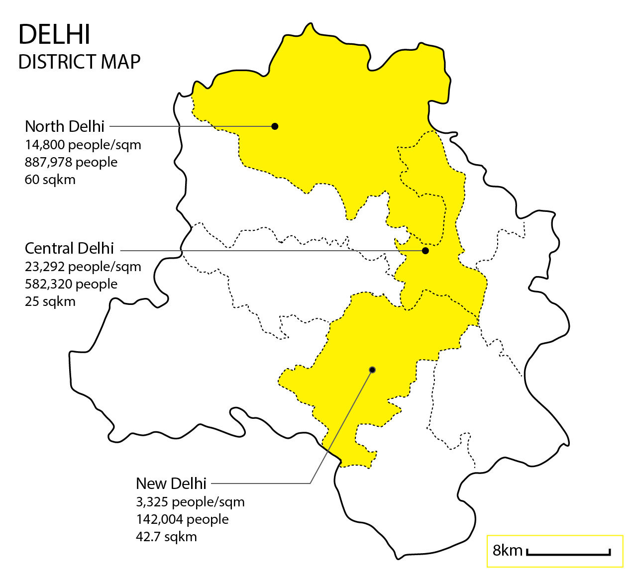
Urban: 16,368,899 people
Area:
Urban: 1113.65 sqkm
Population Density:
Urban Average: 14,698.4 people/sqm
Politics:
The Government of Delhi, officially the Government of the National Capital Territory of Delhi (GNCTD) is the governing body of the Union Territory of Delhi, whose urban area is the seat of the Government of India. The local or city government is headed by the mayor. Delhi is an important cultural, commercial as well as political hub of India. At present, it has 11 districts. They are; Central Delhi, North Delhi, South Delhi, East Delhi, North East Delhi, South West Delhi, New Delhi, North West Delhi and West Delhi. Delhi is divided into three legislative; New Delhi Municipal Committee (NDMC), Municipal Corporation of Delhi (MCD) and Delhi Cantonment Board (DCB). The Supreme Court of India is located in Delhi, along with the regional Delhi High Court, the Magistrate Court, the Sessions Court for criminal cases and other Small Causes Courts for civil cases.

FROM LEFT TO RIGHT
1 OLD DELHI
2 NEW DELHI
3 CENTRAL DELHI
4 FAMOUS CHANDNI CHOWK
SOURCES:
Image source: shutterstock
Map source: mapsofindia
Population data source: Delhi Government Census Report 2011
1 OLD DELHI
2 NEW DELHI
3 CENTRAL DELHI
4 FAMOUS CHANDNI CHOWK
SOURCES:
Image source: shutterstock
Map source: mapsofindia
Population data source: Delhi Government Census Report 2011
Urban Void Spaces

SOURCES:
Google Earth - Maps
Google Maps
Google Street View Photos
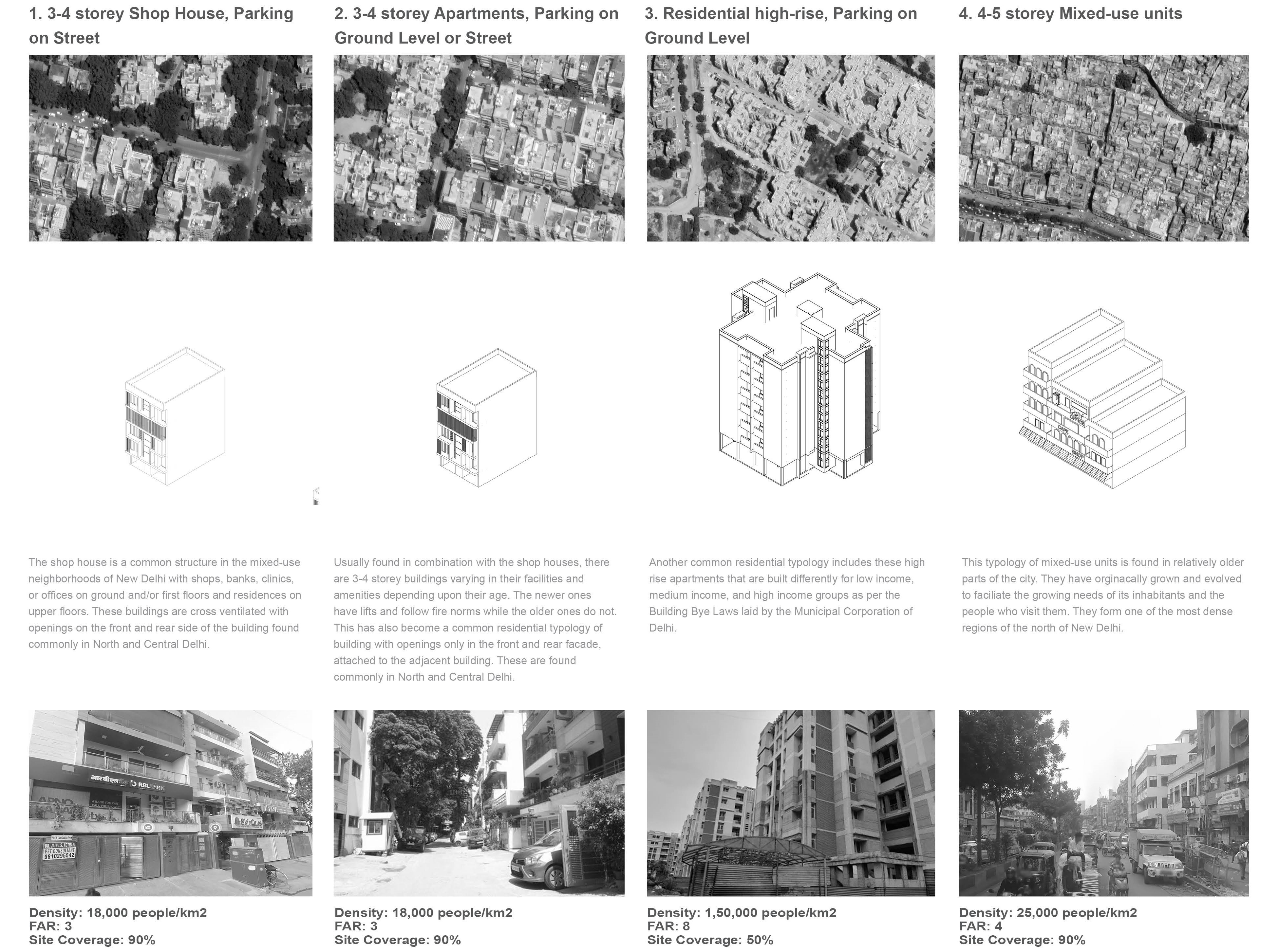
ANALYZING + REPRESENTING URBAN FORM
Theme: Mix-used Building Around Traffic Hub
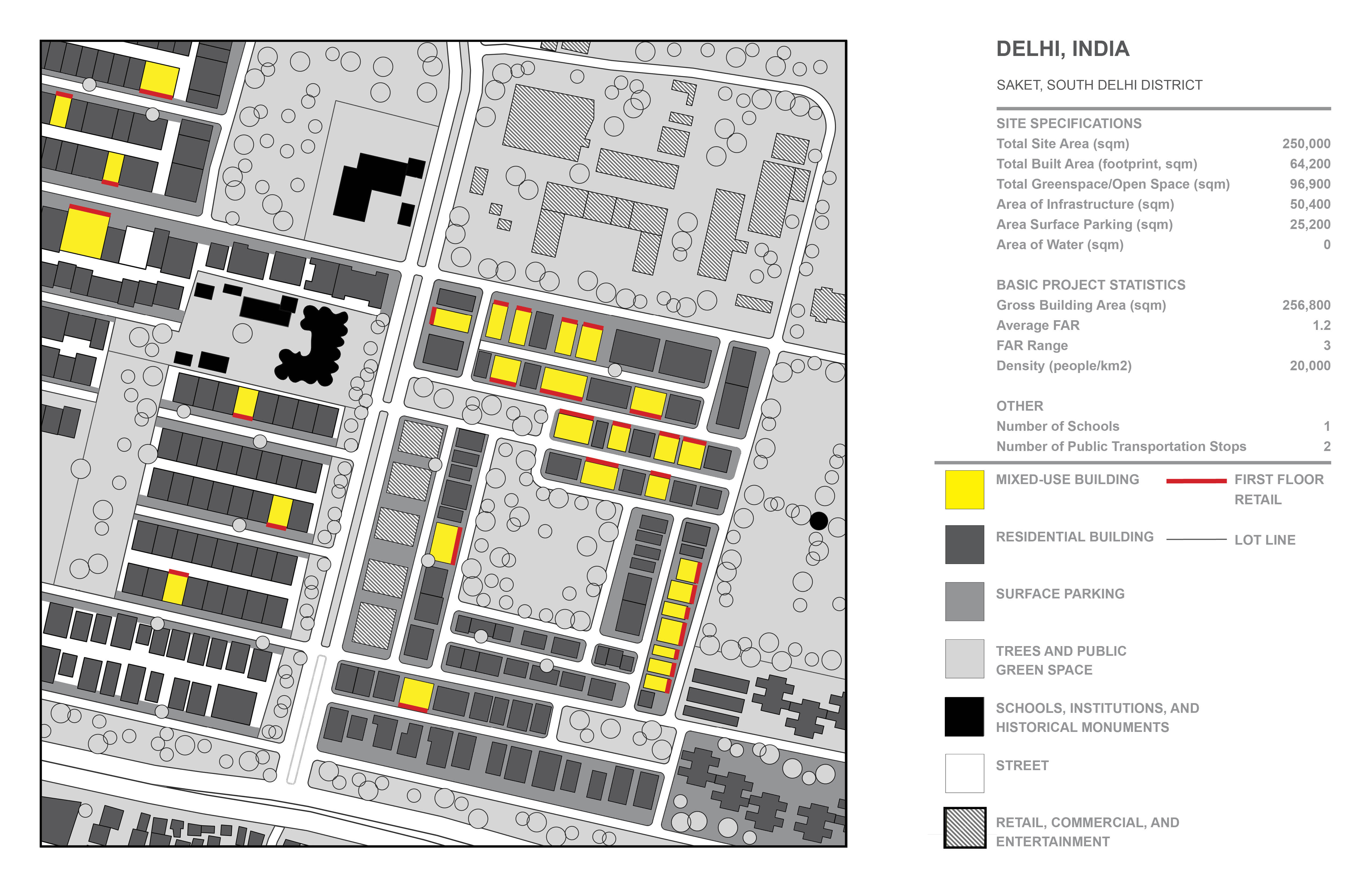
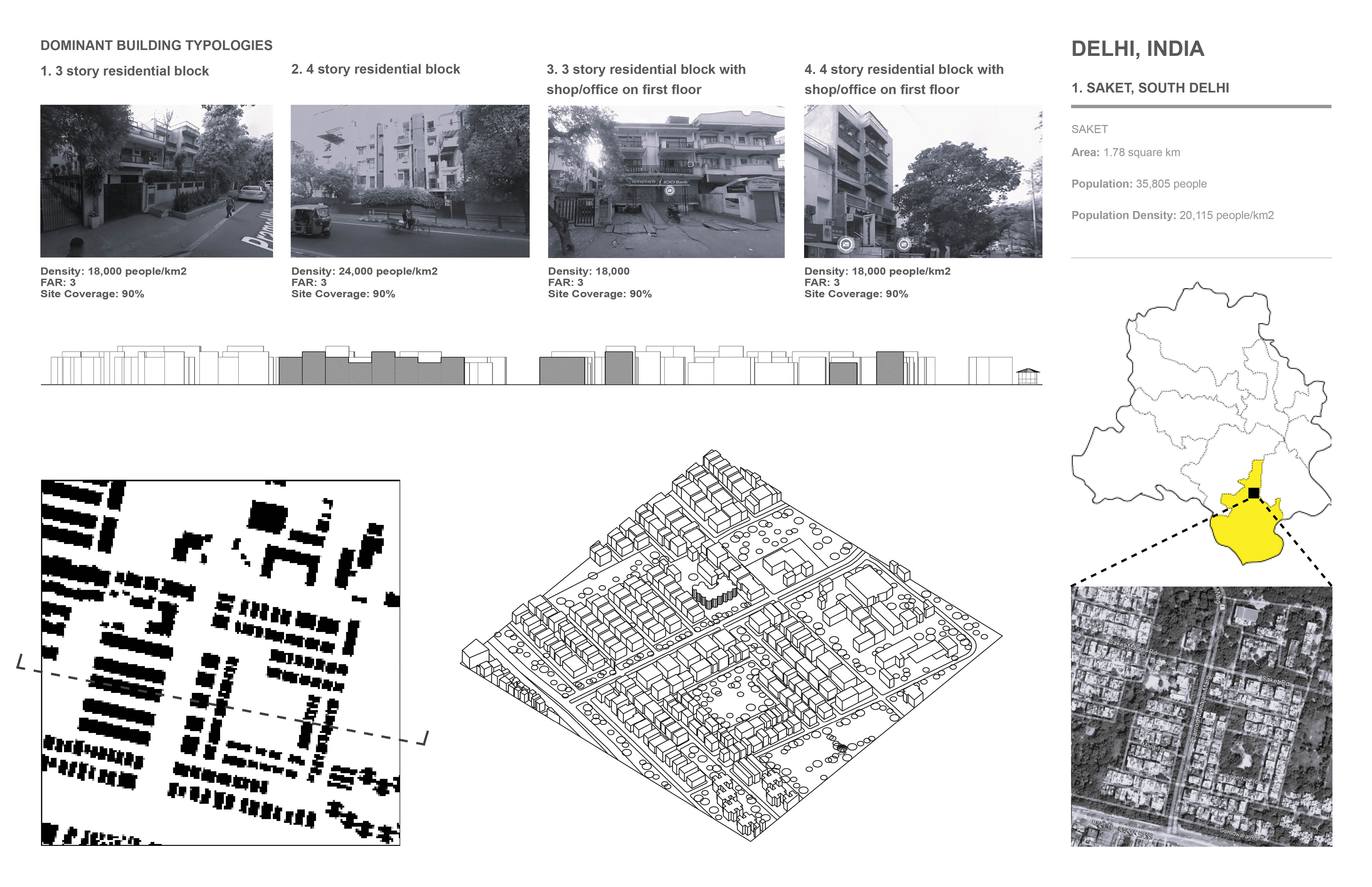
1. Saket, South Delhi District
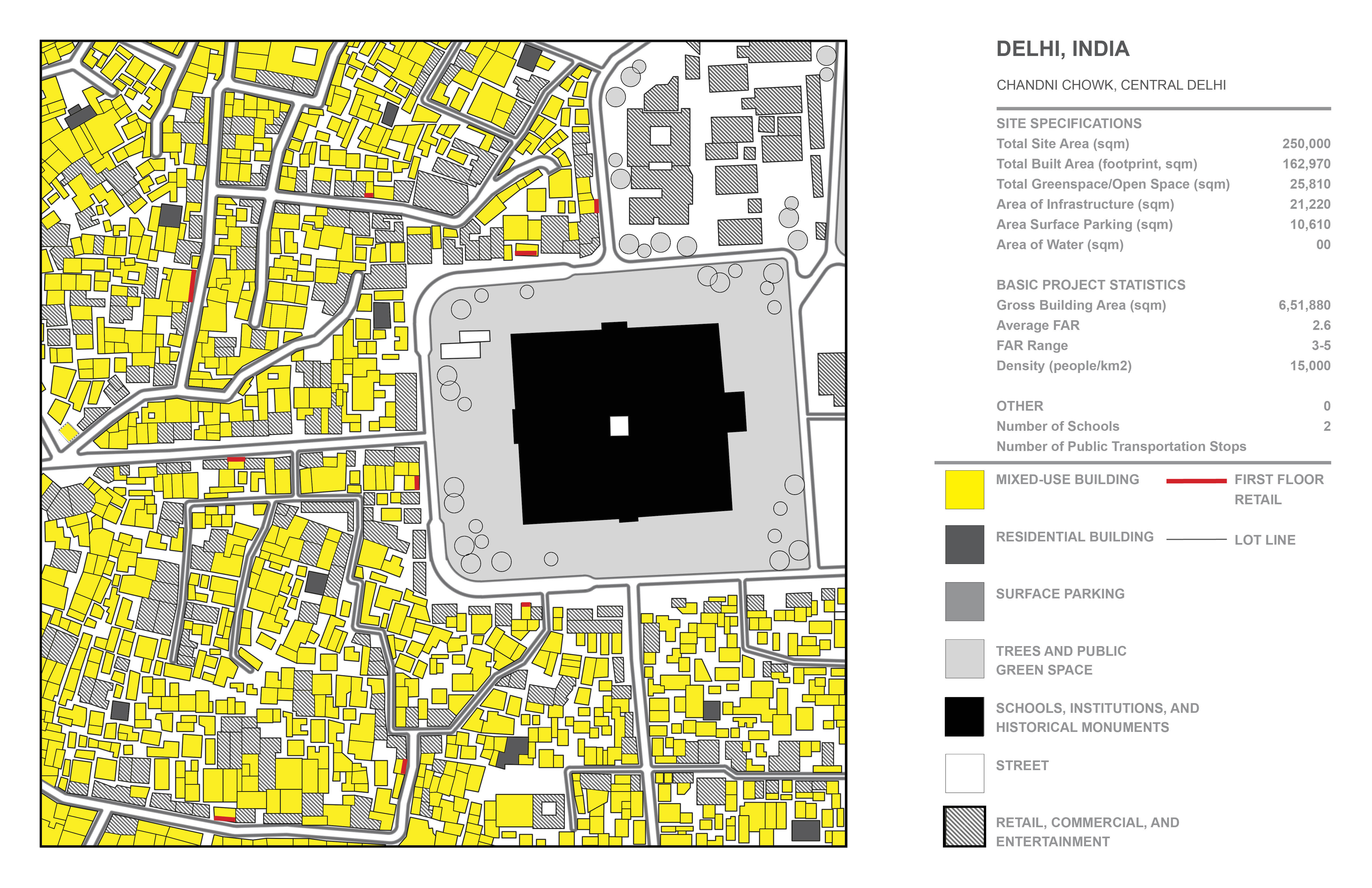
2. Chandni Chowk, Central Delhi District

3. Paharganj, Central Delhi District

https://dccentral.delhi.gov.in/en
FAR & Ground Coverage: Municipal Corporation of Delhi - Unified Building Bye Laws for Delhi 2016 (Annexure VI)
Google Maps
Google Earth
TOWARDS RESILIENCE
Site Plan
Dequindre Cut Greenway which was formerly a GrandTrunk Railroad line is a two mile greenway which was opened to the public in May 2009 as a result of a public, non-profit, and private partnership to create a pedestrian link between the East Riverfront, Eastern Market, several residential neighborhoods and sites in between. One of these many sites which is south of Lafayette Towers sits between two beautiful green spaces - Dequindre Cut Greenway and Lafayette park. This site is a massive parking lot with an unimpressive strip mall but I wonder if this could be more than that?
This proposal for a high density development on this site in Detroit is inspired by the mixed-use neighborhoods in Central and South Delhi which are walkable and diverse. The project proposed retail uses on the lower floors to activate streetlife and plaza environment, residential in the middle floors, the office or commercial uses on the top floors, and parking in the basement. While ensuring a blend of architectural aesthetics, my attempts are mainly directed towards a mixed-use composition of every building to ensure more economic and social resilience.

Axonometric
 Section
Statistics