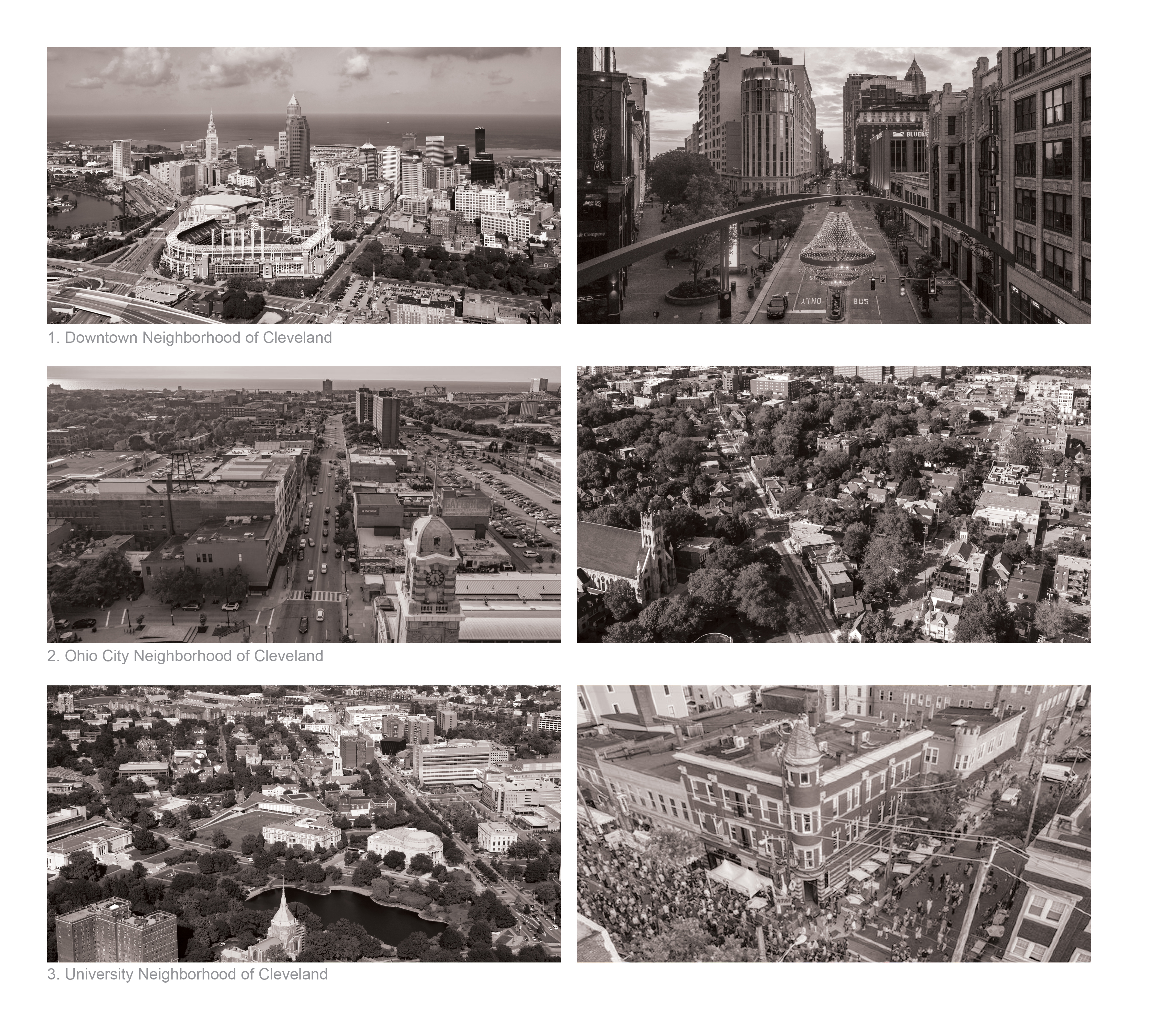
XXXXIX. Cleveland, Ohio

Cleveland, Ohio
Cleveland, Ohio — Cameron Blakely
Cleveland, Ohio, USA
Cleveland is the largest city in the state of Ohio in the United States. Located on the shores of Lake Erie, the city quickly developed into a major industrial center in the early and mid 20th Century. Like other Great Lakes cities, however, the city saw rapid decline and population loss due to shifting economies and suburbanization. Today the city population sits at a fraction of its peak, while the metro continues to spread out. While the city proper occupies a staggering 200 square kilometers, its population currently sits at just under 400,000 making it the second largest city in Ohio. The city has struggled to deal with this surplus of land as well as how to reimagine its long industrialized waterfronts. Cleveland remains an important industrial hub and a major sports city with several large stadiums and a large fan base. It’s downtown is home to Playhouse Square, the largest performing arts center in the US outside of New York City.
Population:
Urban: 361,607 people
Metro (MSA): 2,063,132 people
Area:
Urban: 201 sq km
Metro (MSA): 5,177 sq km
Population Density:
Urban Average: 1,851 people/sq km
Metro Average: 399 people/sq km

Cityscape:
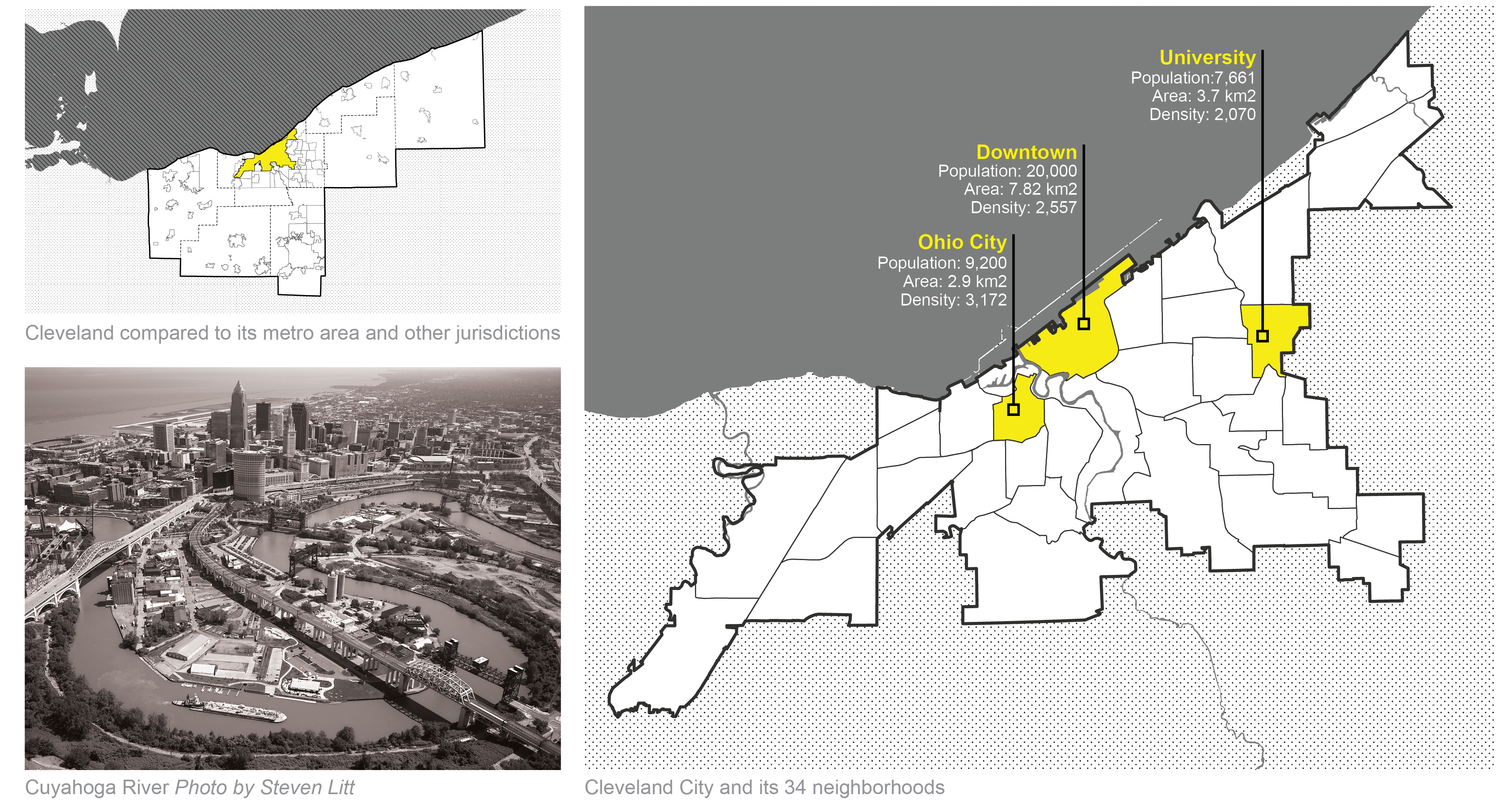
The Cuyahoga River is the primary geographic feature running through the city as it makes its way to Lake Erie. This river has a history of neglect and contamination from the industries along its backs, but in recent years has been undergoing many remediation efforts. Cleveland is made up of 34 different neighborhoods with most of these consisting of detached, single family homes. Neighborhoods closer to downtown exhibit a higher concentration of historic and mixed use structures as well as large areas of vacant post-industrial land.
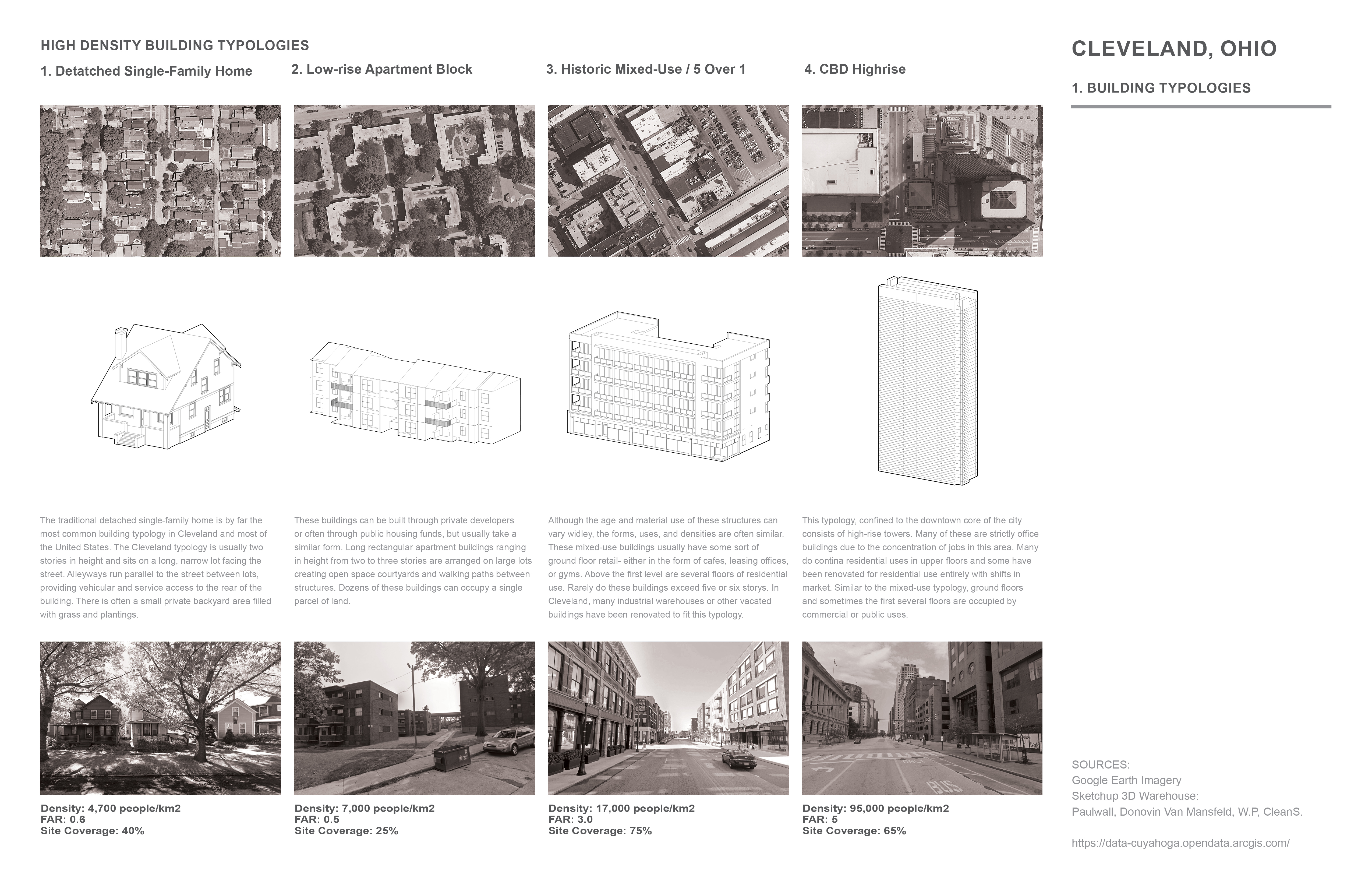
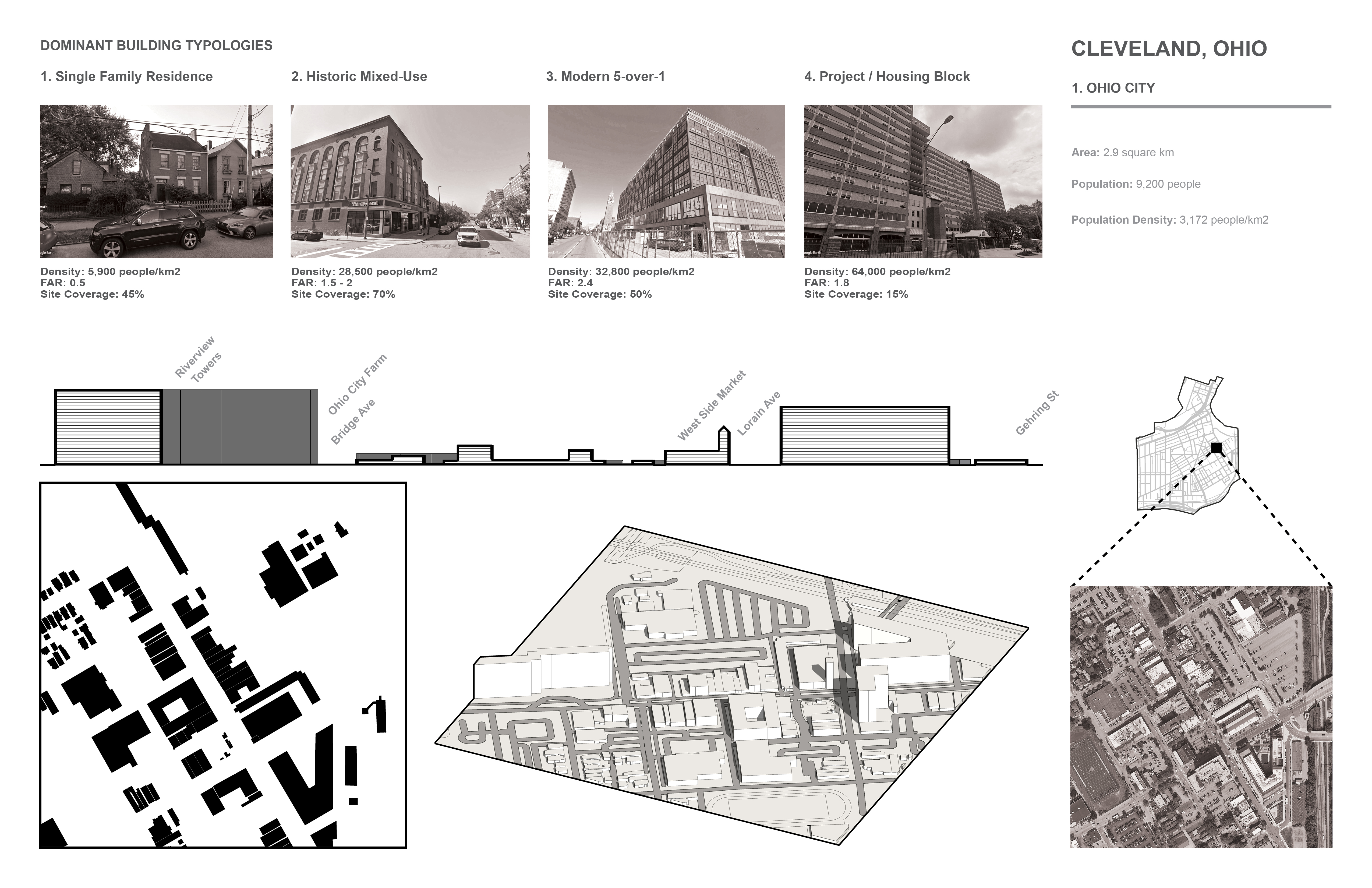
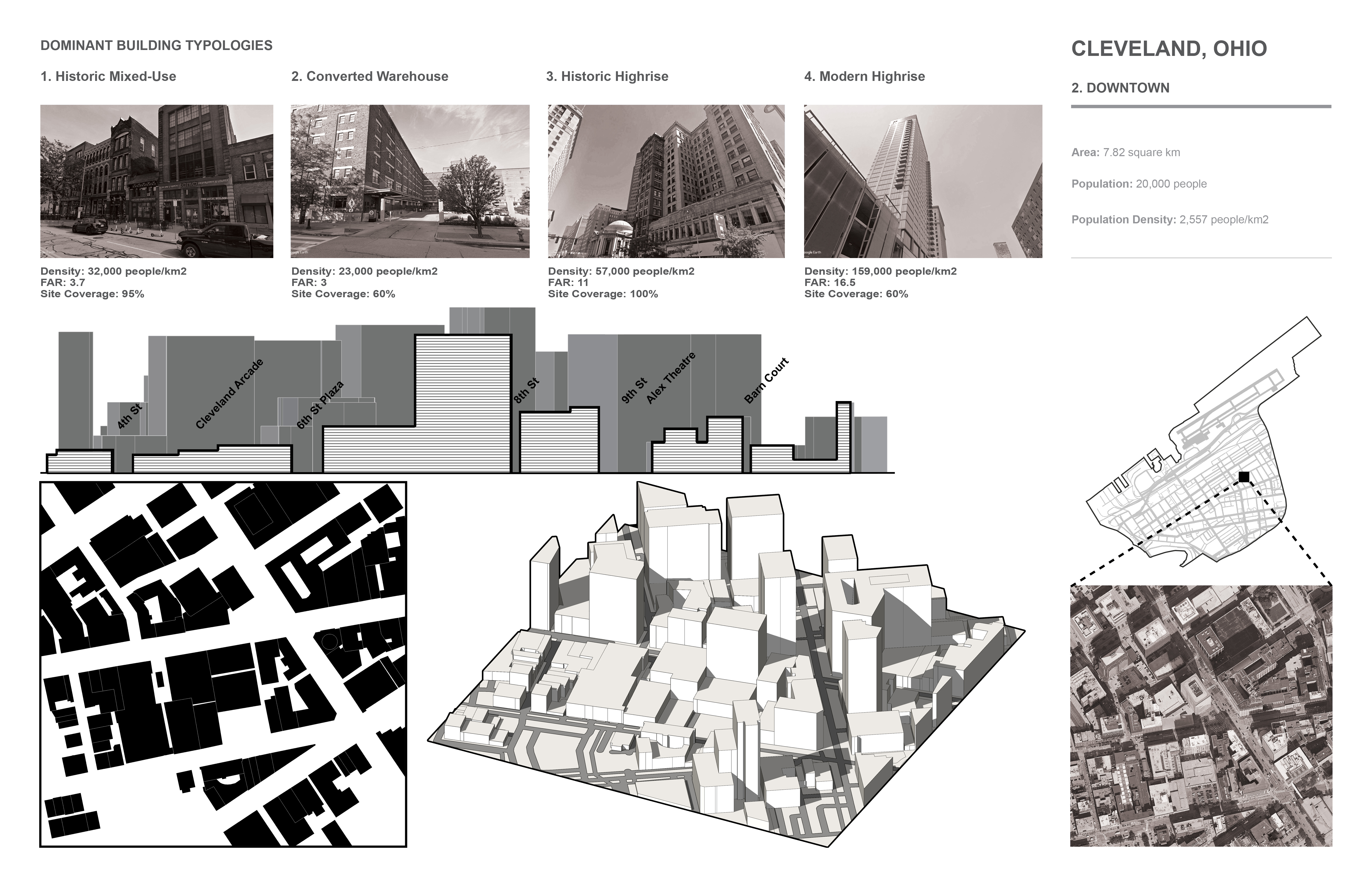
TYPOLOGY STUDY
Cleveland, Ohio: High-Density Building Typologies
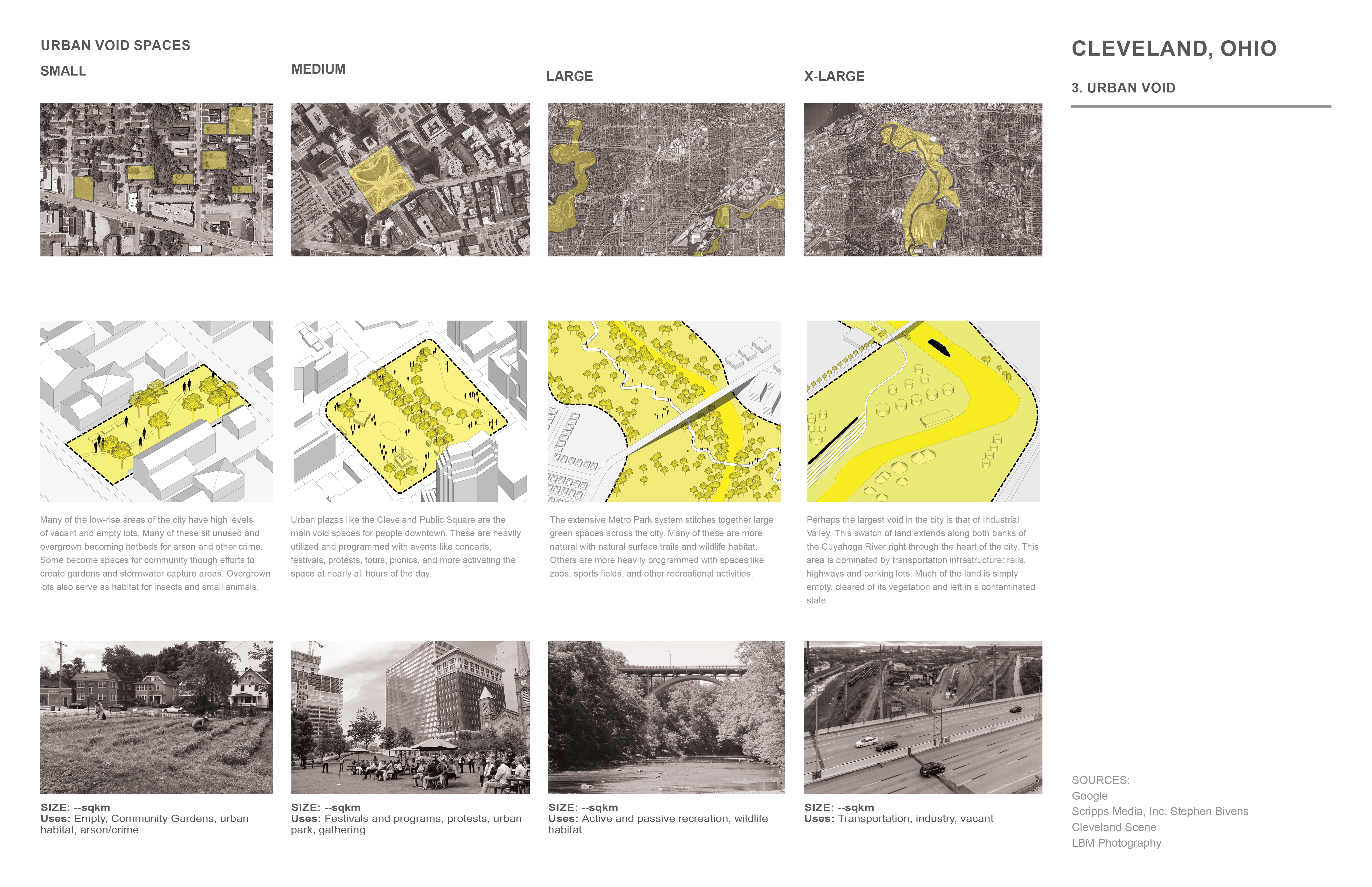
Cleveland, Ohio: Urban Void Typologies
Due to the relatively flat land that the city is built on, geography has played little role in city density, aside from proximity to the lake front and the Cuyahoga River. Older neighborhoods exhibit higher densities due to the era in which they were built, given the modes of transportation available at the time. With the combined forces of the automobile, shifting economy, and post-war
development changes, the city began to spread further out. Clevelend is a city exhibiting “sprawl without growth”. Many of its already low-density suburbs have continued to thin out with many vacant houses and parcels. Despite the surplus of over 70,000 houses, the city still exhibits unnafordablehousing for many of its citizens. Too little new housing stock combined with too
many low-wage jobs, has created a precarious situation for many citizens. Over 400,000 households spend more than half of their income on rent. Finding ways of introducing new density, not only to downtown but to other nearby neighborhoods in the city, esecially those in proximity to transit, could provide more affordable and high quality living for many residents.
Sources:
https://www.cleveland.com/realestate-news/2023/03/advocateswarn-of-worsening-affordable-housing-shortage-for-poorestohioans.html
https://journals.openedition.org/metropoles/4950#tocto1n2
Area: 3 km2
Population Density: 3,172 people/km2

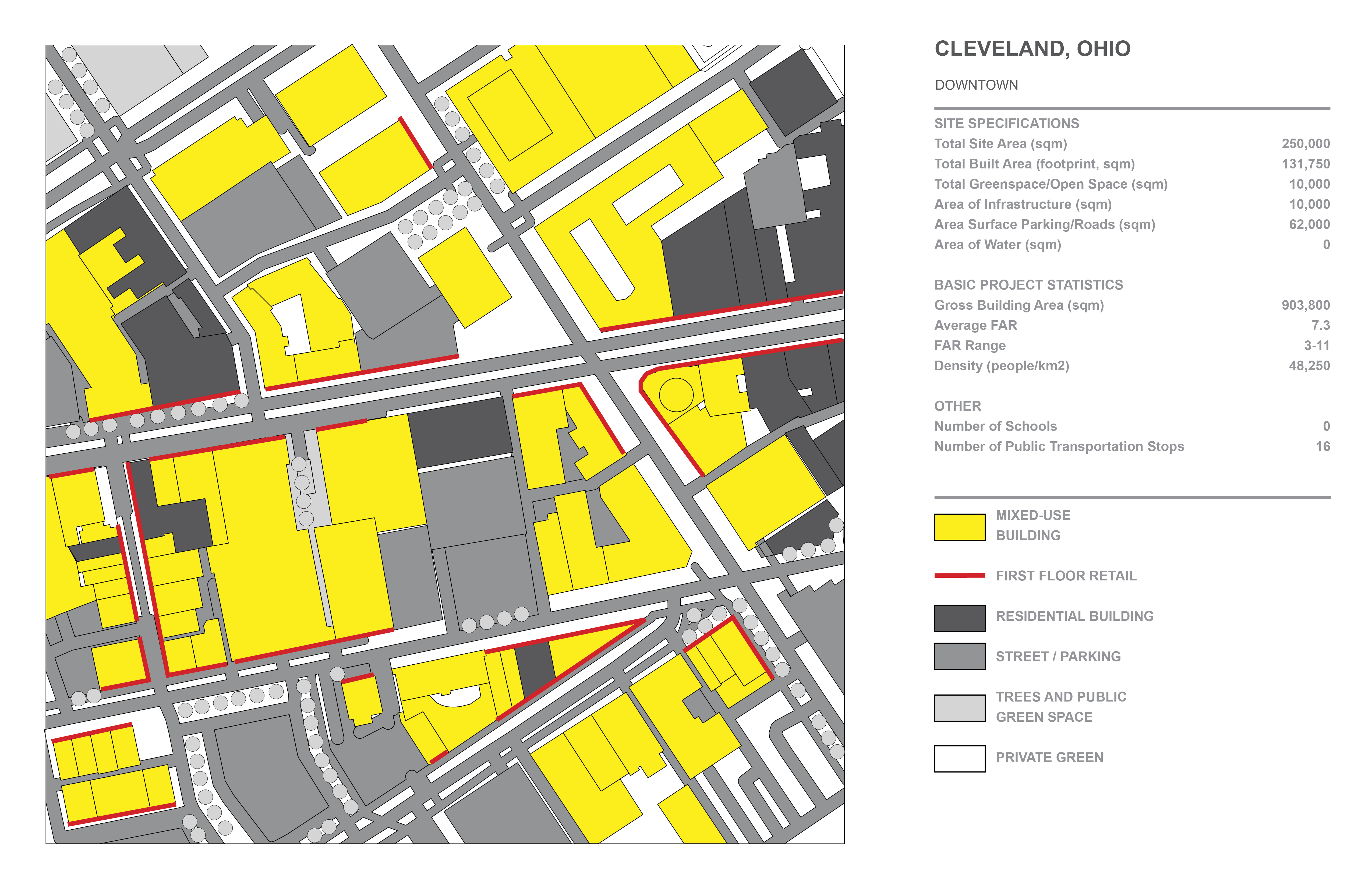
2. Downtown
Area: 7.82 km2
Population Density: 2,557 people/km2
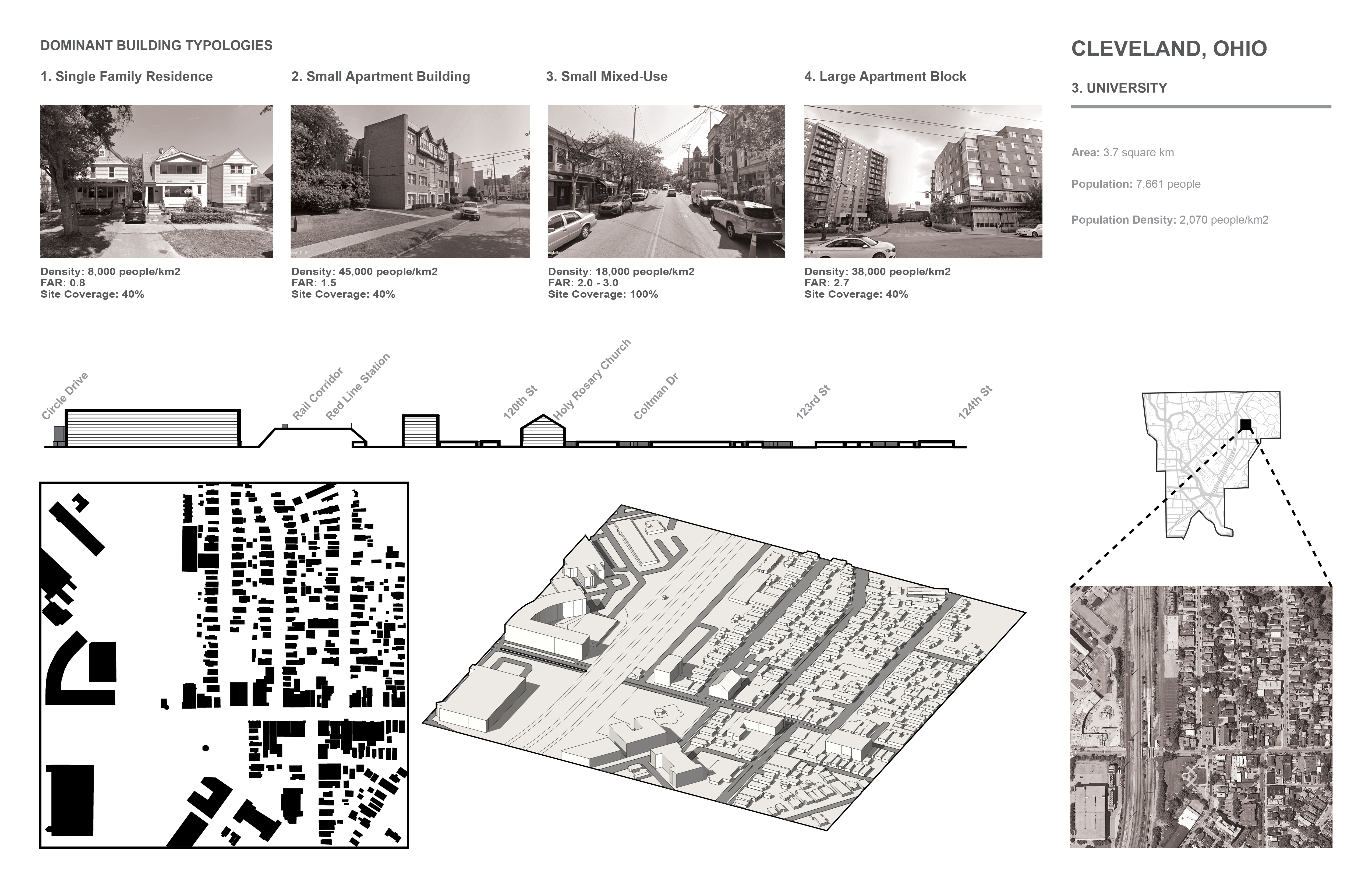
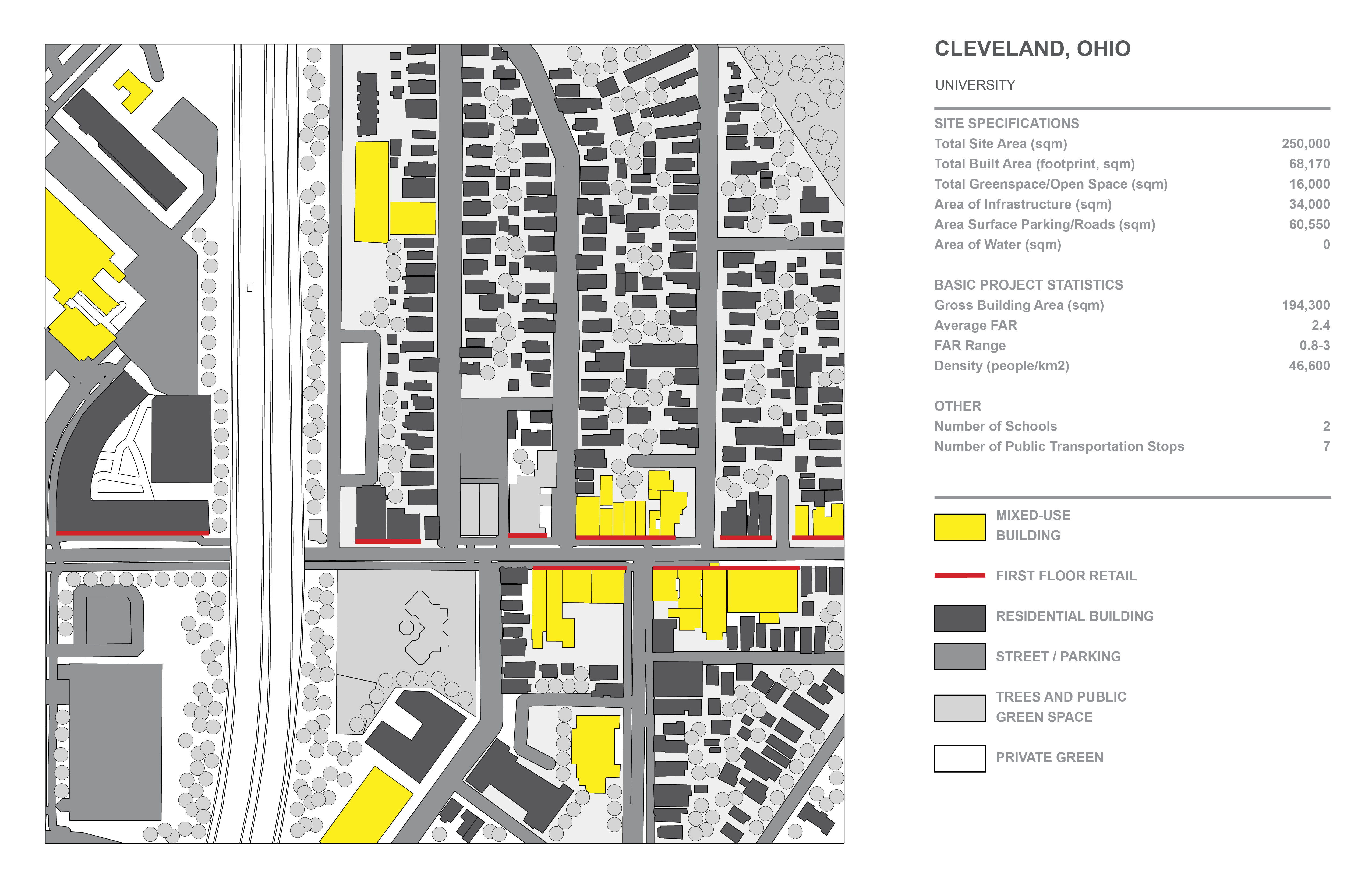
3. University
Area: 3.7 km2
Population Density: 2,070 people/km2
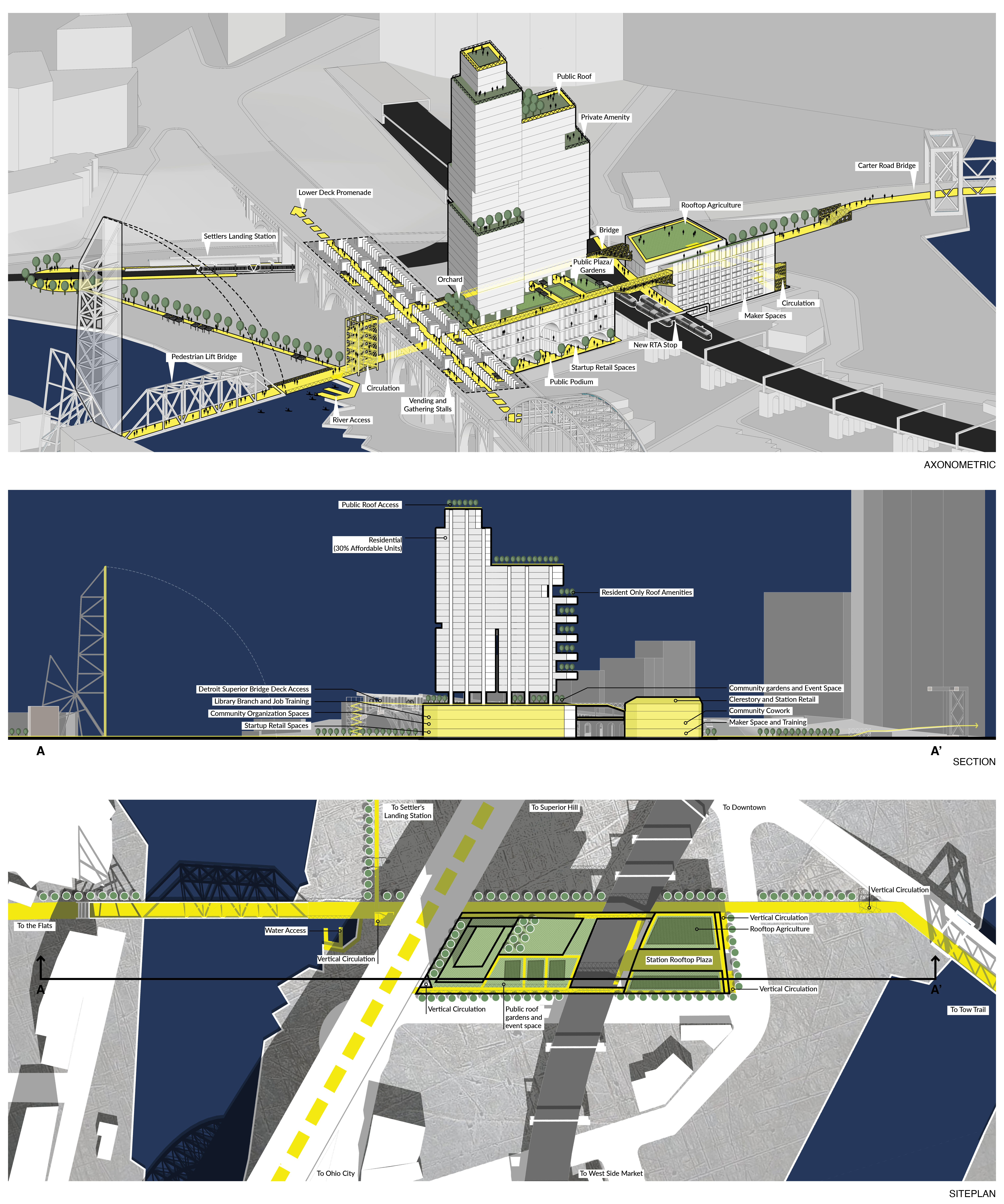
BRIDGING THE GAP
The city of Cleveland is an important port and manufacturing center in the Midwest of the United States. Despite its historic significance and economic prominence in the region, it, like other Rust Belt cities, has suffered from shifting economies, suburbanizing populations, and an overabundance of vacant land and infrastructure.
Located near the city center at the convergence of the Detroit-Superior bridge and the RTA metro viaduct, Bridging the Gap is a new hyper-dense community, built on the backs of surrounding infrastructure creating physical and programmatic ties to the surrounding community and redefining how vacant lands can be accessed and used. Connecting to surrounding viaducts and rail lines, the project literally bridges rivers and barriers while its interior program of public space, workshops, job training facilities, gardens, and startup retail spaces bridges socio-economic gaps in the community.
As rust belt cities continue to spread and lose population in their cores, Bridging the Gap invites us to reconnect and explore the infrastructure of the past while reimagining the future.