IV. Miami, Florida


Miami, Florida — Noah Russin
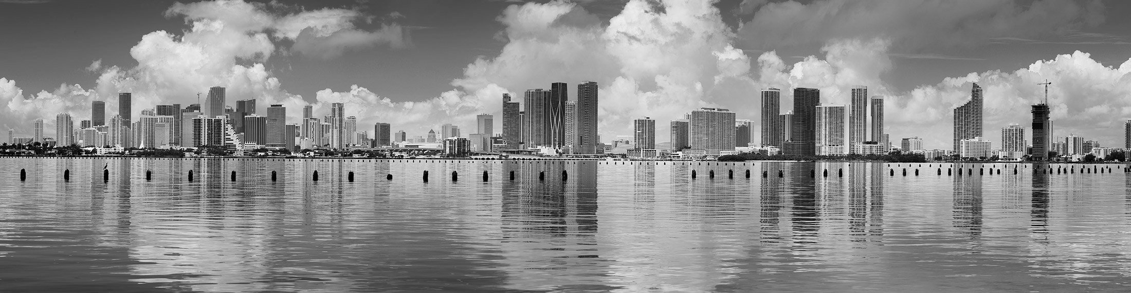
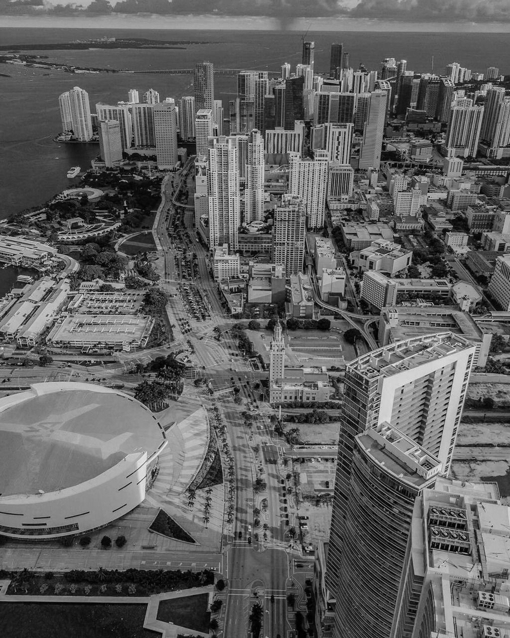
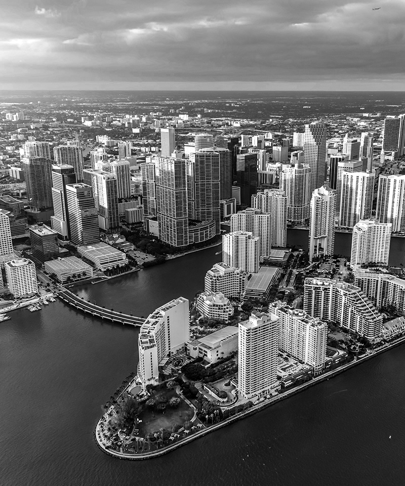
The City of Miami, located in southeast Florida, is the 44th largest city in the United States in terms of population. It is a major center and leader in finance, commerce, culture, arts, and international trade boasting the 12th largest metro economy in the United States. It has one of the largest skylines as well, with over 300 high-rises. Miami is currently experiencing one of the largest population growth rates in the world. .

Left: Brickell, Miami. Right: Edgewater, Miami.
Miami, Florida
Population:
Urban: 478,820 people
Metro: 6,800,000 people
Area:
Urban 93.2 km2 (36.0 sq mi)
Metro 15,890 km2 (6,137 sq mi)
Population Density:
Urban Average: 13,300 people/mi2
Metro Average: 1,108 people/mi2
Politics:
Miami-Dade County has operated under a a two-tier federation since 1957, a unique governing system for the metropolitan area. Unlike a consolidated city-county, where the city and county governments are a single entity, the two entities (city and county) are kept seperate. There are 34 municipalities in the county, the City of Miami being the largest. The Mayor of Miami-Dade County is elected countywide to serve a four-year term. The current post is occcupied by Daniella Levine Cava, the county’s first female mayor. The Board of County Commissioners is the legislative body, consisting of 13 members elected from single-member districts.
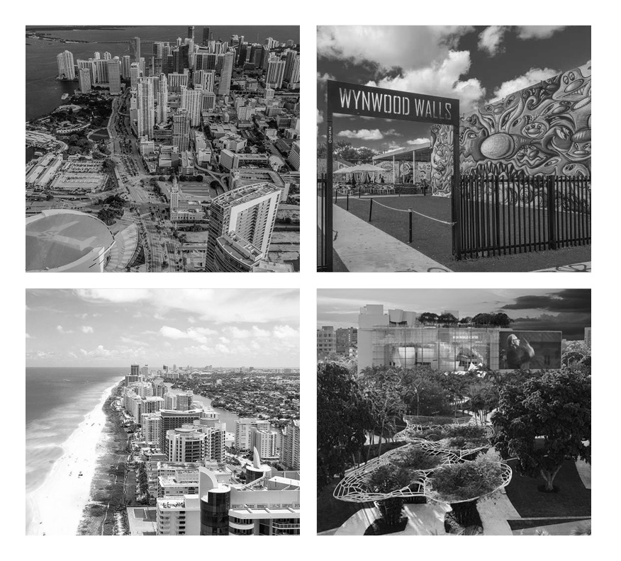
Top Left: Downtown Miami. Top Right: Wynwood Arts District. Bottom Left: Miami Beach Coastline. Bottom Right: Miami Beach Public Space
![]()
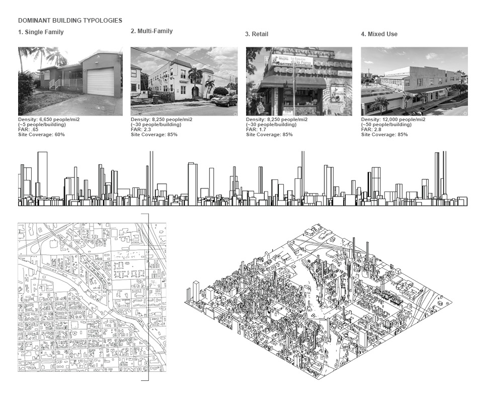
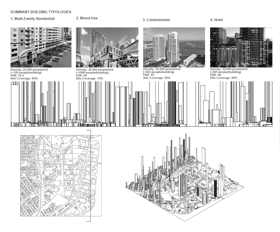
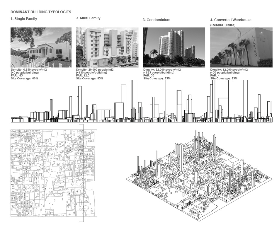
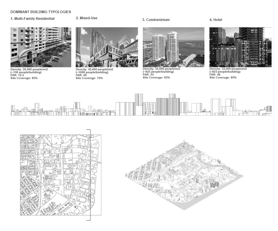
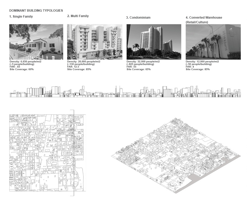
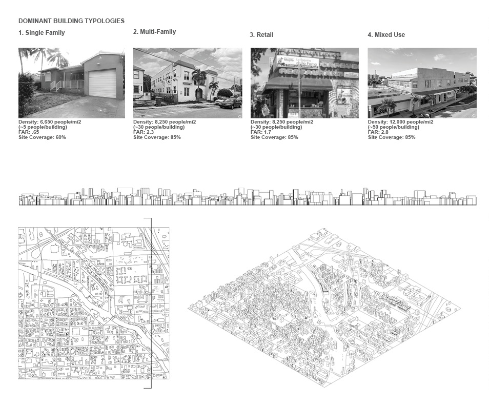
Miami, Florida. High Density Buildig Typologies
![]()
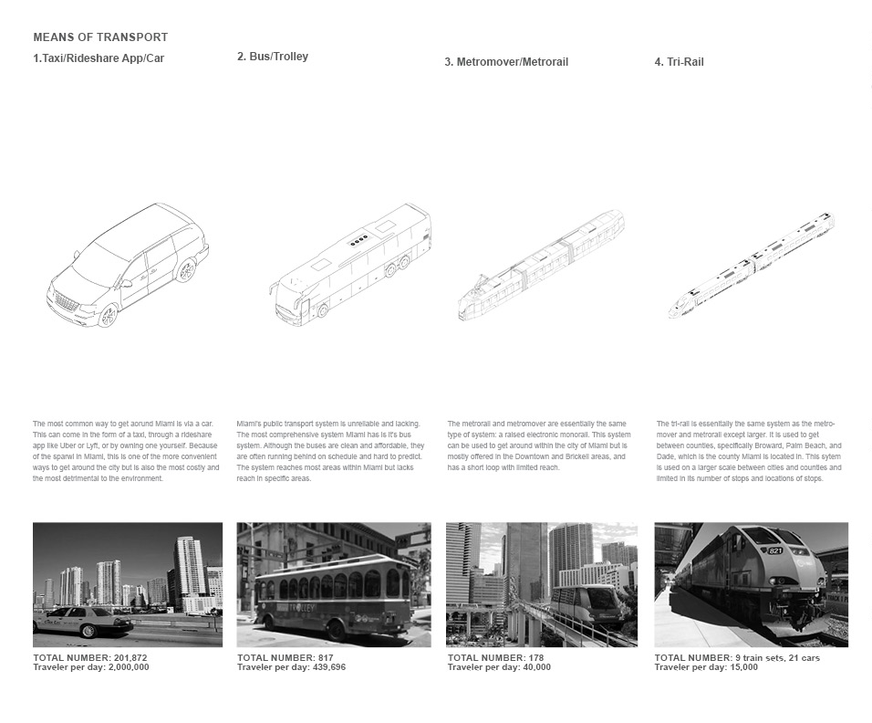
Miami, Florida. Means of transportation
![]()
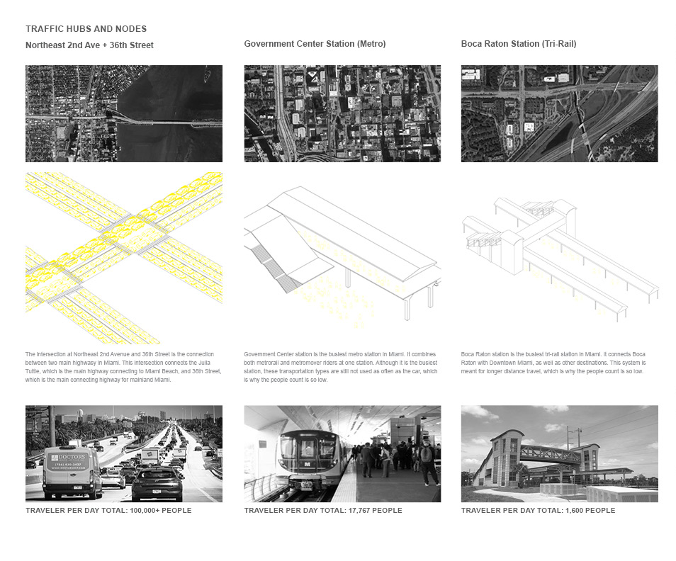
Miami, Florida. Traffic hubs and nodes
![]()
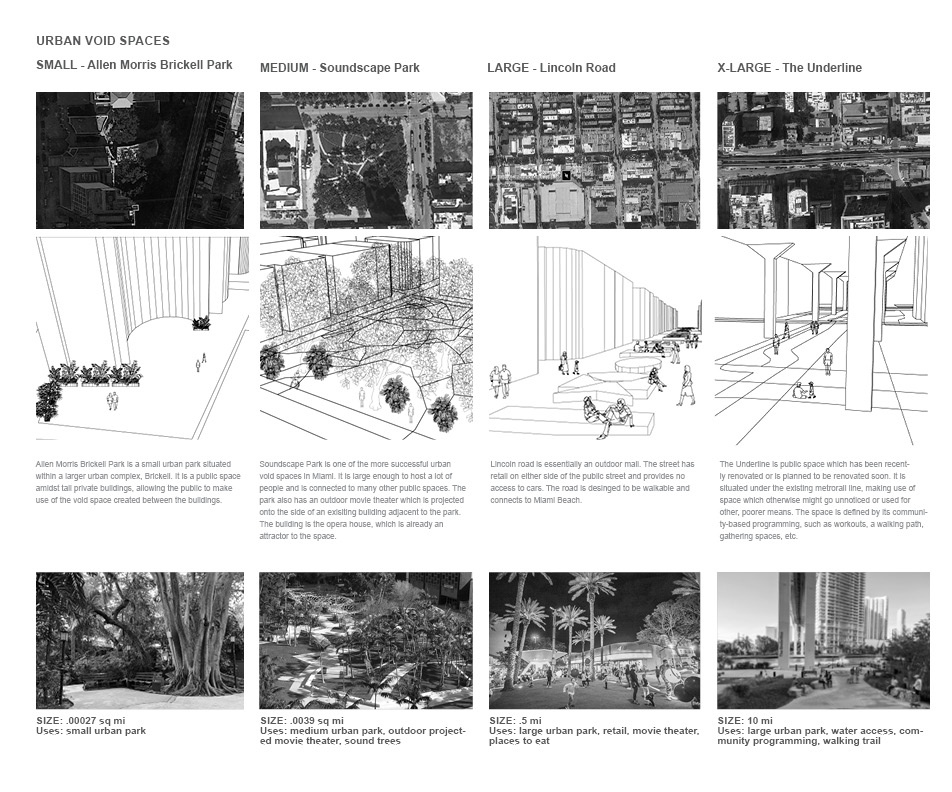
Miami, Florida. Urban Void Spaces
Miami, Florida. High Density Buildig Typologies
Miami, Florida. Means of transportation
Miami, Florida. Traffic hubs and nodes
Miami, Florida. Urban Void Spaces
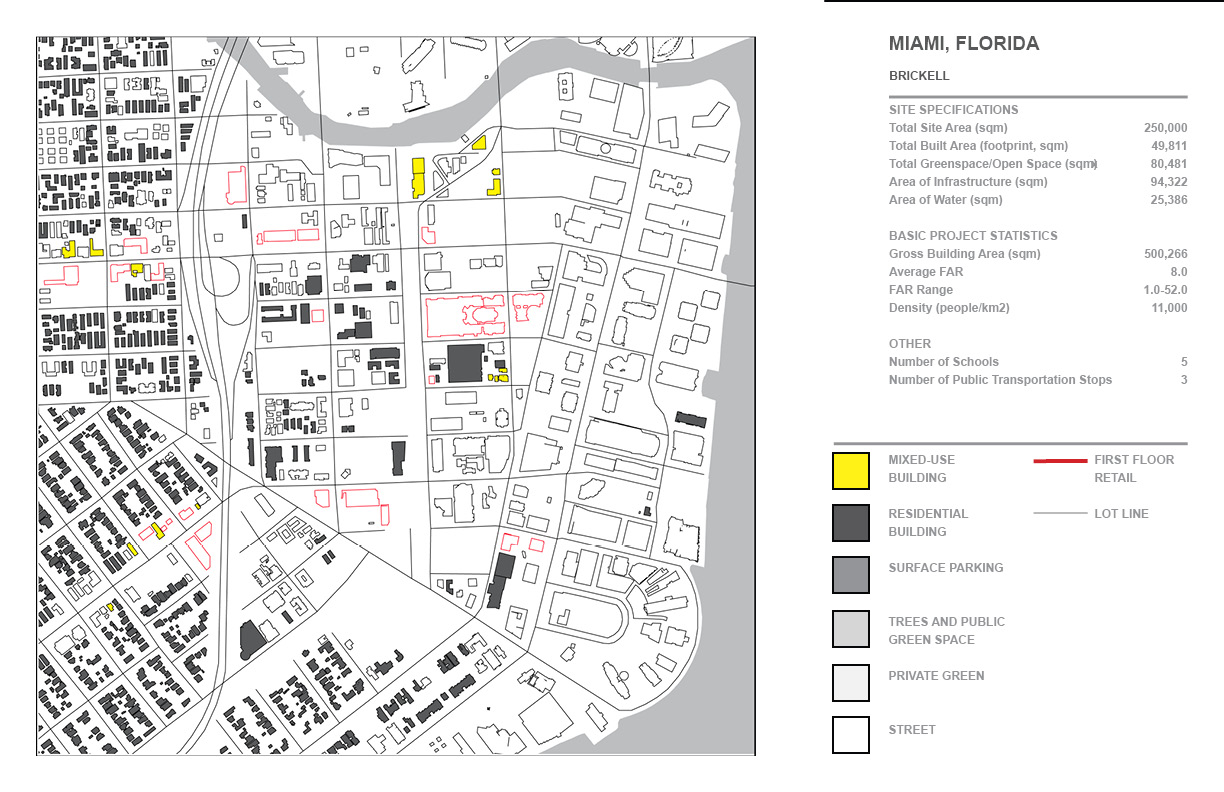
Miami, Florida - Brickell:
Area: 3.08 square km
Population: 32,489 people
Population Density: 10,541 people/km2
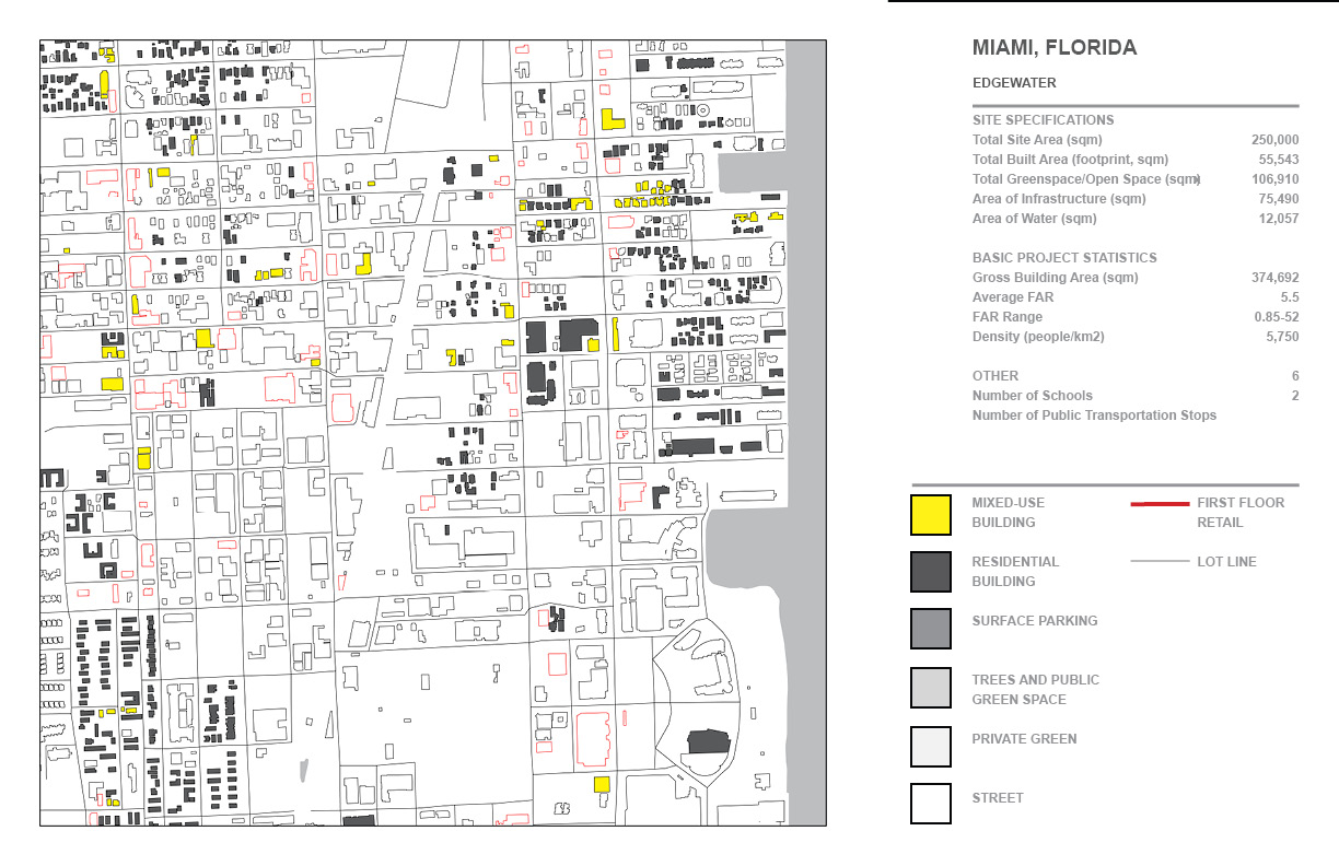
Miami, Florida - Edgewater:
Area: 2.24 square km
Population: 15,005 people
Population Density: 6,675 people/km2
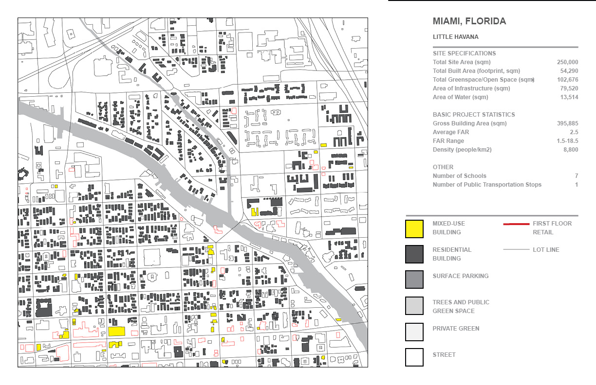
Miami, Florida - Little Havana:
Area: 9.04 square km
Population: 76,163 people
Population Density: 8,423 people/km2
Living With Water, Miami
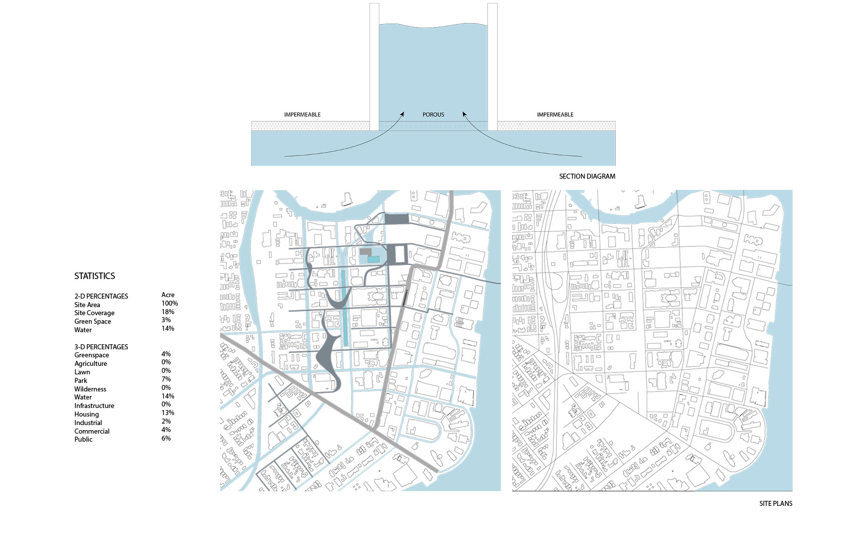
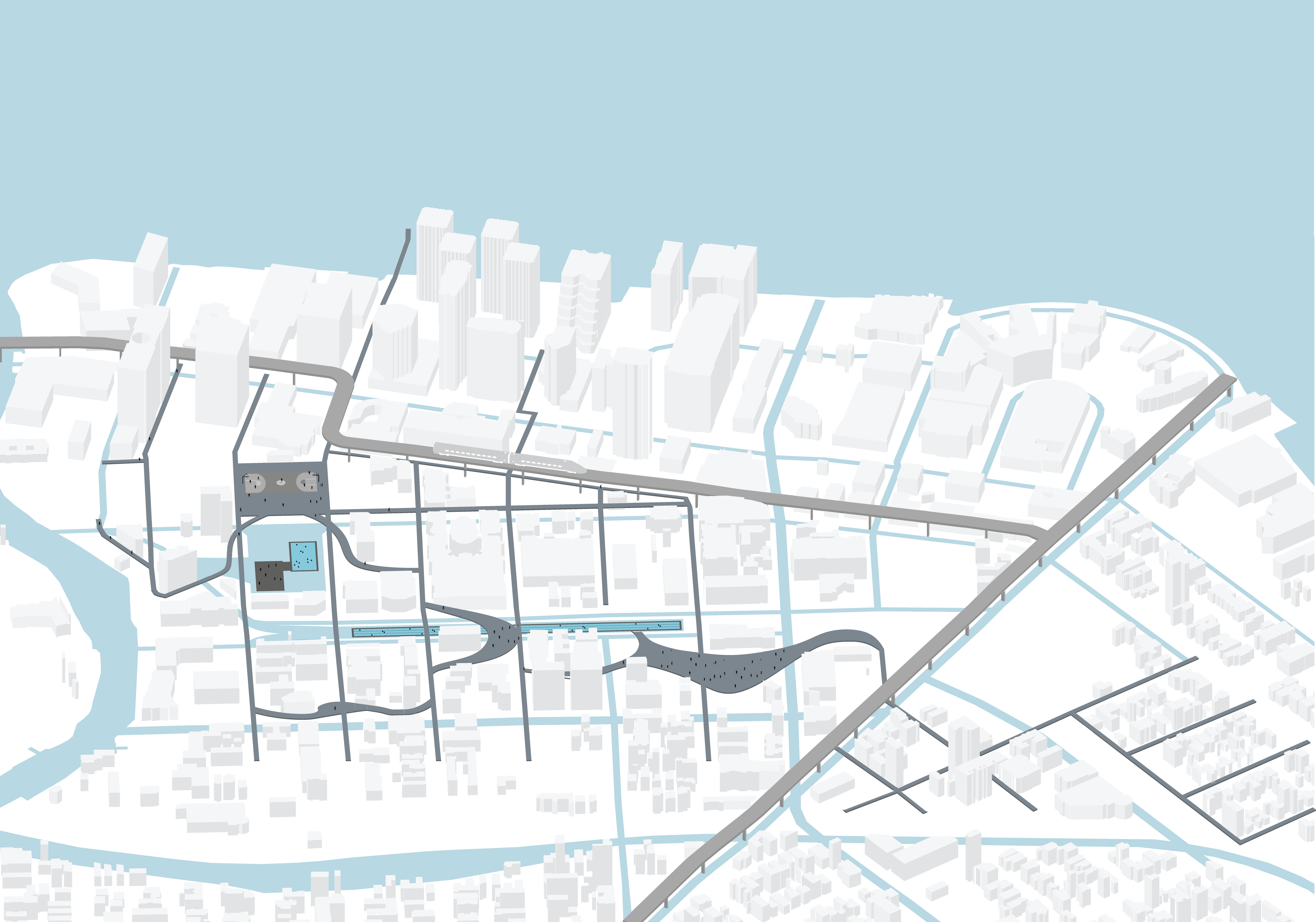
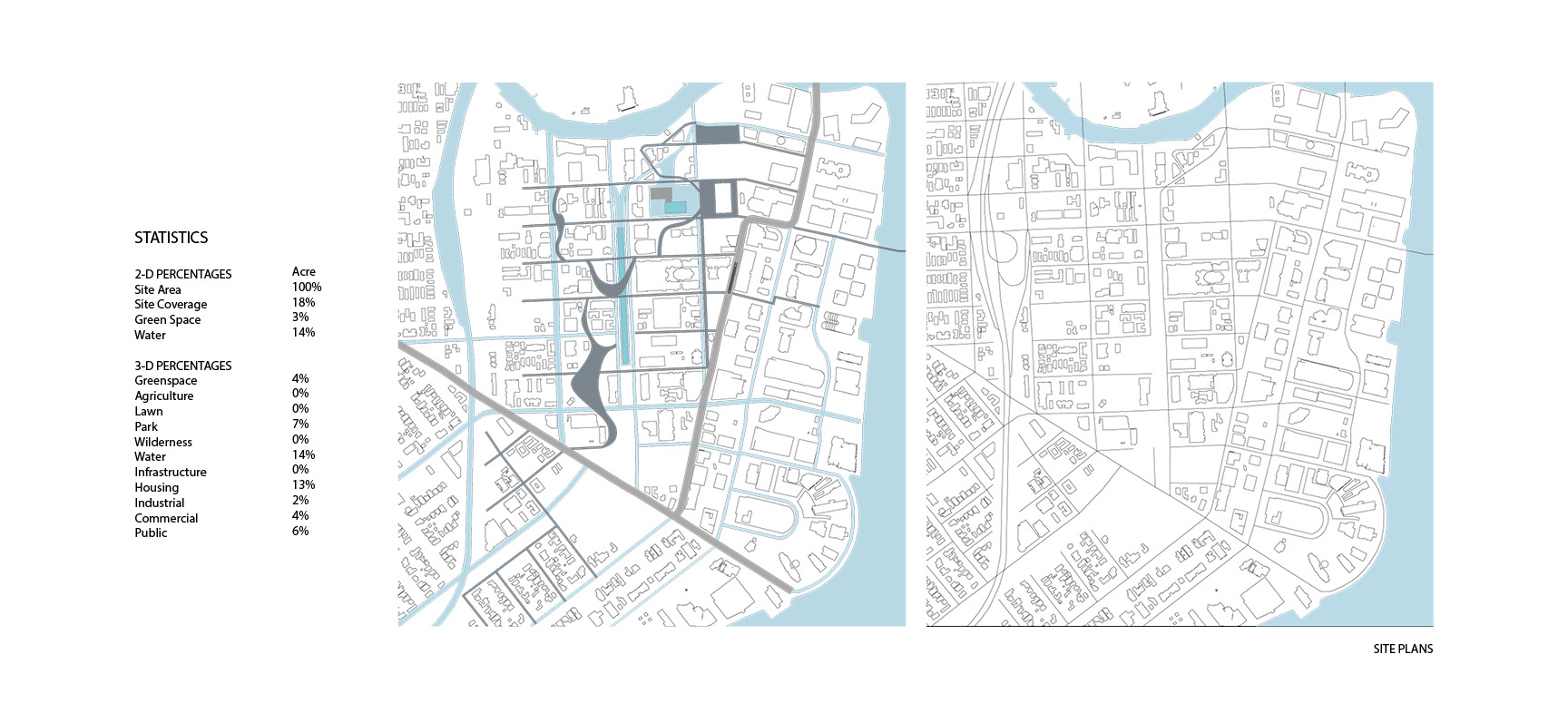
Miami is one of the densest cities in the United States. Miami is also one of the world’s most vulnerable cities to sea-level rise. This is due to the fact that it is built on limestone as compared to bedrock. Limestone is porous, meaning the water easily seeps through it. Bedrock on the other hand is not porous so the water comes up over top of it. For Miami, this means that the water can come up through the limestone, through the streets, and into buildings.
Currently, Miami is proposing a resolution in which the city raises the streets. This project, however, serves as an alternative to that resolution. The proposal presented on this page demonstrates a solution where the city creates more canals to allow the water more room to rise. If spread over a large area, the water will not rise as high. The introduction of these new canals also presents interesting urban dynamics. Travel would need to be lifted above and since the city already has a monorail system, it could be expanded to adapt to this new thinking. The pedestrian walkways would also need to be raised in order to traverse the city. First floors might become basements and lobbies might move to the second floor. This system would operate with various non-porous and porous grounds, dictating where the water can go.
Project Details
SOURCES:
“Miami, Florida Population 2021.” Miami, Florida Population 2021 (Demographics, Maps, Graphs), https://worldpopulationreview.com/us-cities/miami-fl-population.
SOURCES:
“Miami-Dade County, Florida.” Wikipedia, Wikimedia Foundation, 18 Jan. 2022, https://en.wikipedia.org/wiki/Miami-Dade_County,_Florida (1988).
“Miami Population.” World Population, https://www.populationu.com/cities/miami-fl-population.
Google Images, Google, https://images.google.com/.
Google Maps, Google, https://maps.google.com/.
staff, New Times. “South Florida’s Ten Worst Intersections.” Miami New Times, 14 Sept. 2016, https://www.miaminewtimes.com/news/south-floridas-ten-worst-intersections-8767824.
“Tri-Rail.” Wikipedia, Wikimedia Foundation, 28 Jan. 2022, https://en.wikipedia. org/wiki/Tri-Rail#:~:text=Boca%20Raton%20station%20near%20 Yamato,station%20in%20Miami%2DDade%20County.
McCaughan, Sean. “Ten of Miami’s Greatest Tiny Public Spaces.” Curbed Miami, Curbed Miami, 27 Feb. 2015, https://miami.curbed.com/maps/ten-of- miamis-greatest-tiny-public-places.
“Miami’s 10-Mile Linear Park and Urban Trail.” The Underline, 24 July 2021, https://www.theunderline.org/.
https://www.city-data.com/city/Miami-Florida.html
https://mdc.maps.arcgis.com/apps/webappviewer3d/index.html?id=b92a9fa4ff8847bf97f3e628a195a398
https://www.theinvadingsea.com/resources/
https://gis-mdc.opendata.arcgis.com/
https://storymaps.arcgis.com/stories/3f5b7c0c3db545e4a09dd421f43361a7
— AQQ