XIII. Bangalore, India


Bangalore, India — Autumn Bender
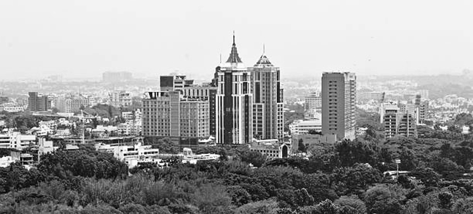
Bangalore, officially known as Bengaluru, is the capital of Karnataka, a southern Indian state that lies along the deccan plateau. Bangalore is known as being the “Silicon Valley” of India, experiencing a major corporation and manufacturing boom between 1985 and 2000. Bangalore is located along the major North-South national highway and is in connection to the southern rail systems.


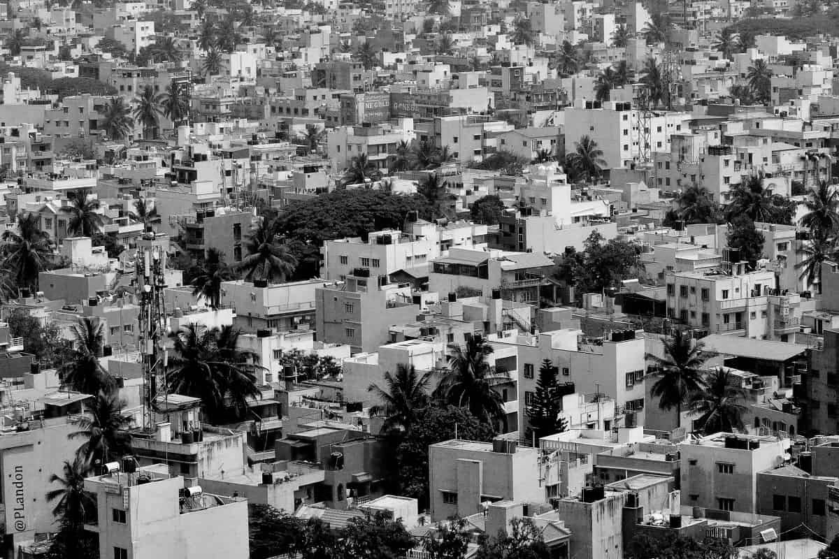
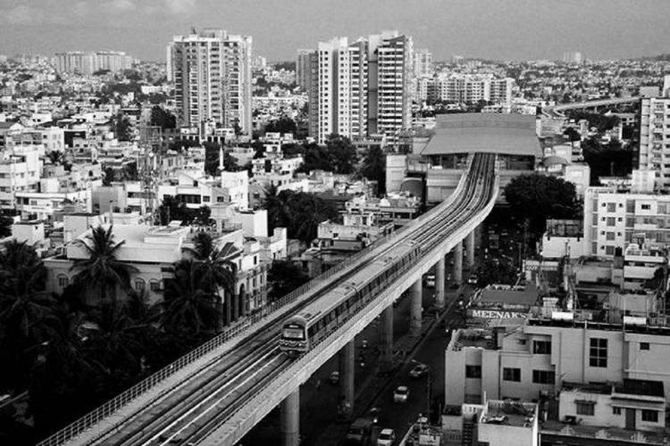
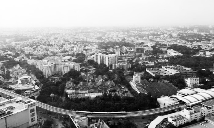
Left: Central Bangalore and the metro rail. Right: Density of mid-rise buildings
Population:
Urban: 8,443,675 people
Metro: 12,300,000 people
Area:
Urban: 709 km2 (274 sqmi)
Metro: 8,005 km2 (3090 sqmi)
Population Density:
Urban Average: 11,910 people/km2
Metro Average: 1,537 people/km2
Politics:
Bruhat Bengaluru Mahanagara Palike, a municipal organization and local government established by the state of Karnataka, has its jurisdiction over Bangalore. Its responsibilities are carried out through organized departments that oversee the overall civic and infrastructural development of the city and include zoning and building regulations, public and green space, water bodies, education, water supply and sewage disposal. The municipal organization is run by a mayor who is elected for a 30 month term. Bangalore is also overseen by a second municipal organization, the Bangalore Metropolitan Region Development Authority, which supervises the orderly development of the 3 districts within the Bangalore Metropolitan Region.

Left: Chickpet-dense retail area. Right: Central Bangalore
![]()
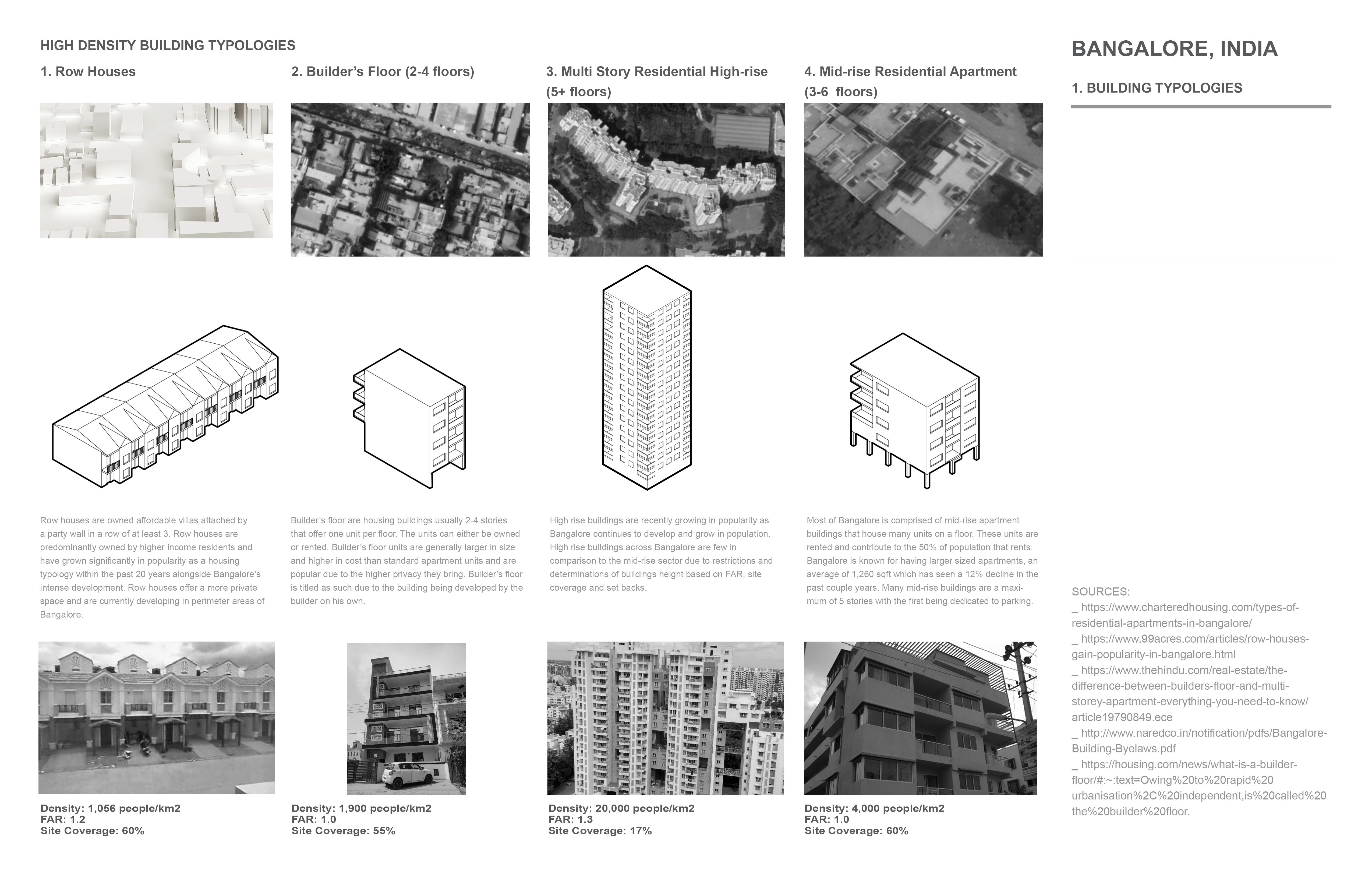
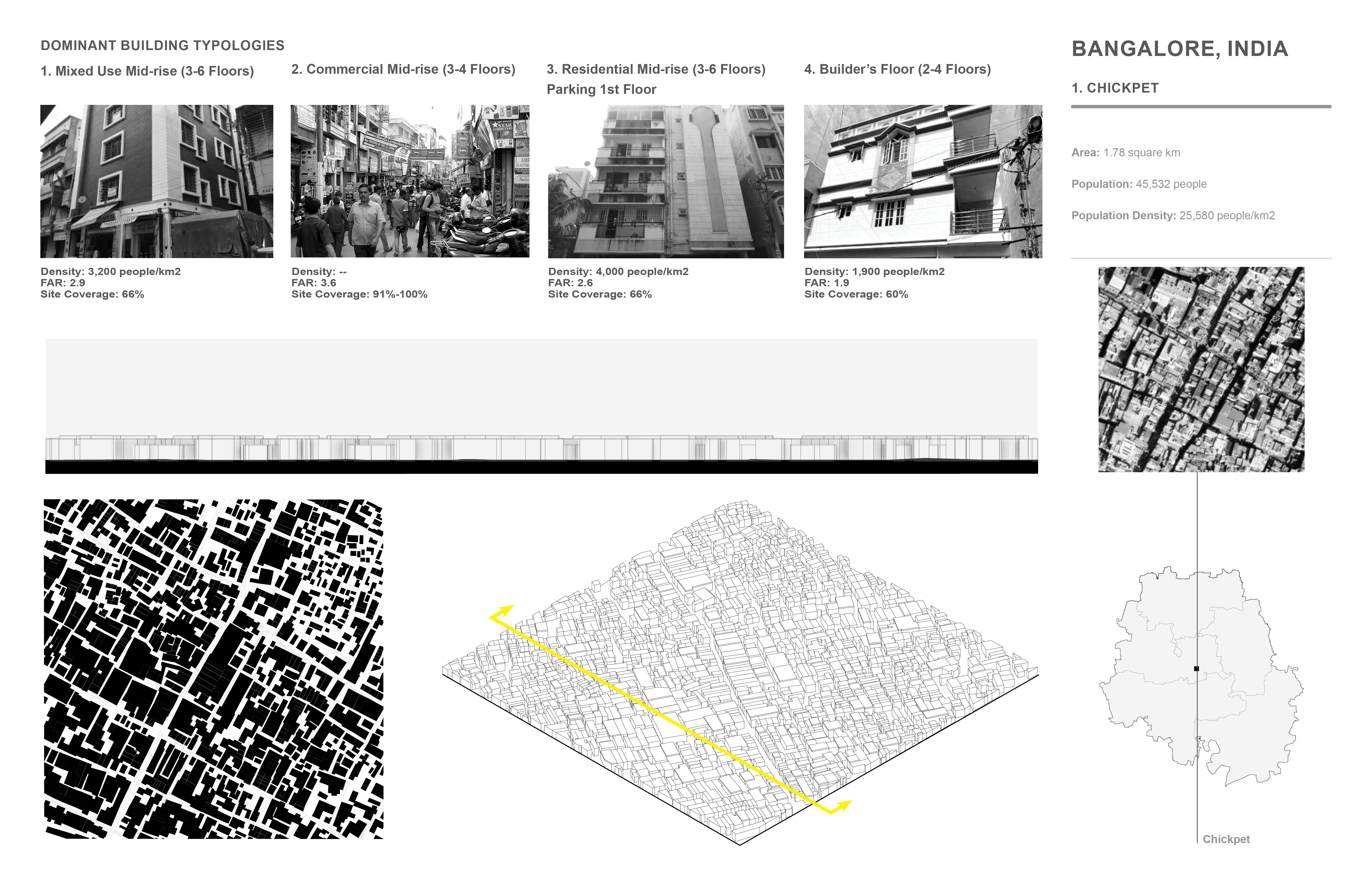
Bangalore, India. High Density Buildig Typologies
![]()
Bangalore, India. Means of transportation
![]()
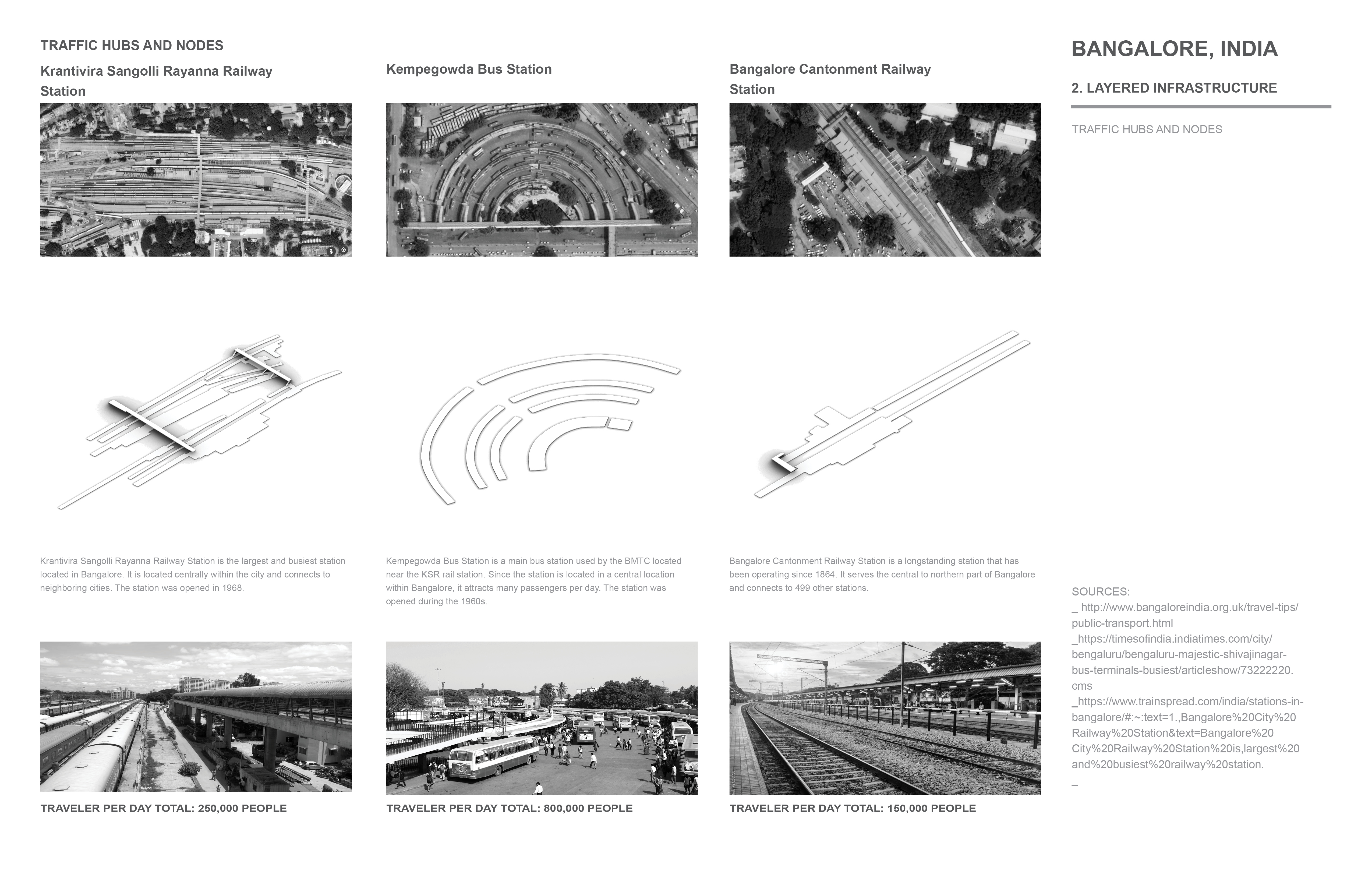
Bangalore, India. Traffic hubs and nodes
![]()
Bangalore, India. Urban Void Spaces
Bangalore, India. High Density Buildig Typologies
Bangalore, India. Means of transportation
Bangalore, India. Traffic hubs and nodes
Bangalore, India. Urban Void Spaces
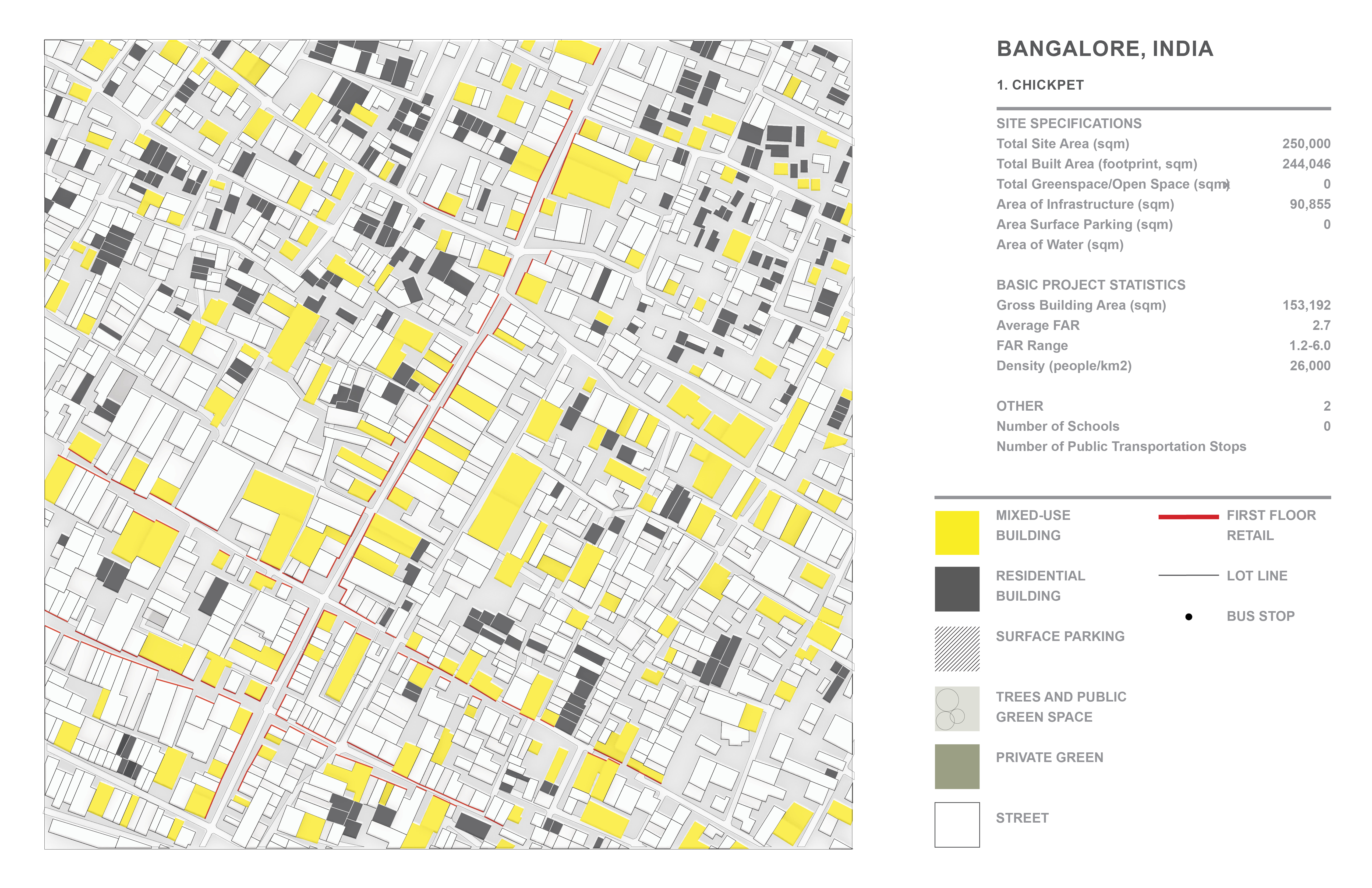
Bangalore, India - Chickpet:
Area: 1.78 square km
Population: 45,532 people
Population Density: 25,580 people/km2
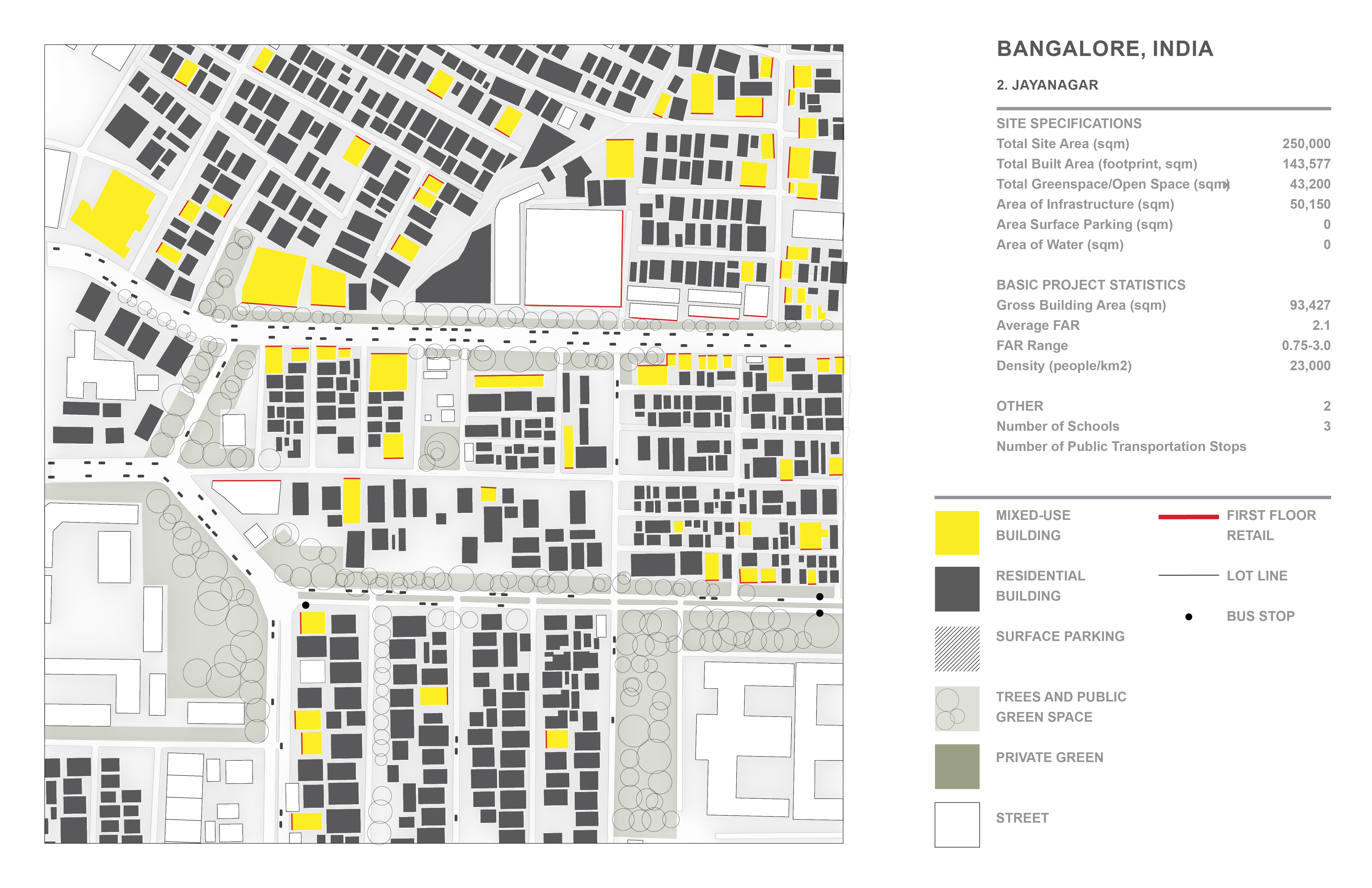
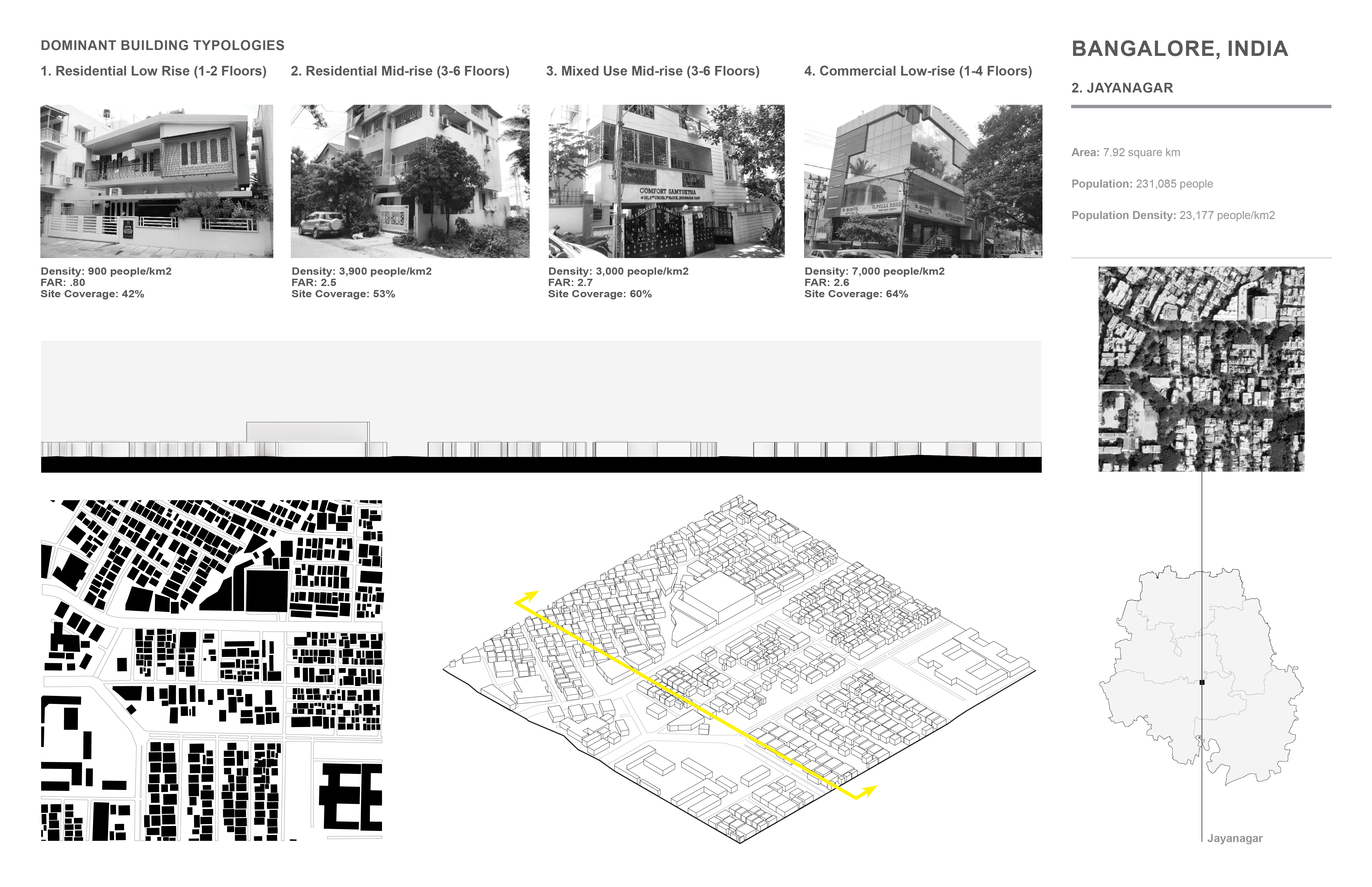
Bangalore, India - Jayanagar:
Area: 7.92 square km
Population: 231,085 people
Population Density: 23,177 people/km2
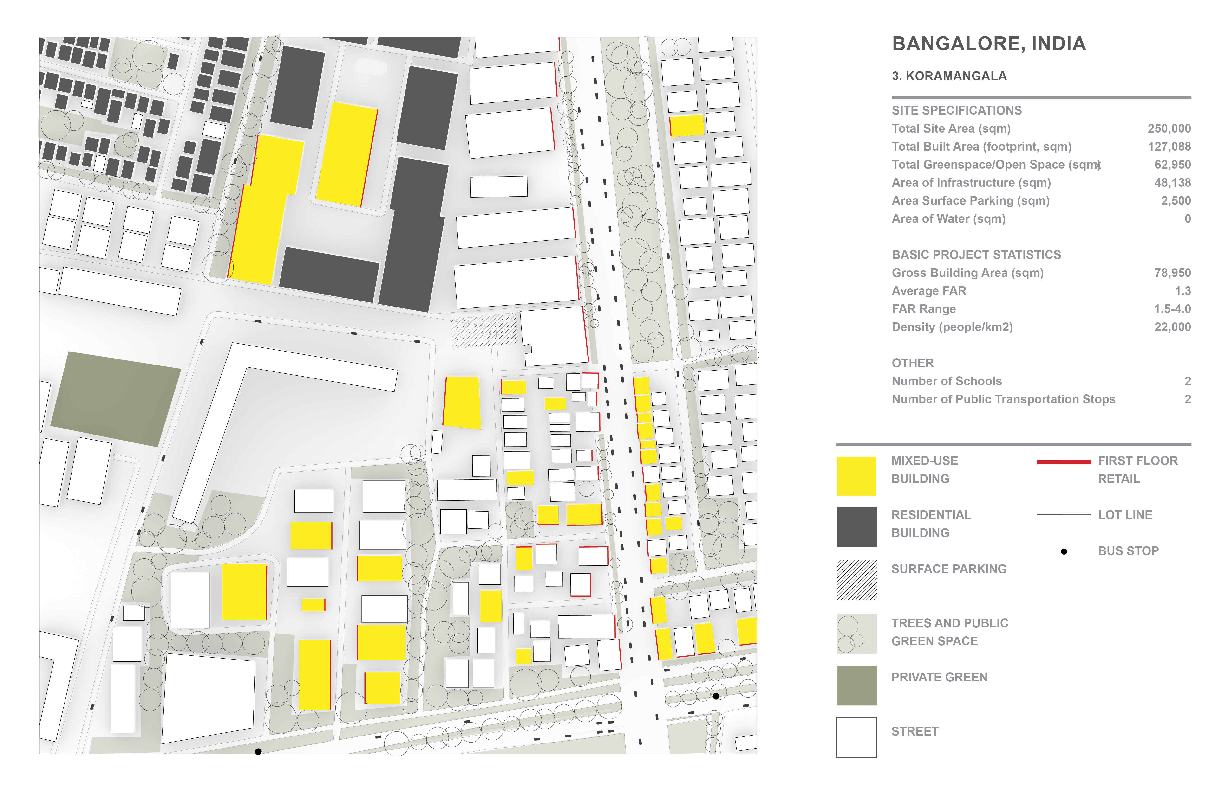
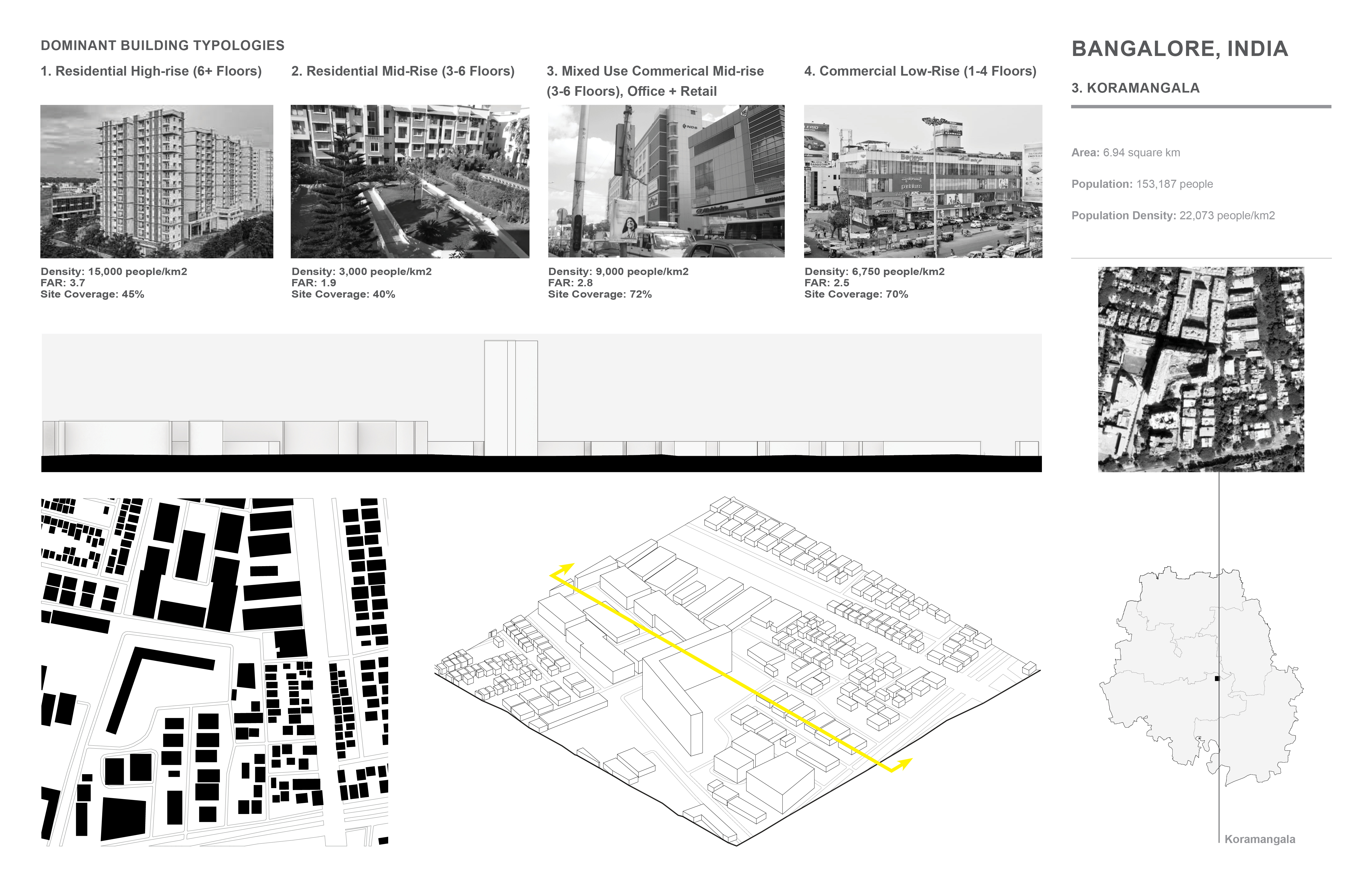
Bangalore, India - Koramangala:
Area: 6.94 square km
Population: 153,187 people
Population Density: 22,073 people/km2

Understanding the Middle, Bangalore
Mid-rise buildings rising up to 6 stories constitute a majority of Bangalore’s infrastructure that allow it to be perceived as being a city built for the human scale. Narrow streets packed with goods, people, vehicles and business signs add a rich character that exemplify the intensities of life within Bangalore and its way of living for its residents. Green spaces scatter the city that date back to its Garden City movement rising in the mid 20th century and juxtapose the harshness of pavement and sidewalk that line most of the city. This proposal attempts to preserve the richness of character known of Bangalore by understanding and utilizing the mid-scale that’s present within buildings, internal programs and outdoor open spaces that make up the city. By stacking smaller sections of floors that are separated by outdoor void spaces, the overall large massing visually becomes scaled to its mid-rise surroundings. It studies existing building models and their program relationships to create a building that disperses commercial amenities throughout its section while placing housing in adjacency to those commercial amenities. In stacking internal programs into a building that would otherwise be dispersed around its ground floor site area, the ground floor opens to allow additional uses for outdoor vegetation, agriculture, leisure and circulation.
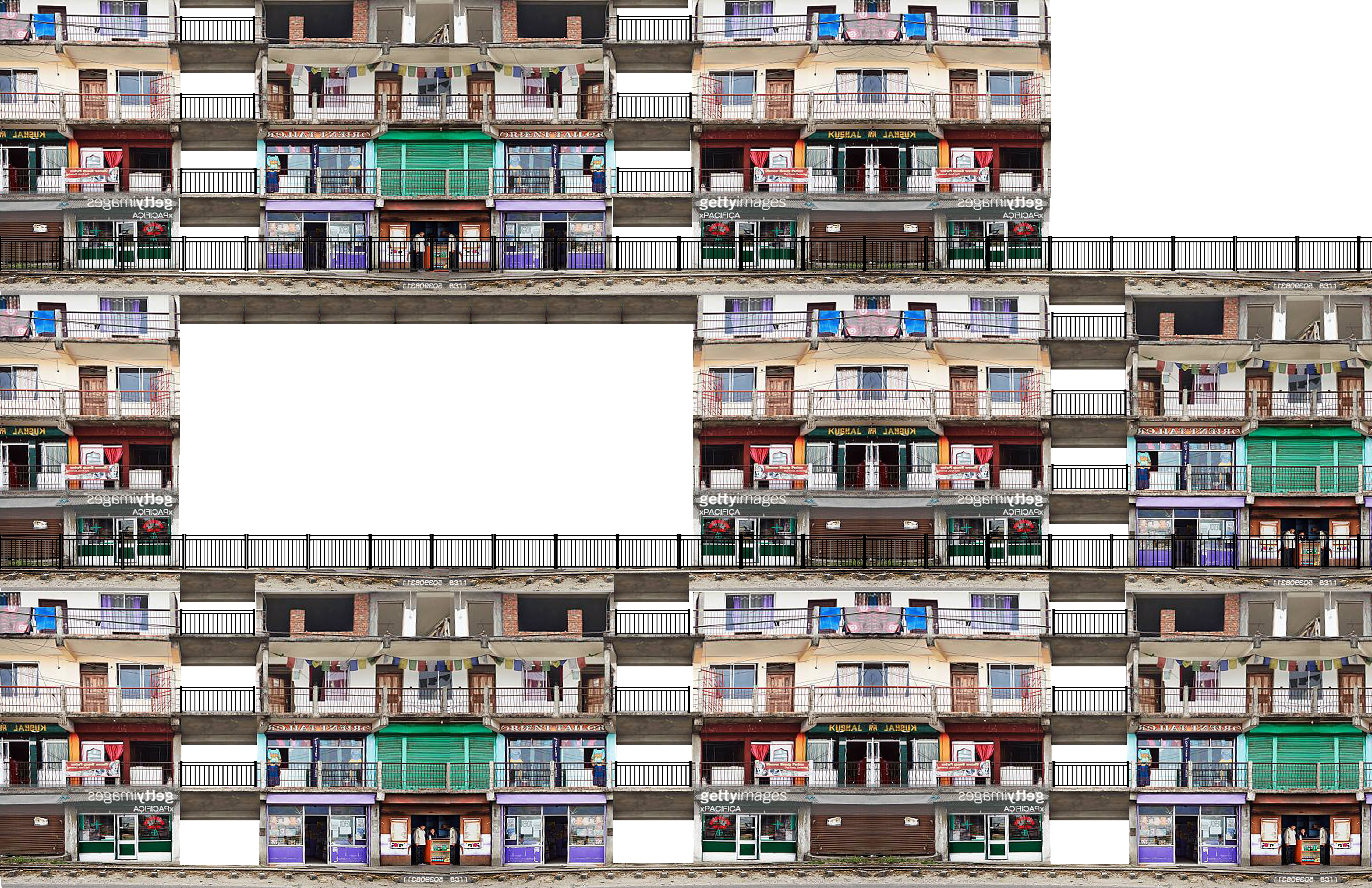
Above: Concept Collage
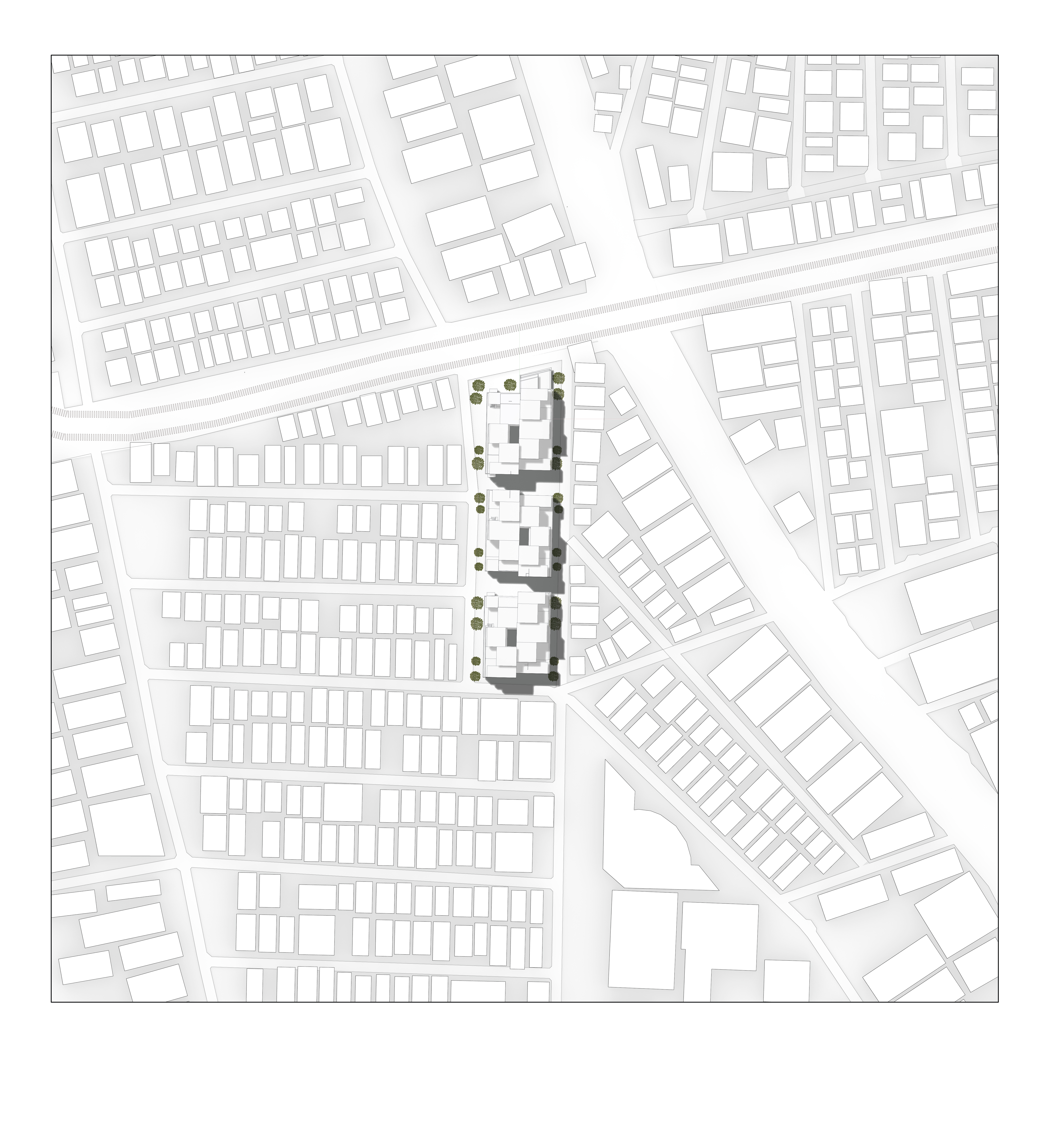
Above Left: Ground floor plan + exterior plazas that continue surrounding city void scales, Above Right: Site plan
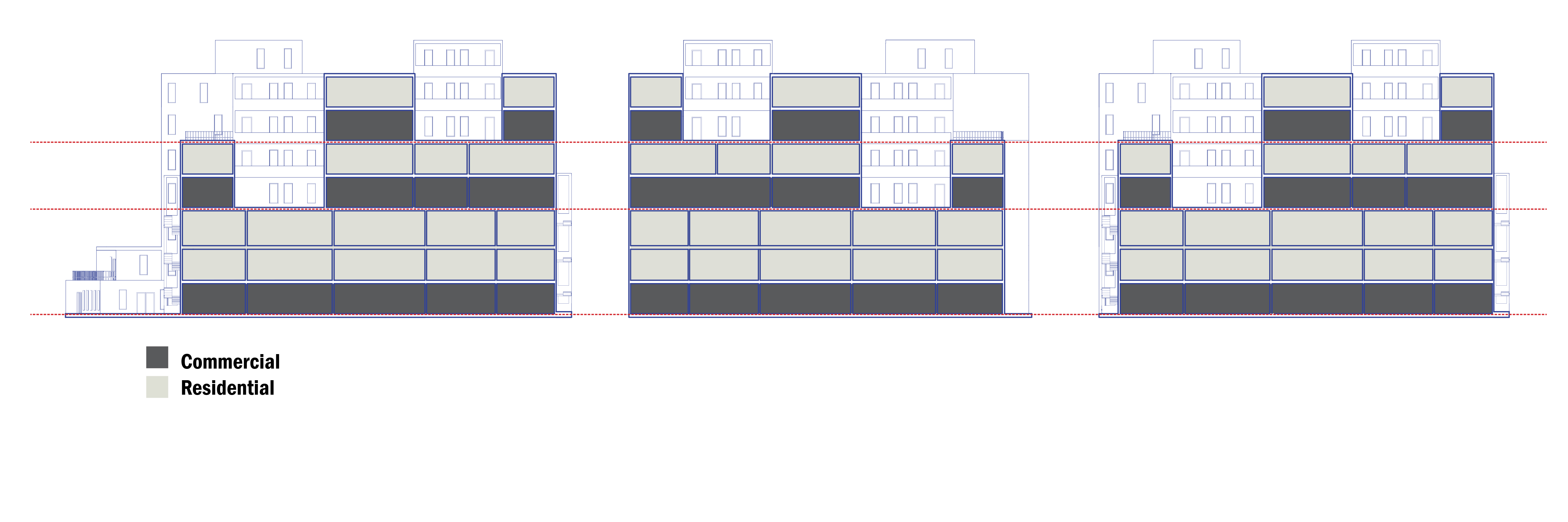
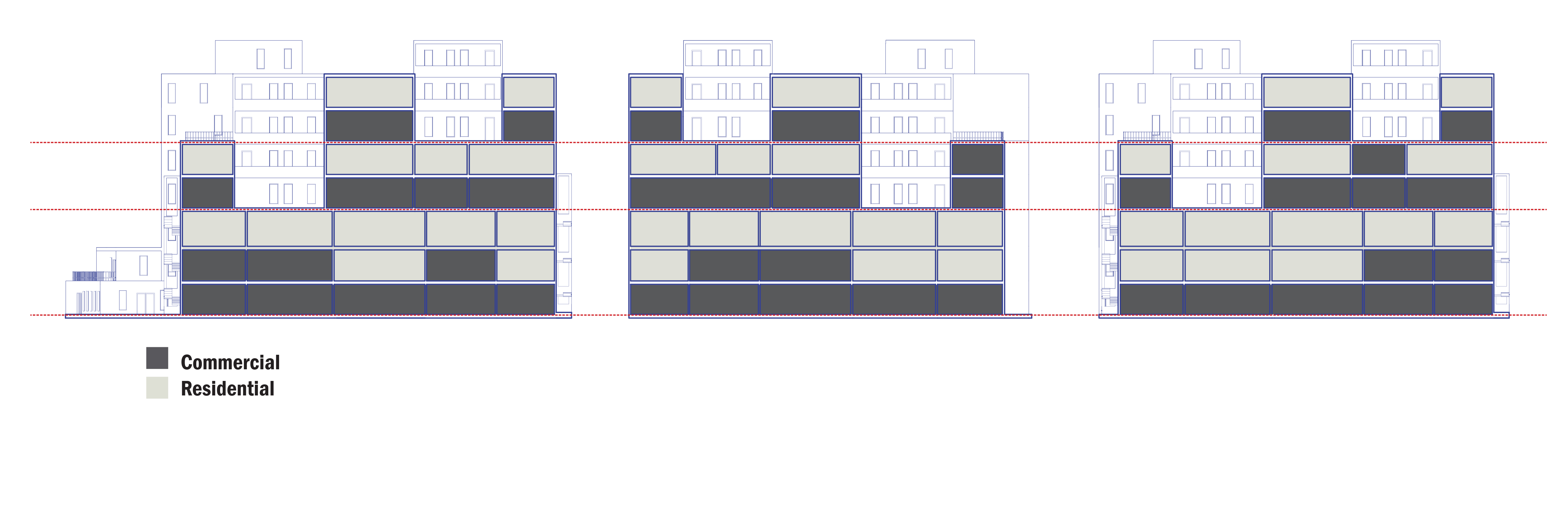
Above Left: Program scenario 1, Above Right: Program scenario 2
Understanding the Middle, Axonometric
— AQQ