X. Busan, Korea


Busan, Korea — Yousun Nam
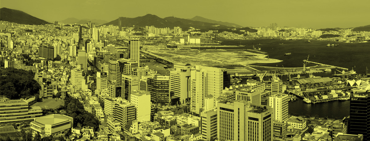
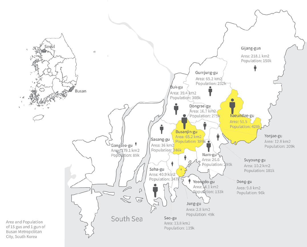
Located in the southeast tip of Korean peninsula, Busan is the second most populous city after Seoul, and the largest port city in South Korea. Along with the adjacent cities, Busan constitutes the Southeastern Maritime Industrial Region, serving as a center of trade and distribution industry. The city is divided into into 15 major administrative districts called “gu” and and a single county called “gun”.
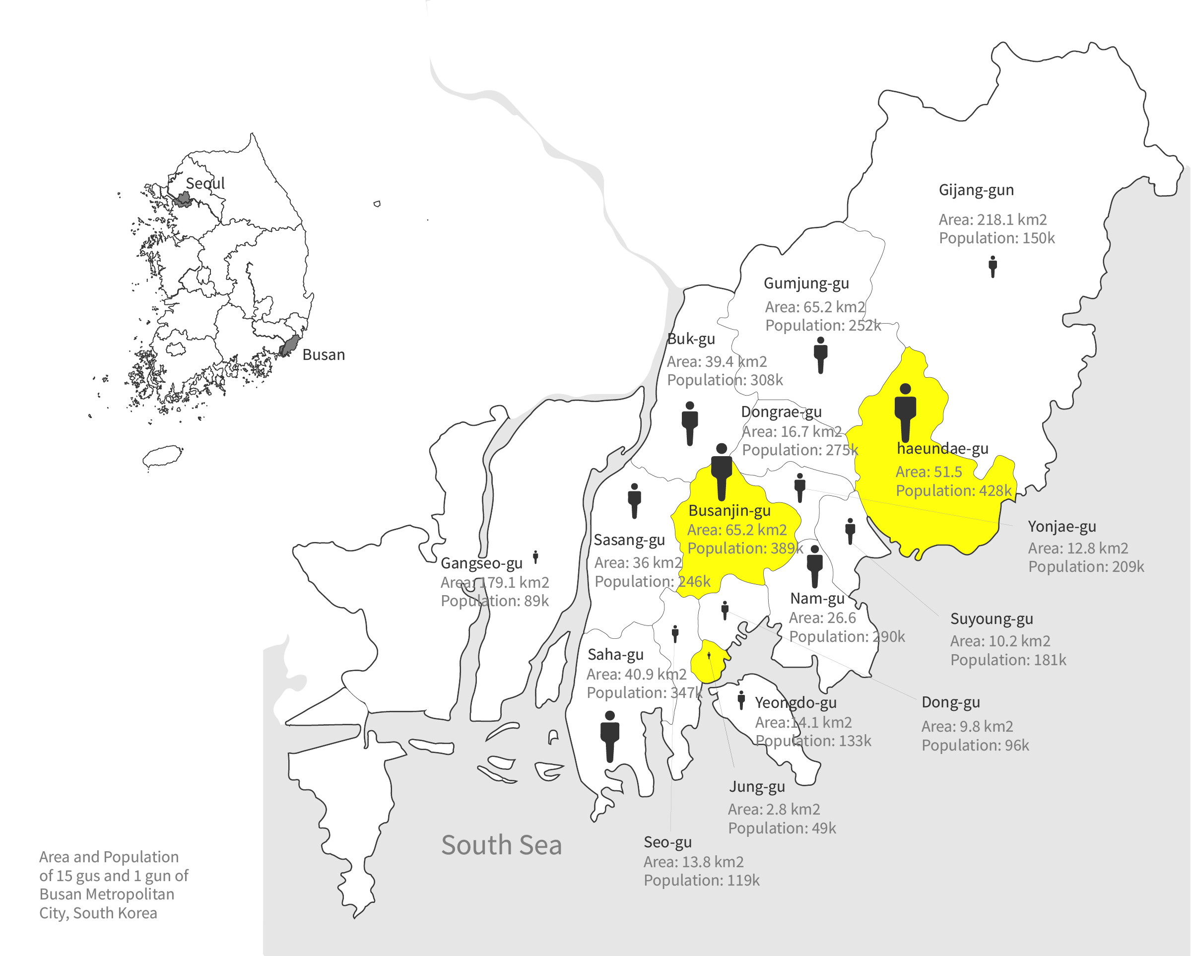
City Map of Busan - Population and Area
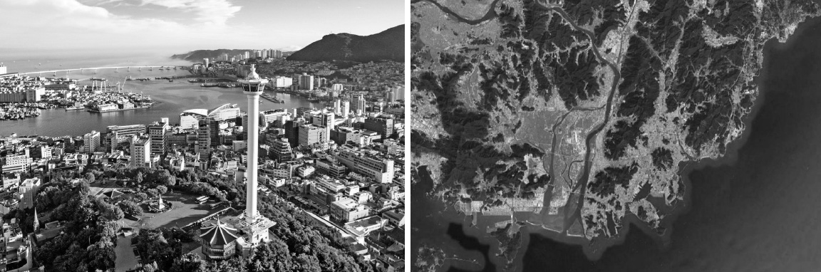
City View and Satellite View of Busan
Population:
Urban: 3,517,491 people
Metro(Busan-Gimhae-Woolju): 4,416,888 people
Area:
Urban: 769.82 square km
Metro(Busan-Gimhae-Woolju): 1,241.12 square km
Population Density:
Urban Average: 4,569.2 people/km2
Metro Average: 3,558.79 people/km2
Politics:
Busan follows the political system of Korea which consists of one central goverment for national affairs and local self-governing bodies for each regions. The city government is divided into a legislative body and a executvie body and they responsible for the citizen’s public safety, walfare, education and sanitation etc. With the greatest elderly population in the country, Busan is known as the stronghold of the conservative party in Korea.
Impression of High Density in Busan
Most of the land of Busan is covered with mountains with steep and undulating topography, Therefore buildings are mostly built upon those hilly lands which creates the unique landscape with the mountins on the back. The population and the people density is concentrated in the center of the city where the land is relatively flat and low. The city was historically a refuge city during the Korean war when all population of Korea temporarily fled to Busan. People who remained after the war created a densly-packed refuge village with low rise builidings on the mountains. A little bit off from the city center, these villages are built in the relatively high lands. These area usually have high site coverage with less open space.
On the other side of city, we can also see many high-rise buildings.
Going through rapid urbanization, the city started to build high-rise apartment buildings from 1980s allowing high plot ratios with high occupancy rate. Especially the coast area along the beaches have been the most popular regions for development until now because of their prime views toward the sea. Currently the coast lines are built up with high rise residential towers.
In the central part of the city coexists the high-rise towers, mid and low-rise buildings and they are creating high perceived density and crowding problem along with disorderly built commercial buildings.
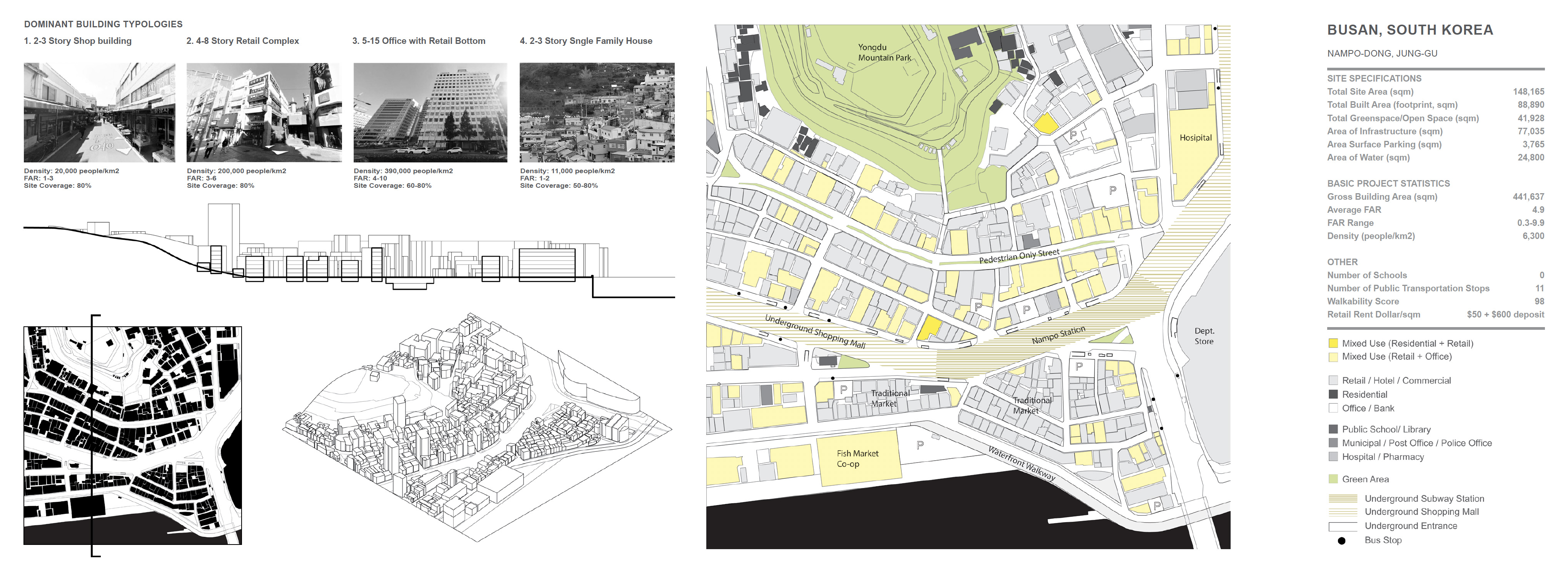
Busan, South Korea. High Density Buildig Typologies
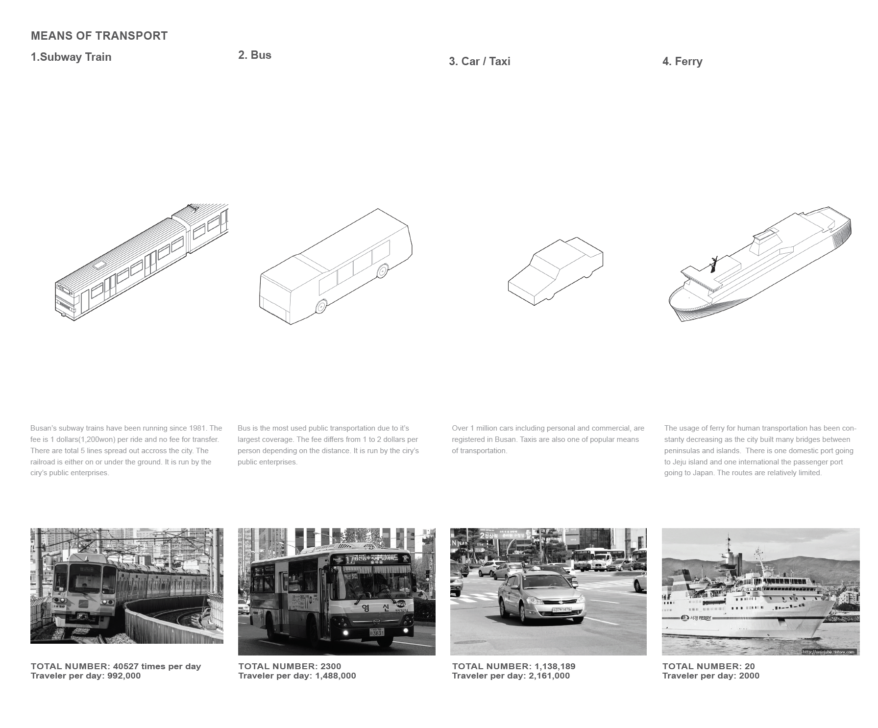
Busan, South Korea. Means of transportation
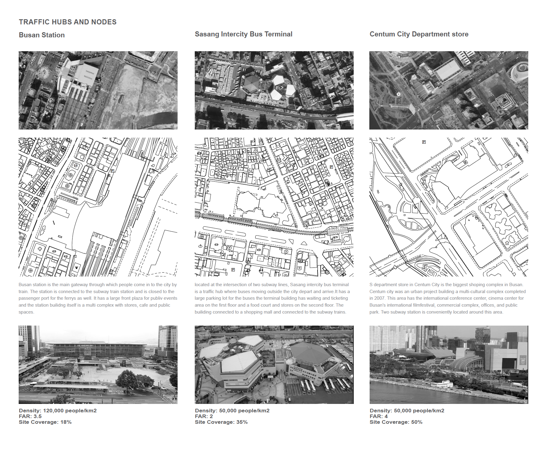
Busan, South Korea. Traffic hubs and nodes
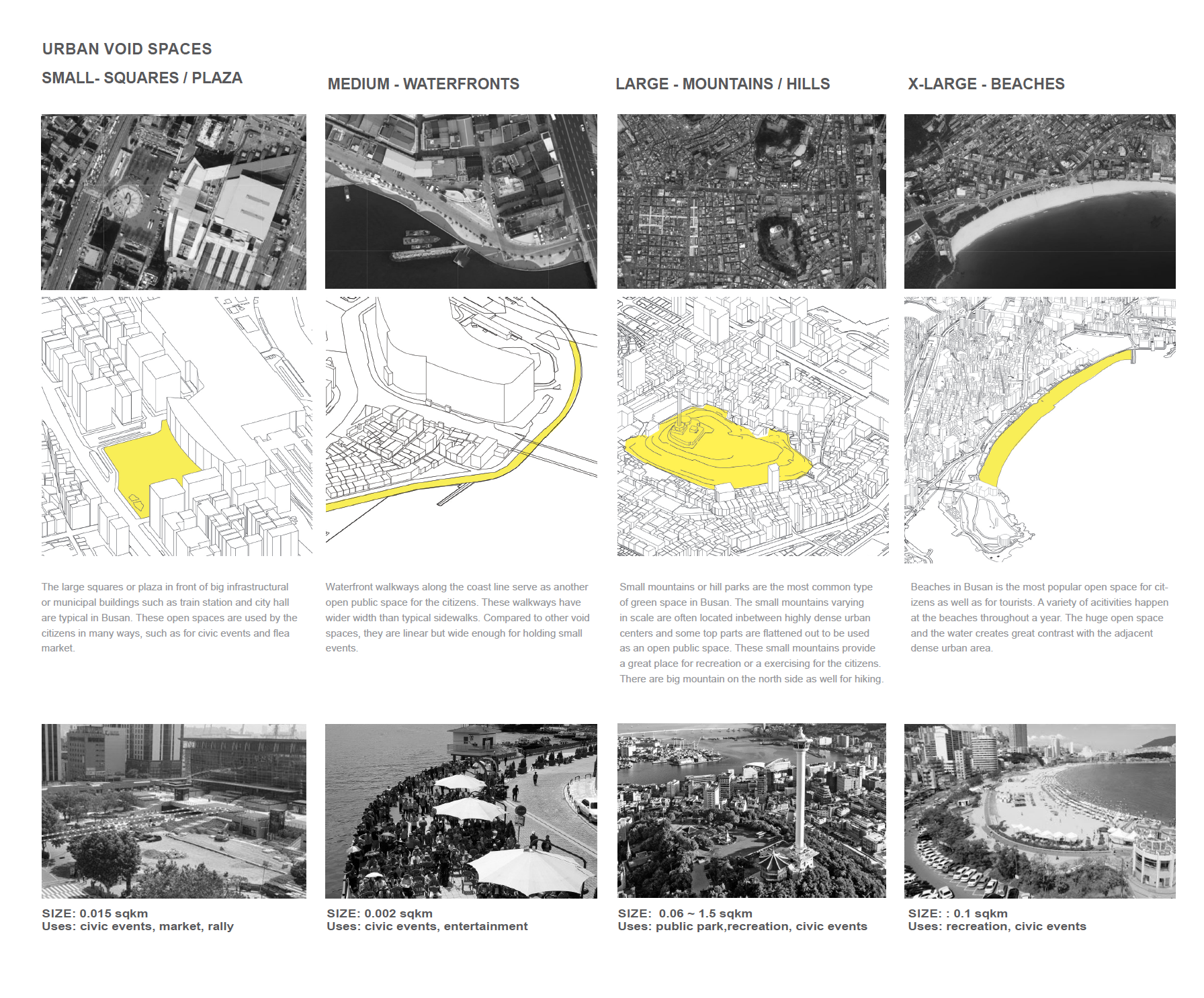
Busan, South Korea. Urban Void Spaces
Busan, South Korea- Nampo-Dong, Jung-Gu:
Area: 0.23 square km
Population: 2480 people (resident) /380,000 people (floating)
Population Density: 6,900 people/km2
Busan, South Korea- Jeonpo-Dong, Busanjin-Gu:
Area: 0.57 square km
Population: 39,200 people (resident)/ 150,000 people (floating)
Population Density: 23,000 people/km2
Busan, South Korea- Wu-Dong, Haeundae-Gu:
Area: 6.96 square km
Population: 21,747 people (resident)/ 250,000 people (floating)
Population Density: 3,125 people/km2
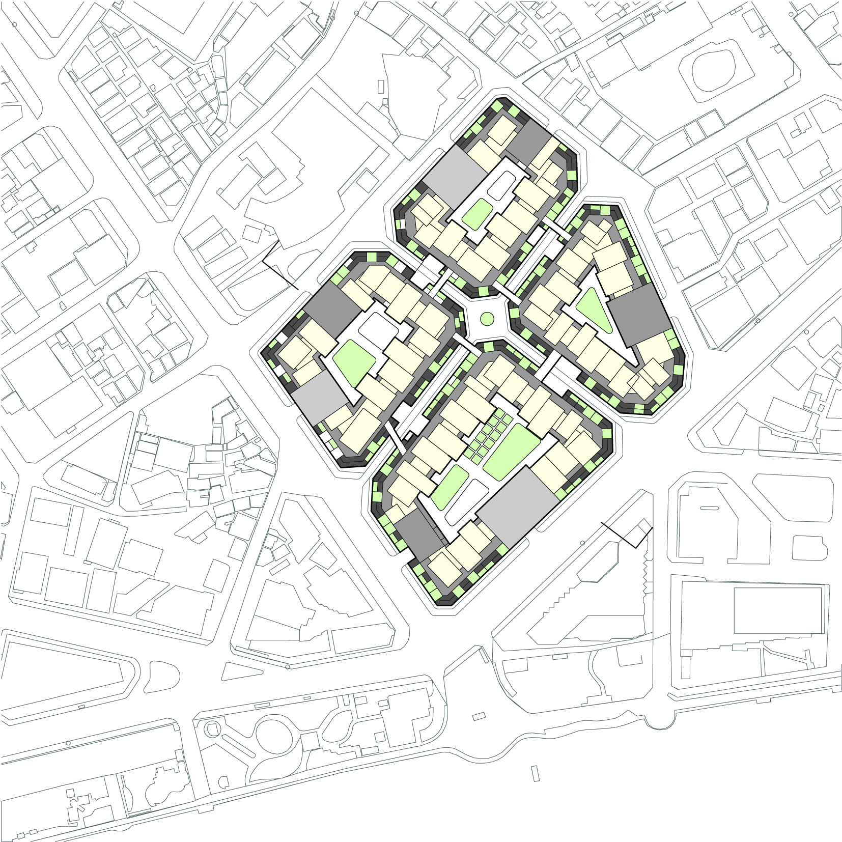
Market City, Busan
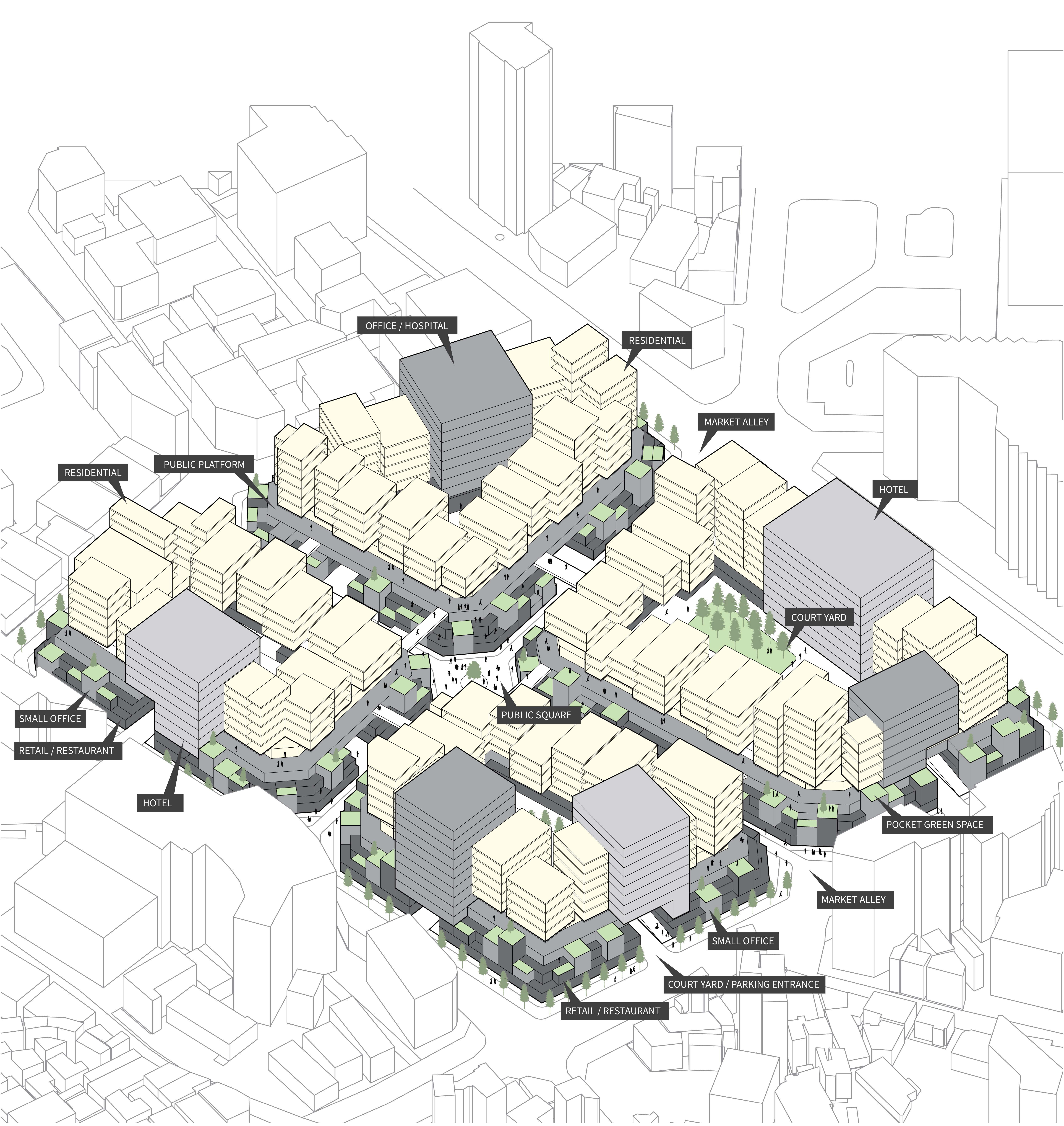
“Market City” reconfigures the existing programs within the big blocks of the deteriorated Haeundae traditional market in Busan and proposes a new market complex with additional residential units. The project attempts to provide more pleasant working and living environment for people in the market area, especially for the shop owners, by converting the existing shop houses and adjacent buildings into interconnected multi-complex. The proposal maintains the existing axis of the market alley but radically transforms the whole block by introducing different formal structure. Referring to the European mixed-use block typologies with commercial layers on the bottom and the central courtyard, it divides the market block into four big blocks with courtyards and stacks the programs vertically. The volumes of the first three stories with market and commercial programs are terraced in order to let more light into the market alleys, and pixelated with different heights to form the dynamic street view along with the pocket green spaces. The project separates the residential layers with the commercial layer by creating another public platform on top of the commercial volume, as a buffer to protect residents from the crowding and sanitary problem of the market alley, which also serves as additional public spaces. The residential, hotel and office volumes with different sizes creates small alleys on the platform while producing formal variety. The four inner courtyards are also different in their functions, including urban farming, playground, swimming pool and public park.
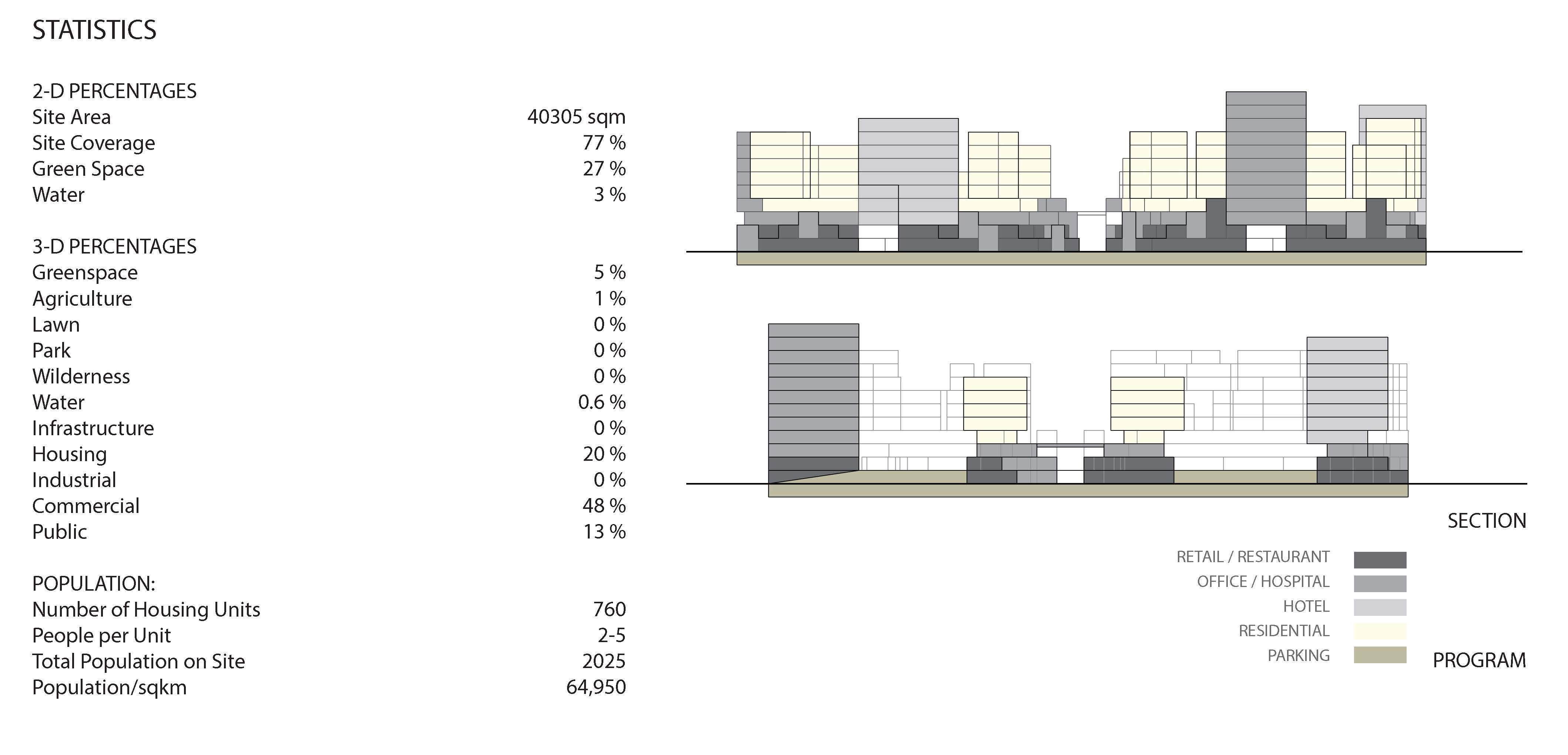
Market City, Statistics
Market City, Site Plan
Market City, Axonometric