LXX. Istanbul, Turkey
Istanbul, Turkey — Dijie Chen

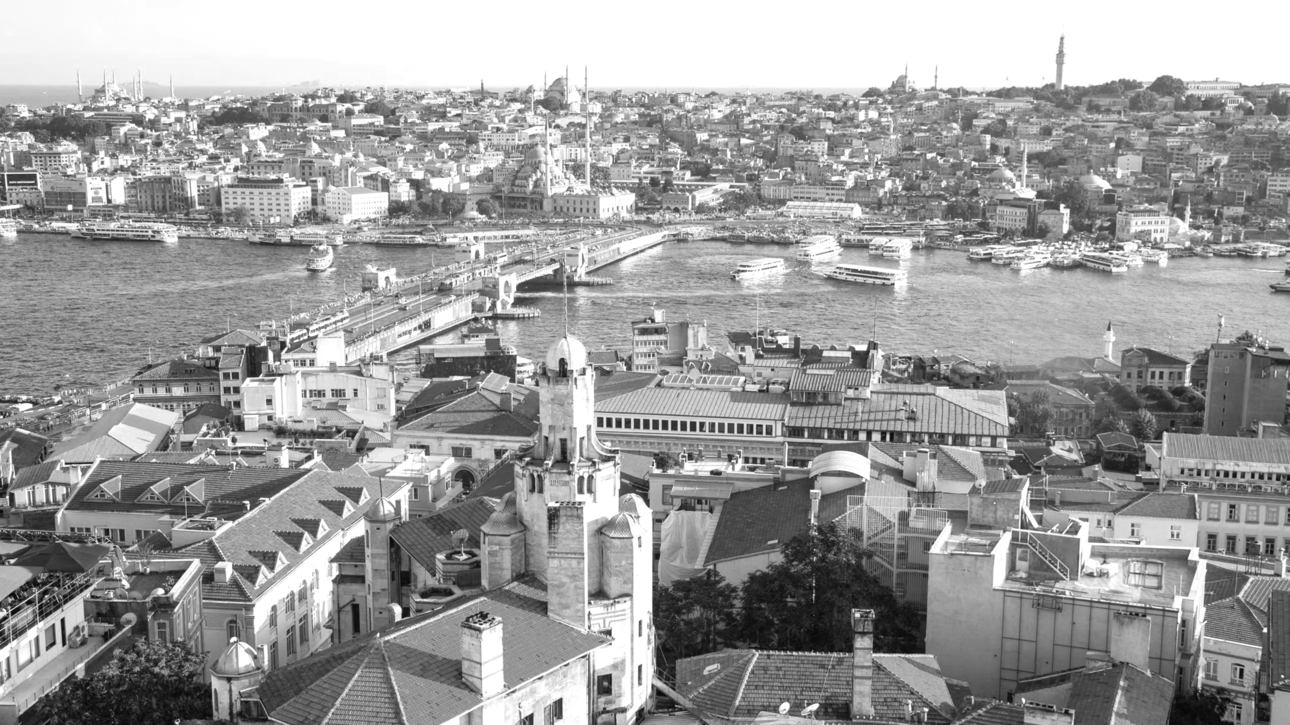
Istanbul is Turkey’s largest city, uniquely spanning Europe and Asia across the Bosphorus Strait. Once the capital of the Roman, Byzantine, and Ottoman Empires, it blends ancient history with modern life. Iconic landmarks like the Hagia Sophia, Blue Mosque, and Grand Bazaar reflect its rich heritage. As a cultural and economic hub, Istanbul is vibrant and diverse, with 39 districts, each offering unique character and charm.

Population:
Urban: 15,305,000 people
Metro: 15,655,924 people
Area:
Urban: 2,576.85 km2
Metro: 5,460.85 km2
Population Density:
Urban Average: 5,939 people/km2
Metro Average: 2,930 people/km2


Politics:
Istanbul Metropolitan Municipality is the administrative body governing Istanbul. The mayor is elected every five years by Istanbul’s residents and oversees the city’s administration. As Turkey’s largest city, Istanbul’s government manages areas such as transportation, urban planning, public safety, waste management, water supply, and cultural heritage. The m
unicipality works with 39 district municipalities to address local needs, balancing Istanbul’s rol
e as an economic, cultural, and historical hub.

1 BEYOĞLU: ISTANBUL’S MOST CULTURAL AND COMMERCIAL AREA
2 HIGH-DENSITY HOUSING VS. TALL BUILDINGS
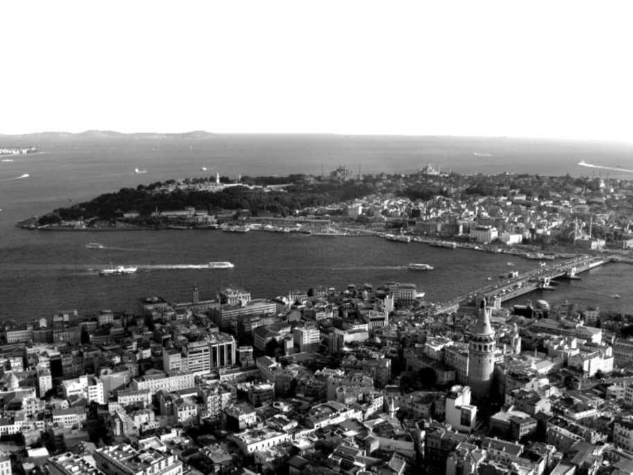
3 CITYSCAPE, VIEW FROM THE HEIGHT ISTAMBUL
4 ISTIKLAL STREET: THE BUSIEST STREET IN TURKEY
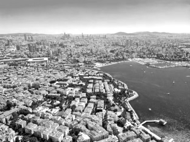
Istanbul’s terrain is diverse, with hills and valleys shaping much of its landscape, especially on the Asian side. Many traditional neighborhoods are built on these slopes, creating a unique urban fabric with dense, low-rise housing in elevated areas. The population is concentrated in flatter, central districts, particularly on the European side, where the city’s historic core features narrow streets and mid-rise buildings.
Historically, Istanbul was a major center of migration during the Ottoman period, attracting people from across the empire. These populations established dense, mixed-use neighborhoods, often near key trade and cultural hubs. In more modern times, rapid urbanization has led to the rise of high-density housing developments, particularly from the mid-20th century onwards. Coastal areas along the Bosphorus and Marmara Sea have become prime zones for high-rise residential and commercial towers, offering scenic waterfront views.
Istanbul has endured numerous challenges throughout history, including fires, earthquakes, riots, and over sixty battles, all of which have shaped its urban development. The city’s population surged tenfold in the 20th century, straining infrastructure and causing overcrowding, pollution, social conflicts, and inadequate public services. Seismic activity further compounded these issues, leading to significant loss of life. The rise of automobiles led to urban sprawl as parts of the city were demolished to build highways. Today, Istanbul struggles to connect its European and Asian sides, divided by the Bosphorus Strait, both socially and physically.


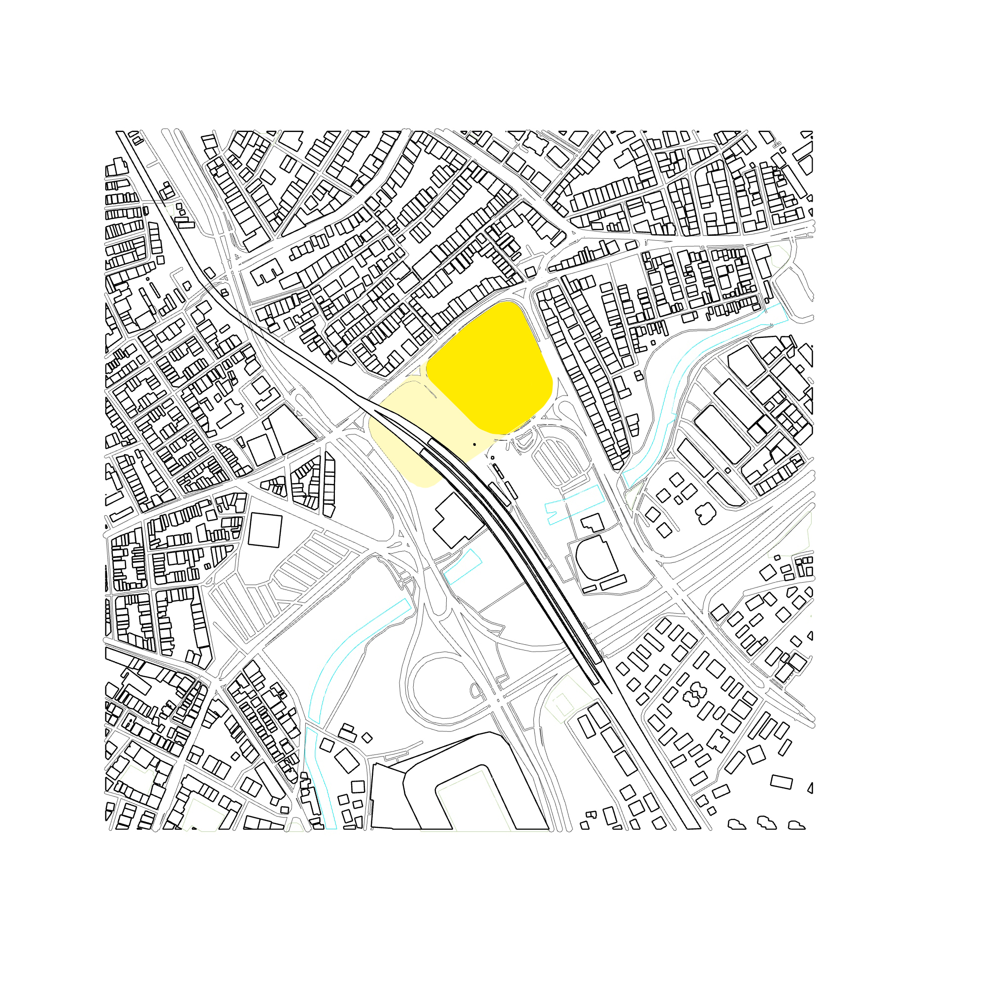
Analyzing Urban Fabric
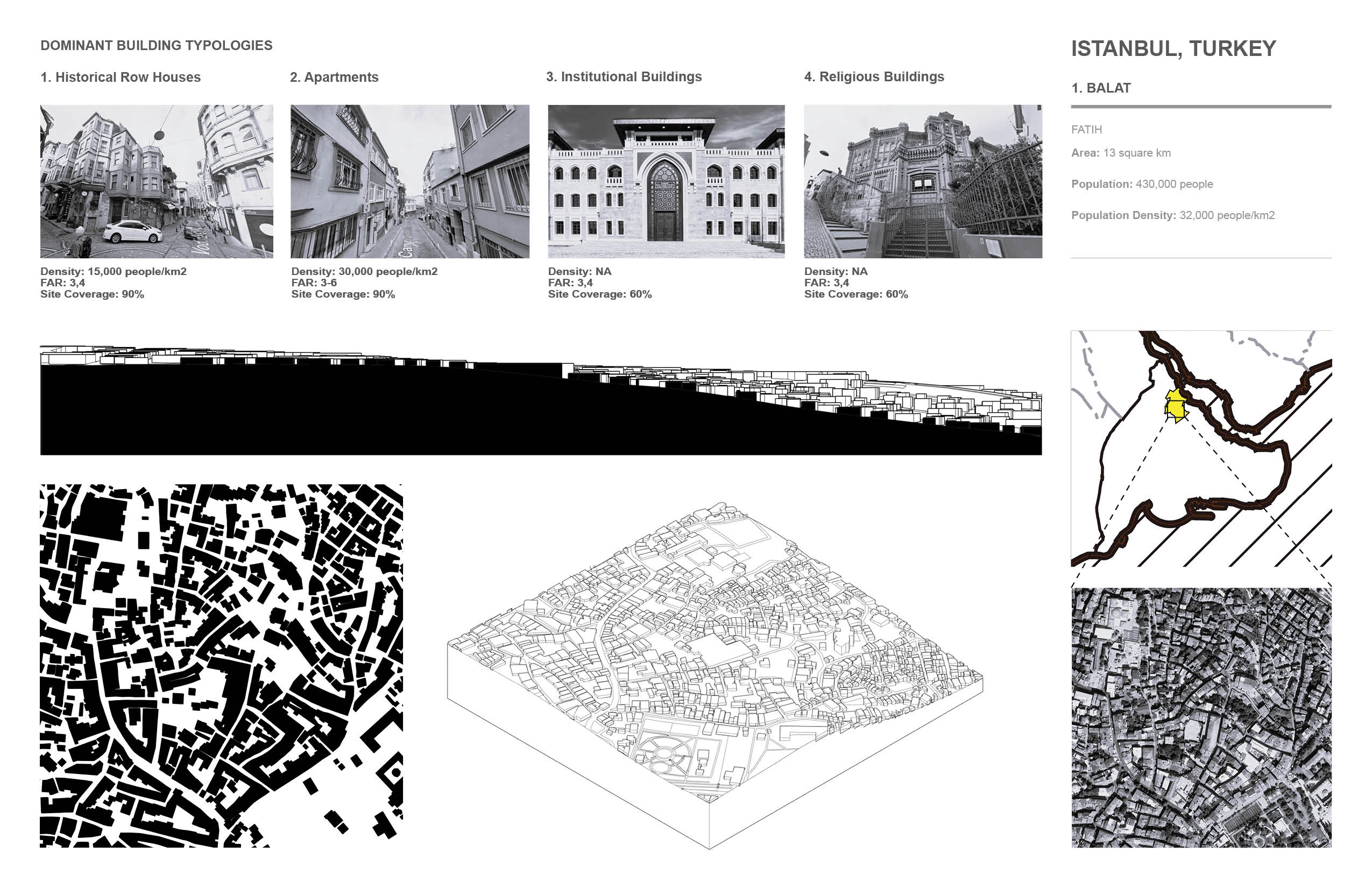
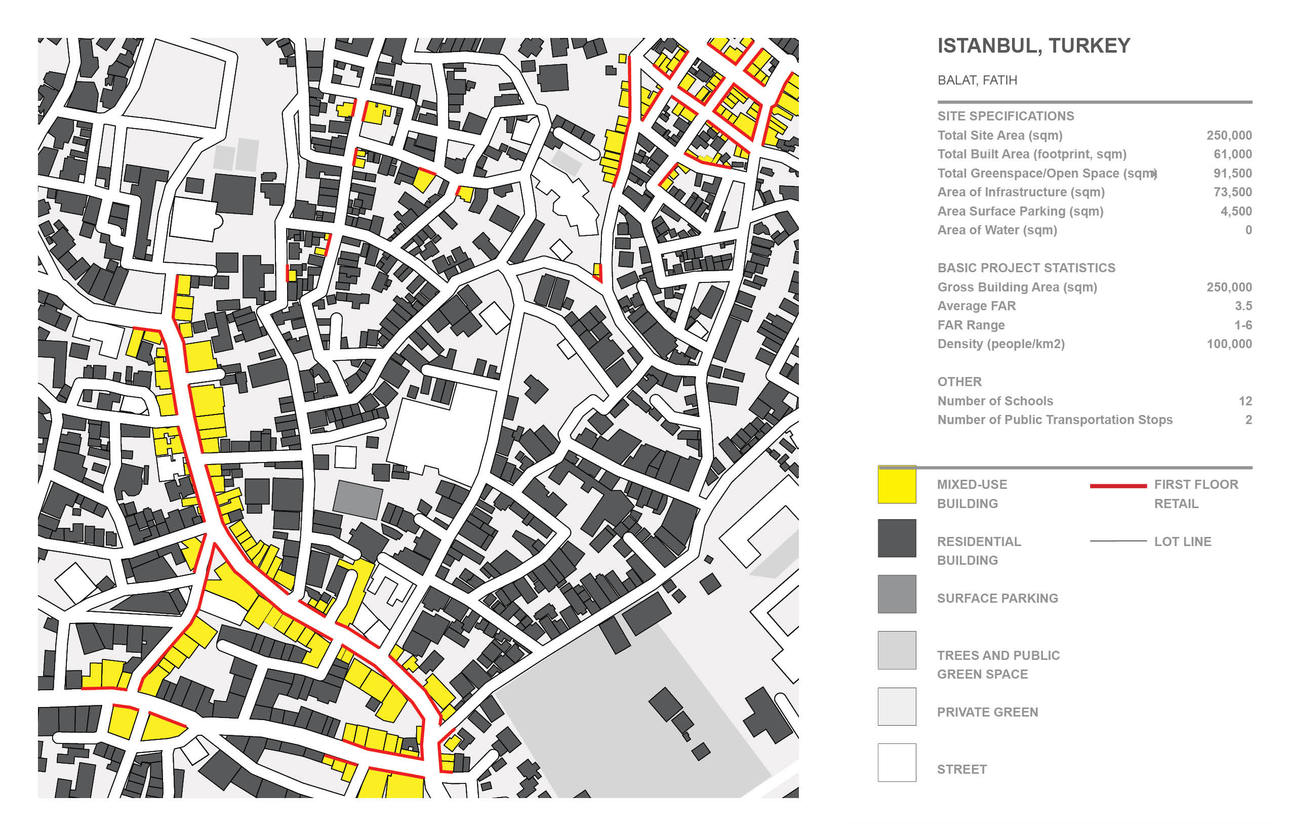
1. Balat:
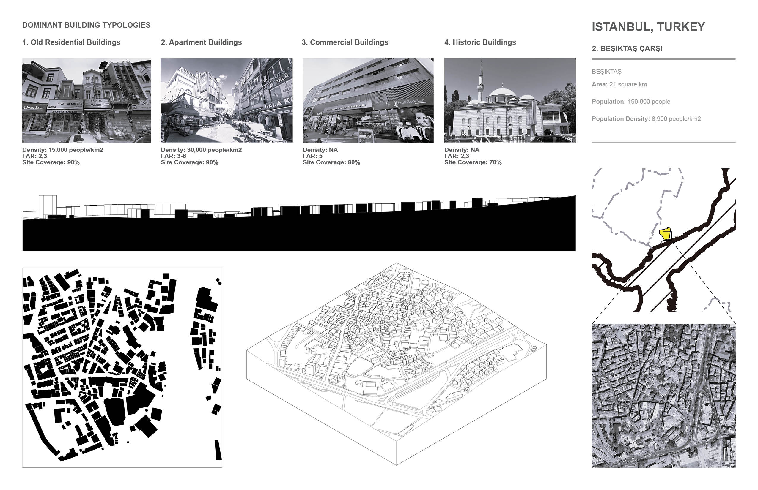
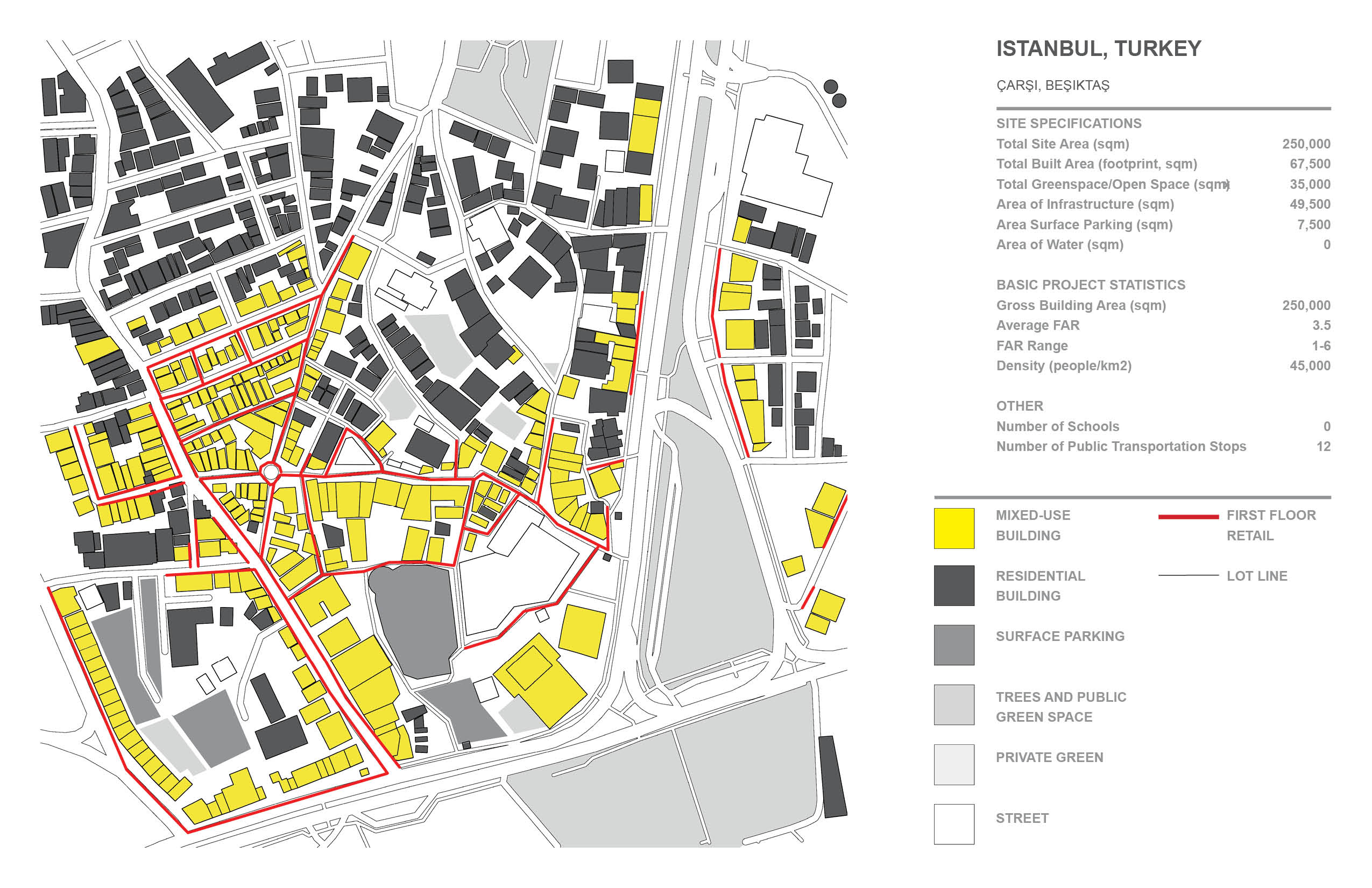
2. Beşiktaş Çarşı
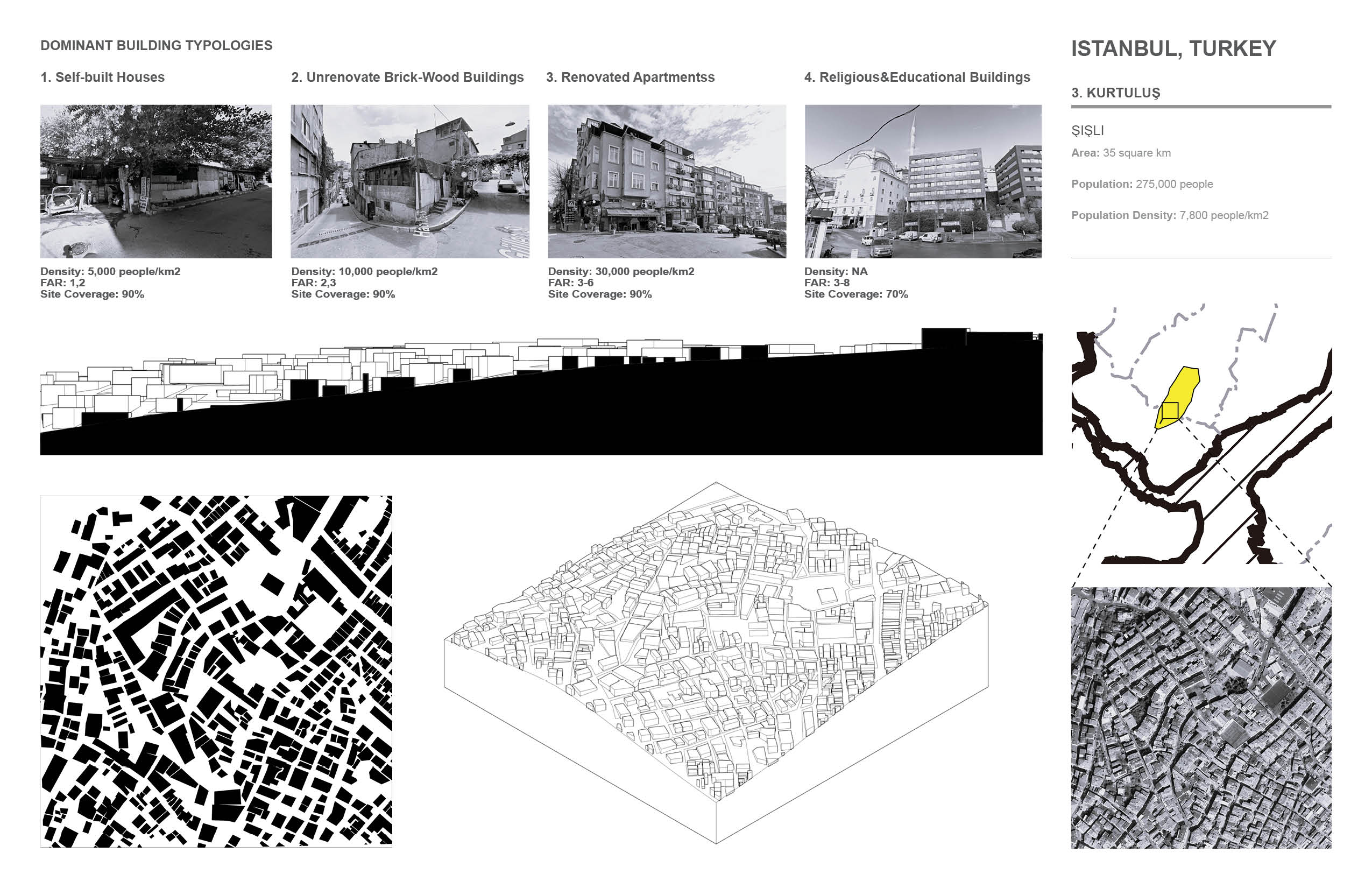
3. Kurtuluş

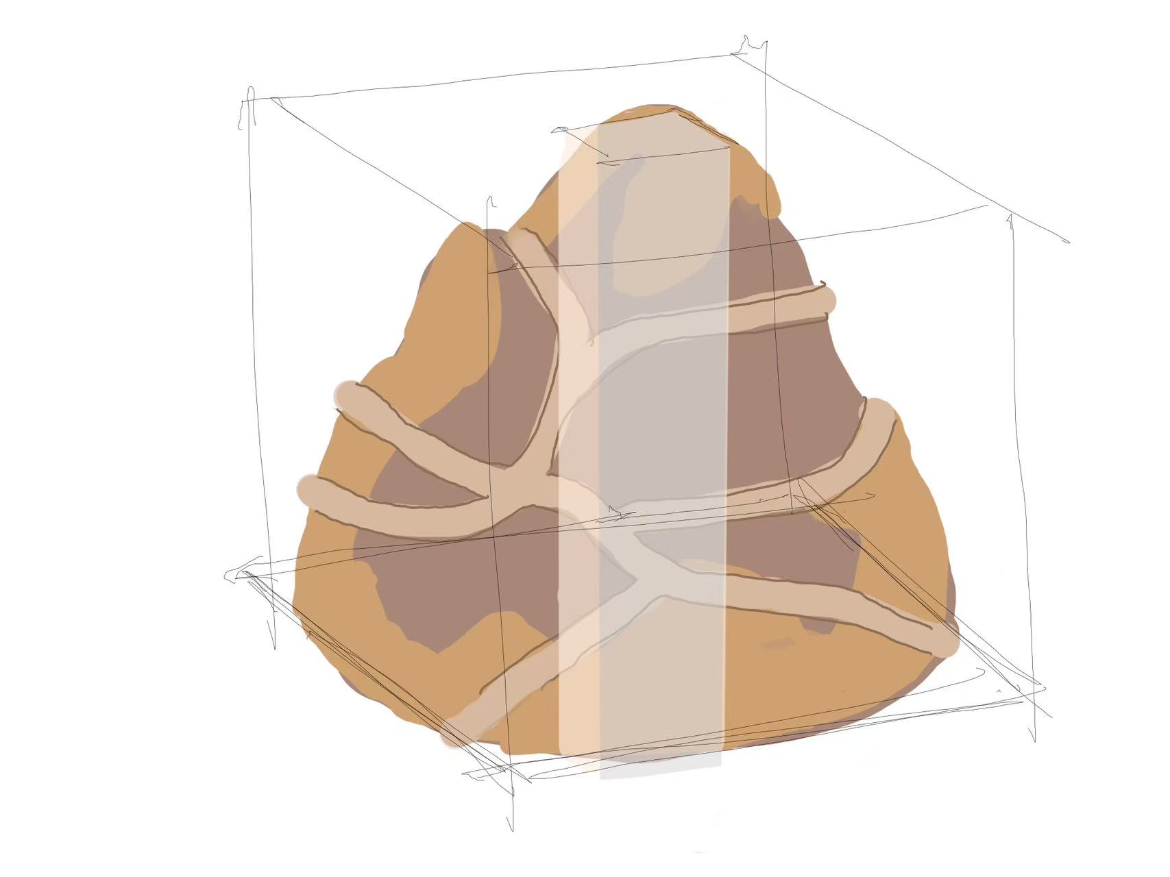
Living Between Mountains: A New Topography of Return
Istanbul’s urban fabric is a narrative of heights and lows, of walking and returning. People walk home up the rugged hillside, through the street stores, up the slopes, and finally to their own homes. This rhythm of life is a unique way of embedding the everyday in the “climb”.
However, the backyard space enclosed by street-level buildings in this city often becomes a neglected gray area, while those triangular plots of land sandwiched between the organic road network and the topography are accidentally transformed into green spaces shared by the neighbors. The informality and spontaneity of these urban spaces is one of the most moving qualities of Istanbul.
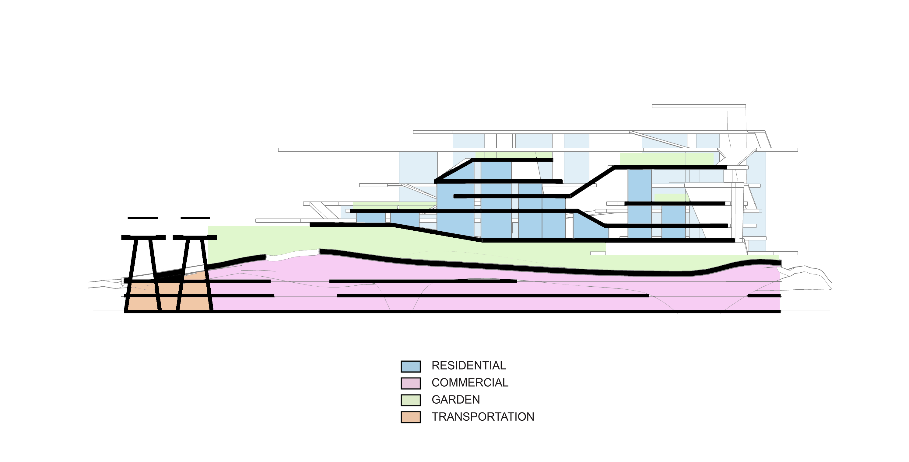
The project attempts to embed these spatial memories in a plain: the site is re-topologized and two “mountains” are artificially shaped. The first “mountain” is an overburdened park, whose surface is open to the public, while the ground floor accommodates a vibrant commercial space. The second ‘mountain’ is the building itself, which is undulating in form and ‘climbing’ in experience - through ramps, slopes and staggered floors, residents on their way back to their homes Through ramps and staggered floors, residents naturally come into contact with the green space on their way home, stopping and meeting each other. The residential volumes are ‘hidden’ in the mountain, like dwellings in a rock formation, invisible but deeply involved in the construction of the terrain. The site is connected to an elevated railroad station, which leads directly to the underground commercial area, where commuters step into a continuous network of green and public spaces as soon as they get off the train.
This is not a traditional above ground building with underground commerce, but an attempt to transform the path of “going home” into a rich spatial experience: life is embedded in the terrain, the community grows between the slopes, and the green space and the street are no longer destinations, but parts of daily life.