LXI. Osaka, Japan


Osaka, Japan
Osaka, Japan
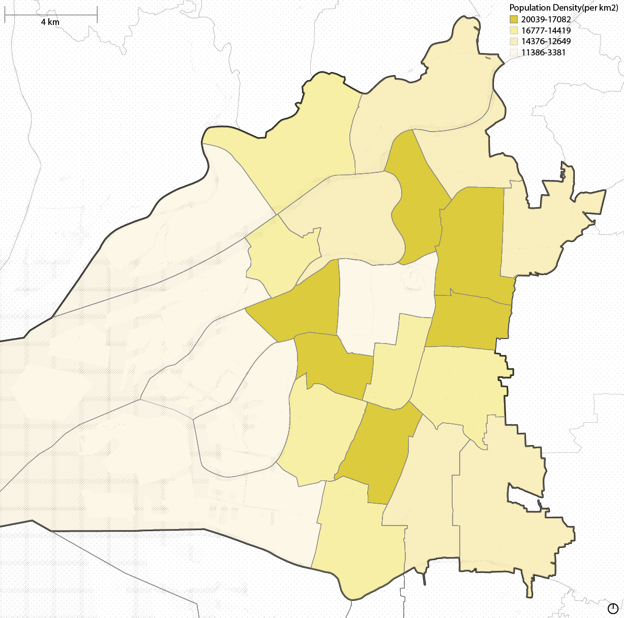
Osaka Prefecture, located in the Kansai region of Japan, is a vibrant and densely populated area centered around the bustling metropolis of Osaka City. Known for its rich history, modern architecture, and dynamic urban culture, the prefecture encompasses 33 municipalities, including Sakai, Higashiosaka, and Suita.
Population:
Urban: 11,000,000 people
Metro: 19,000,000 people
Area:
Urban: 223 square km
Metro (Osaka-Kyoto-Kobe): 13,033 km2
Population Density:
Urban Average: 12,110 people/km2
Metro Average:1,458 people/km2
Politics:
Osaka’s political landscape is dynamic, with a strong focus on regional governance and reform. The city and prefecture are key strongholds for the Japan Innovation Party (Nippon Ishin no Kai), which advocates for administrative reforms to enhance efficiency and competitiveness. A significant political issue has been the “Osaka Metropolis Plan,” which proposed merging Osaka City’s wards into larger administrative units to streamline governance and improve coordination between the city and prefecture. Osaka’s political priorities also include economic revitalization, urban development, and addressing challenges like population aging and disaster preparedness, which are central to its role in Japan’s broader political and economic framework.

FROM LEFT TO RIGHT
1 Rising demand for housing in central areas has driven up costs, making it challenging for lower-income residents
2 Heavy pedestrian and vehicular traffic during peak hours
3 Extensive railway and subway networks like JR and Osaka Metro make the city highly accessible, even in densely populated areas
4 Skyscrapers and underground malls (e.g., Osaka Station City and Namba Parks) optimize land use while providing integrated public spaces.


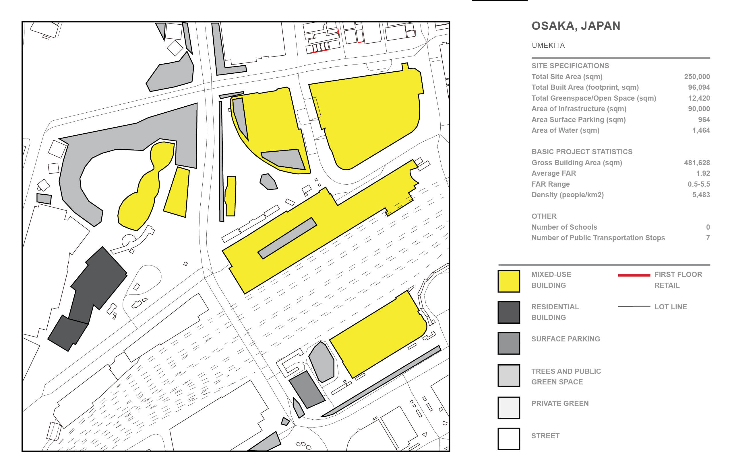
Osaka, Umekita

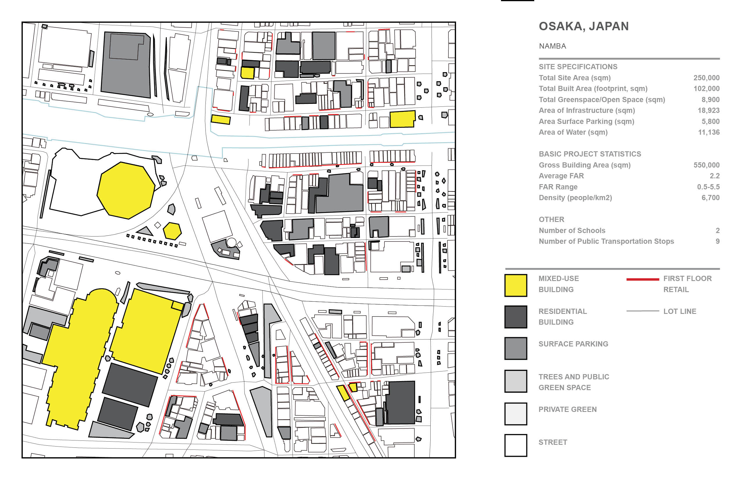
Osaka, Namba

Osaka, Tsukumodai


Kairo Tower: A Modular Beacon in Motion, Osaka, Japan
Rising from the heart of Osaka, Kairo Tower draws its name from the Japanese word (kairō), meaning “corridor” or “gallery”—a metaphor for fluid circulation, temporal transformation, and urban interaction. Rooted in Osaka’s identity as a historic port city and cultural hotspot, the tower’s base is constructed from recycled shipping containers—an ever-shifting urban marketplace that mirrors the energy of Dōtonbori’s nightlife and the port’s industrial legacy. These containers form a lively commercial plinth, designed to be rearranged and renewed as needs evolve, echoing the adaptable spirit of street markets and pop-up culture. Above, the tower transitions into layers of office and residential spaces, offering vertical density in a city where land is increasingly scarce. A monumental central atrium carves through the core, acting as a civic spine that visually and physically links all programs while channeling light and ventilation throughout the structure. At the tower’s side stands a massive crane—not just a tool of construction, but a permanent infrastructural element that embodies the project’s commitment to evolution. This crane enables modular pods and blocks to be hoisted, replaced, or reconfigured over time, allowing the tower to grow, morph, and respond to the shifting rhythms of urban life. Offices may become co-living spaces, homes may transform into workshops or greenhouses, and parts of the building might detach entirely to reappear elsewhere. Kairo Tower is not just a static object in the skyline; it is a dynamic organism—an adaptable system embedded in the socio-economic pulse of Osaka, where impermanence becomes a strategy for resilience, and architecture becomes both a stage and a participant in the choreography of city life.
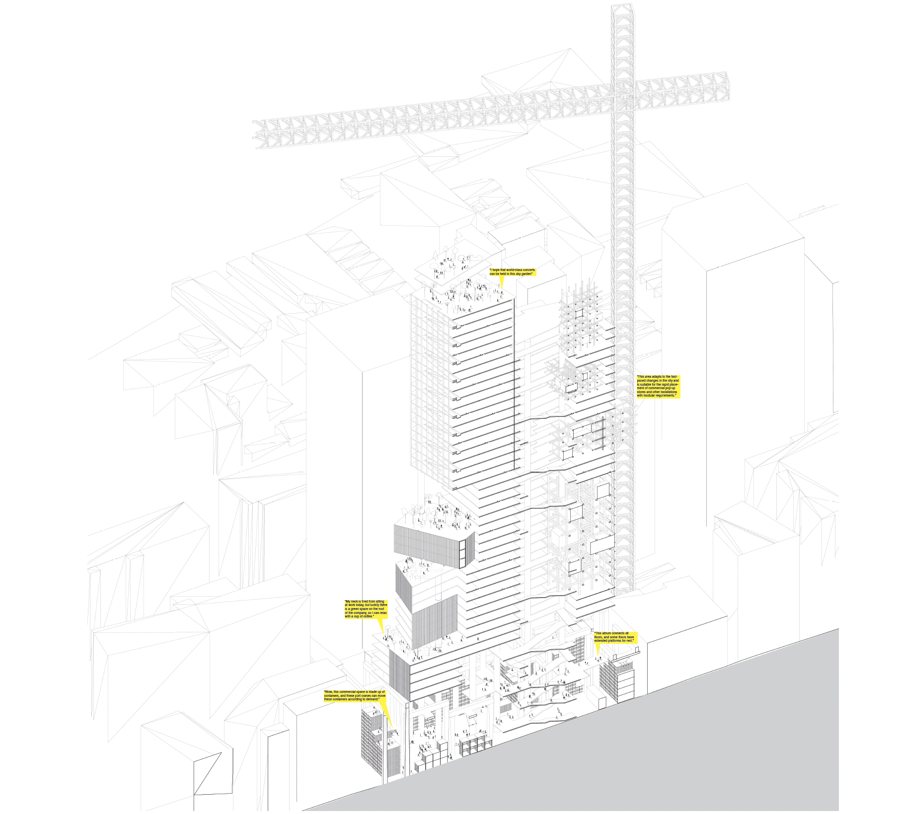
Axonometric View
![]()
![]()
Programmatic Section

Programmatic Section