LX.
Zürich, Switzerland


Zürich, Switzerland
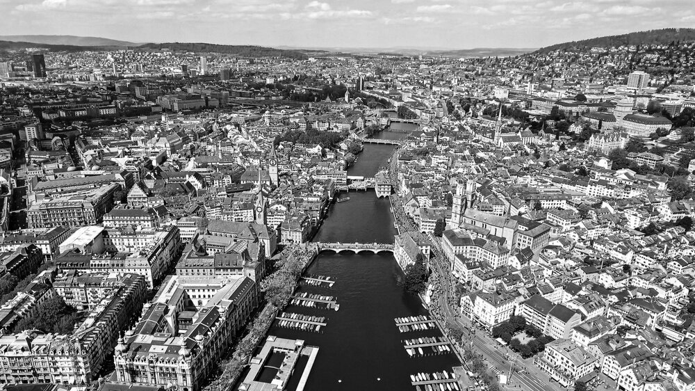
Zürich has the largest population of all cities in Switzerland. It is comprised of 12 districts, each one made up of one to two neighborhoods with the densest districts surrounding the city center. It is divided by the Limmat River which runs from the north-west into Lake Zürich. The entire metro area surrounds the northern portion of the lake and is nestled between mountainous regions to the east and west.
Switzerland is a very mountainous country with mountains definind the north-east and western boundaries of Zürich. The city center, though on a flatter portion of terrain, is still quite hilly. The southern portion of Zürich is along the coast of Lake Zürich where the Limmat River empties. It offers many spaces for people to gather and enjoy the crystal-clear water coming from melted snow from the surrounding mountain tops. Zürich has many options for public transportation including streetcars, buses, trains, and even water taxis. These all create a network which easily connects all 12 districts in the metropolitan region.
Zürich became Switzerland’s financial center around the end of the 19th century. After World War II, there was an influx of immigrants from abroad as well as rural Swiss areas, and that led to a leap in population. It was around this time that the population hit one million people. One third of the population is immigrants, most coming from Italy, Germany, Portugal, and the Balkans. Much of the current population growth can be attributed to incoming Ukranian refugees due to conflict occurring in that region.
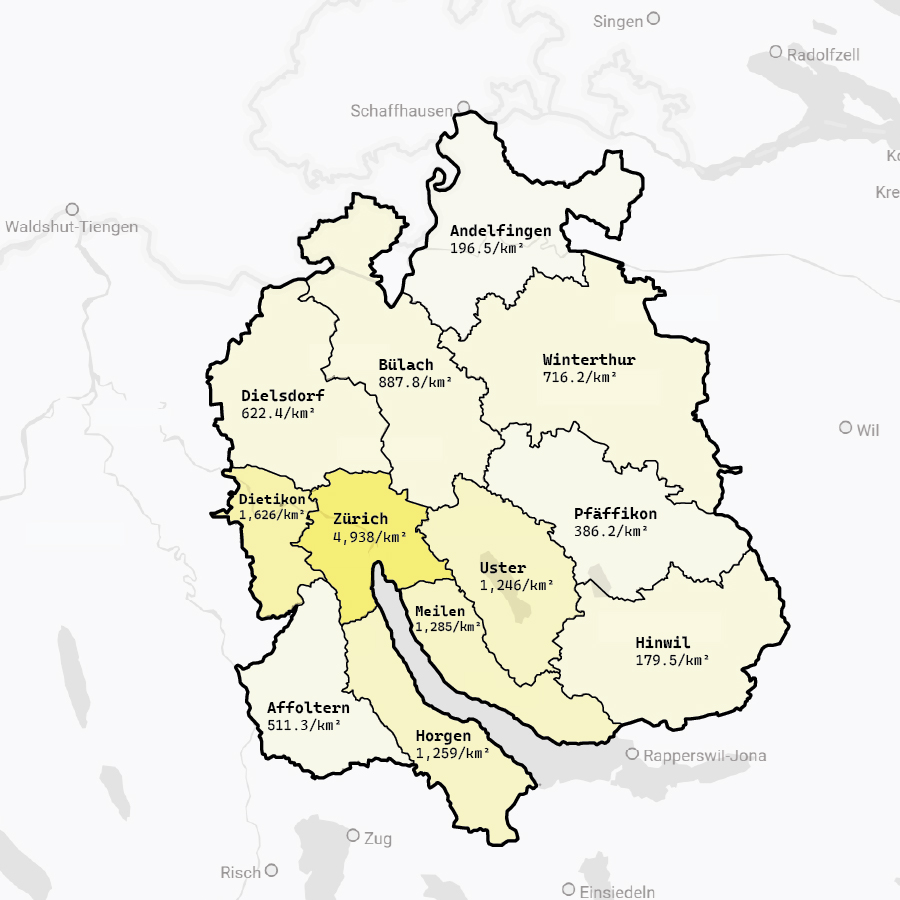
Population:
Urban: 433,989 people
Area:
Urban: 87.88 square km
Metro: 1729 square km
Population Density:
4938 people/km2
Politics:
Zürich’s political rulings are determined by its communities. They have the ability to vote on laws, legistlative proposals, and members of their governing body. The governing body consists of the City Council which is the executive portion of the government and the Municipal Council which consists of parliament and legislature. These positions are voted on by Zürich’s residents every four years. The responsibilities of the Government Council include, but are not limited to, managing cantonal administration; preparing the budget; drafting laws, amendments, and legislation; and negotiating agreements between nations and cantons.

From Left to Right : Munsterhof, Napfbrunnen, Bahnhofstrasse, Rennweg
![]() Zürich
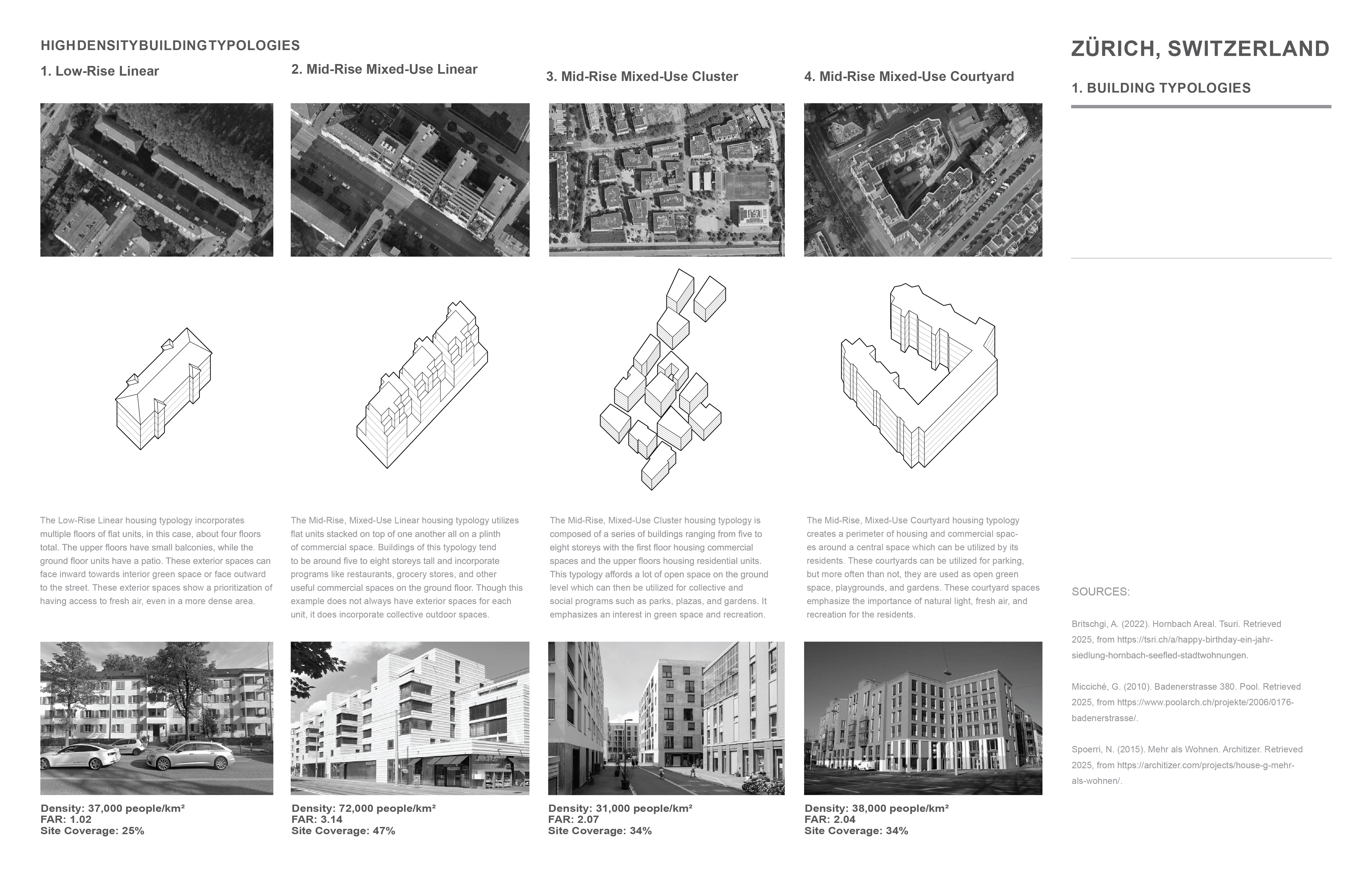
- High-Density Housing Typologies
Zürich
- High-Density Housing Typologies![]() Zürich
- Urban Void Spaces
Zürich
- Urban Void Spaces
 Zürich
- High-Density Housing Typologies
Zürich
- High-Density Housing Typologies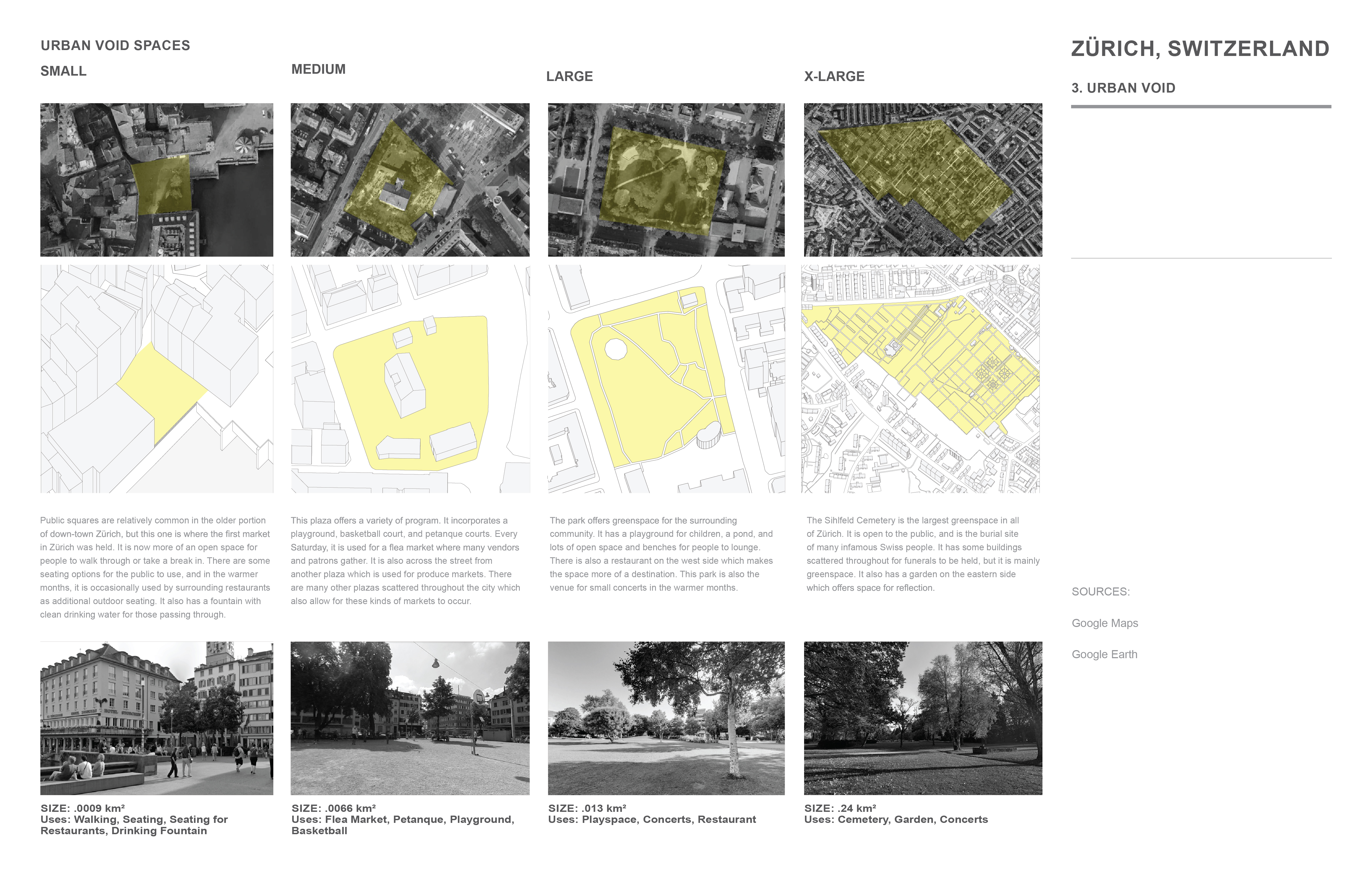 Zürich
- Urban Void Spaces
Zürich
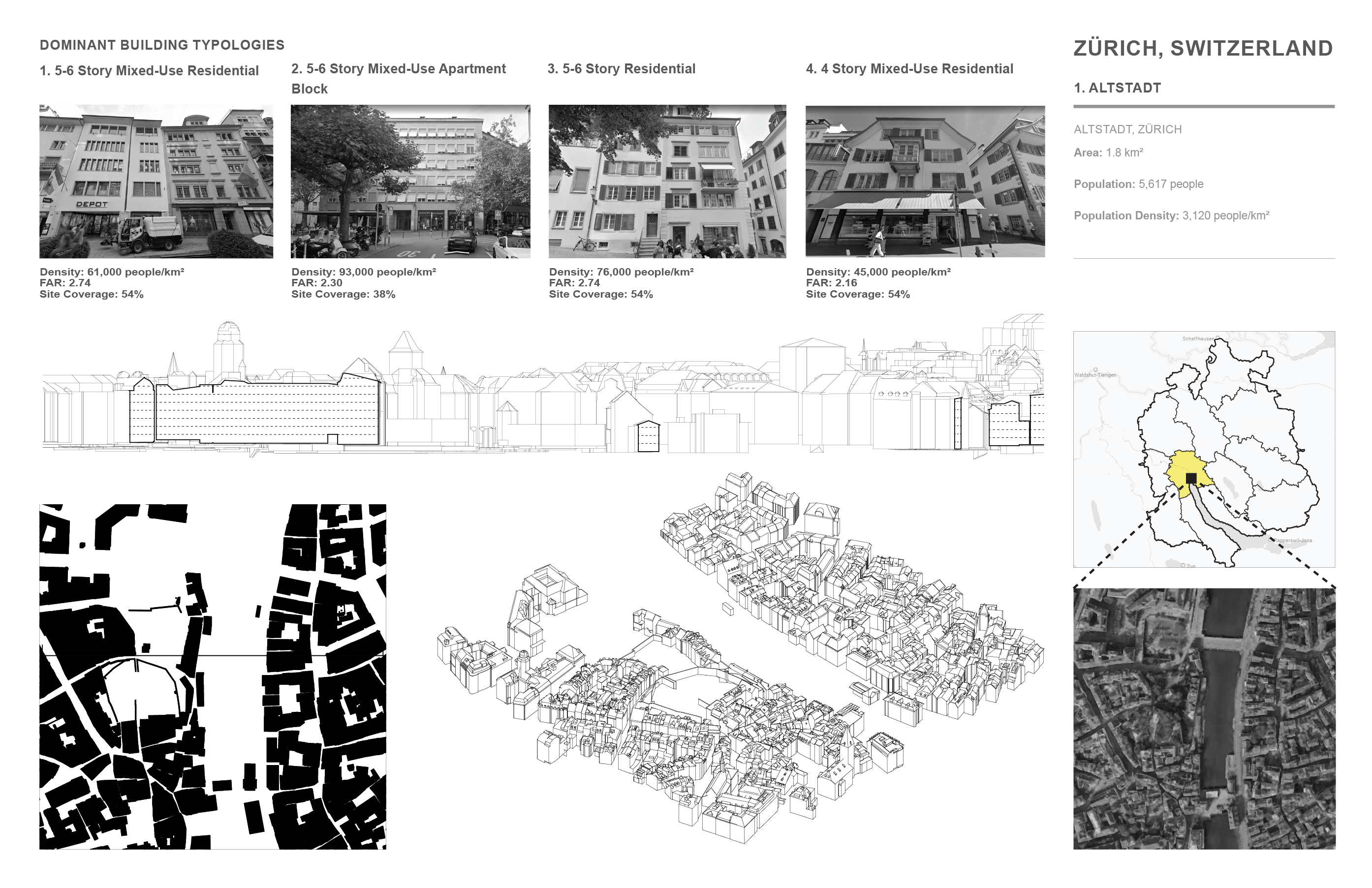
- Urban Void SpacesZürich, Switzerland - Altstadt:
Area: 1.8 square km
Population: 5,617 people
Population Density: 3,120 people/km2

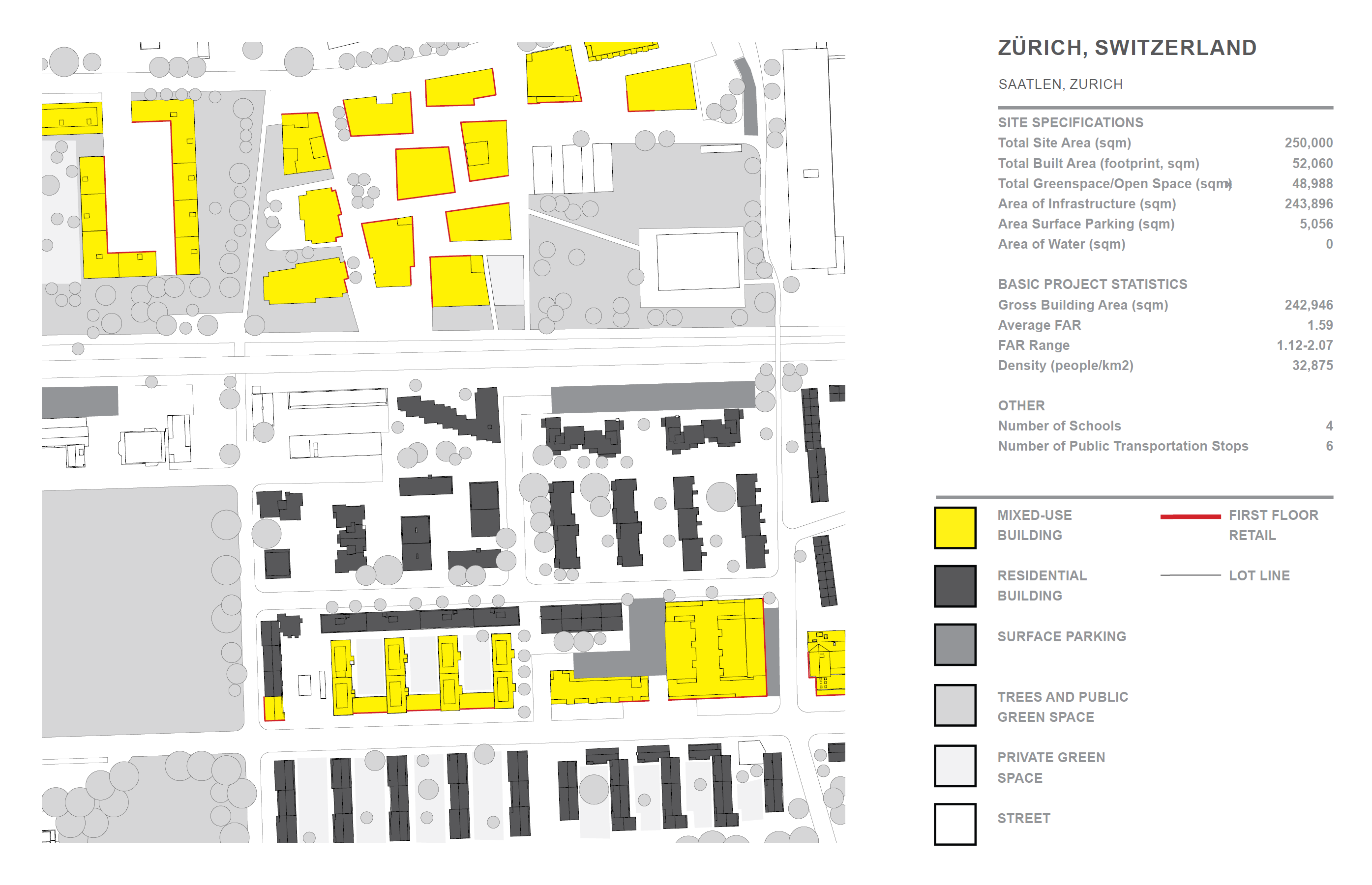
Zürich, Switzerland - Saatlen:
Area: 1.13 square km
Population: 6,727 people
Population Density: 5,963 people/km2

Zürich, Switzerland - Fluntern:
Area: 2.84 square km
Population: 7,325 people
Population Density: 2,579 people/km2


Street Sweep | Chicago, Illinois
Street Sweep is located in Chicago, Illinois and takes inspiration from mixed-use residential buildings in the Altstadt neighborhood of Zurich, Switzerland. It is in the downtown area of Chicago where a majority of residential buildings lack green space and access to fresh air. To combat this issue, it combines outdoor programs with a walkable, vertical streetscape weaving throughout residential spaces.
The building is organized by a series of street-like levels which are bordered by mixed-use residential buildings with commercial spaces on the lowest floor of each. The different street typologies included are a corner, a plaza, a boulevard, a convergence, and an avenue. All of these streets are connected by a series of ramps to create a continuous path from the street at the ground level to the top of the building. Along the path upwards, there is also a series of amenities such as a pool, a basketball court, a playground, and a greenhouse. People walking through will also encounter a shaded plaza, a microforest, and a butterfly garden.
There are two other points of connection to the rest of the city through an 'L' stop on the second level and an extension of the riverwalk on the ground floor encouraging those passing by, or through, to instead venture upwards.

Site Plan
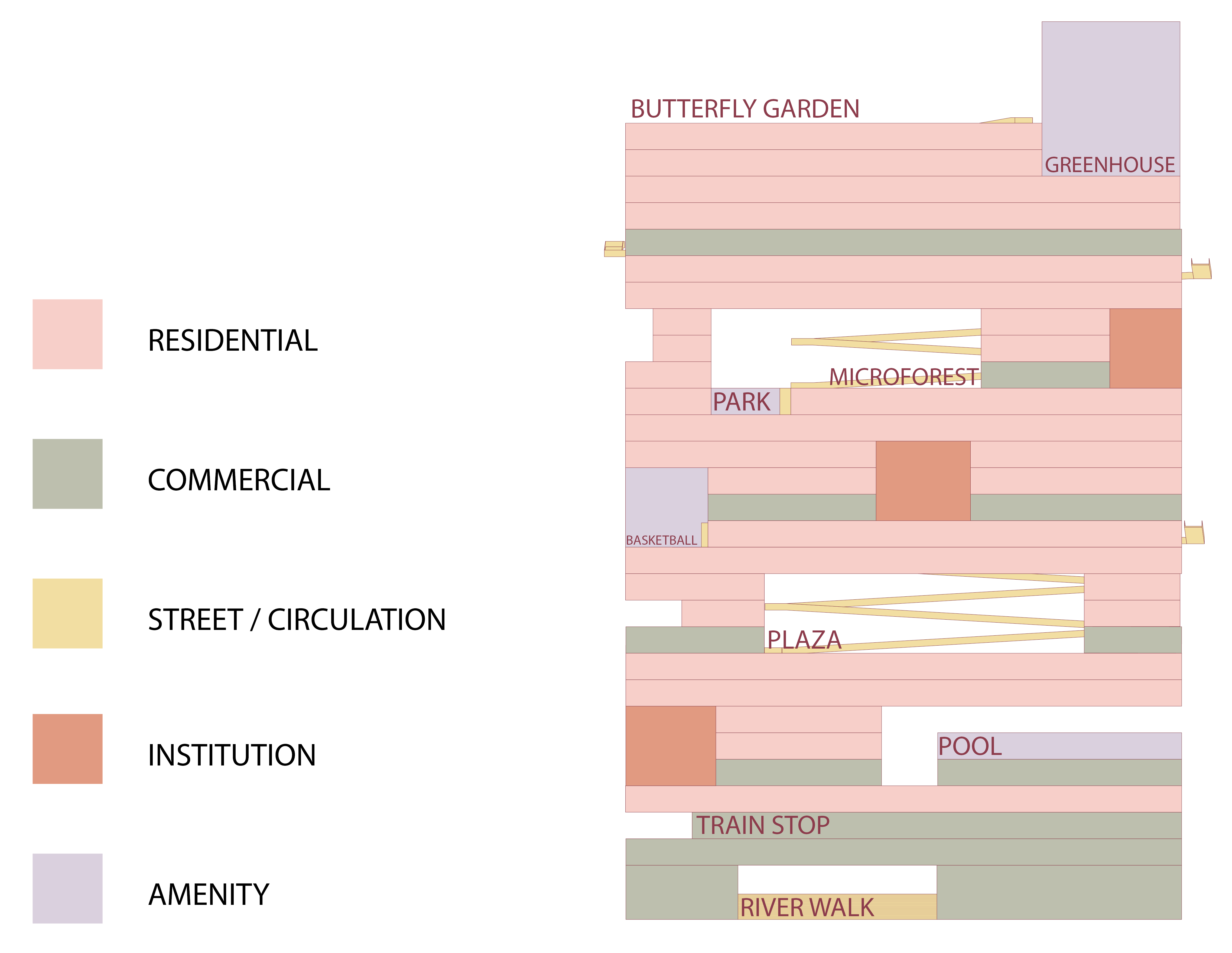
Programmatic Section
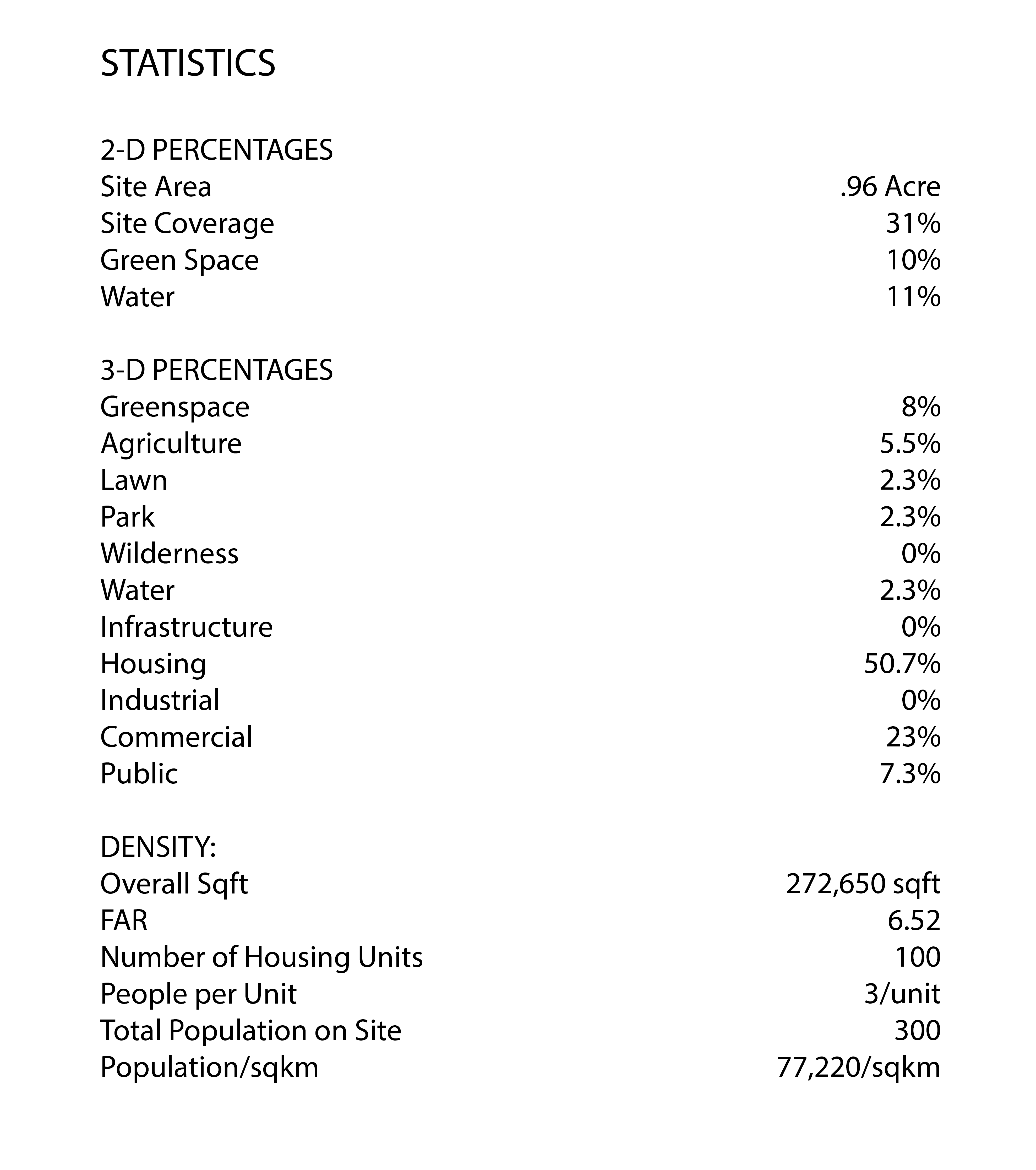
Statistics

Axonometric View