LIV . Tokyo, Japan
Tokyo, Japan

Tokyo, Japan — Shinjuku

Left: Shinjuku, CBD.
Right: Shinjuku, City Center.
Tokyo District Map:

Manila, Philippines
Population:
Urban: 13,440,500 people
Metro: 38,326,500 people
Area:
Urban: 2,193.3 km2
Metro: 13,572 km2
Population Density:
Urban: 6,354 people/km2
Metro: 2,654 people/km2
Politics:
In Tokyo, the governor is elected through a direct popular vote for a term of four years. The Tokyo Metropolitan Assembly, serving as the prefectural parliament, is elected through a mixed-member proportional representation system, combining single-member districts and proportional representation, with its members serving a four-year term as well. Tokyo is governed as a metropolis, which means it functions as both a city and a prefecture. The governor of Tokyo serves as the head of the Tokyo Metropolitan Government


FROM LEFT TO RIGHT
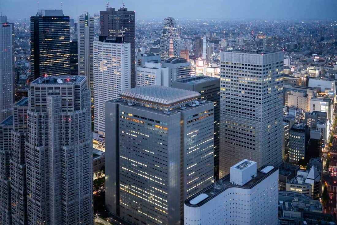
1 AERIAL VIEW OF SHINJUKU, TOKYO - SHOWING VARIATIONS IN TYPOLOGIES
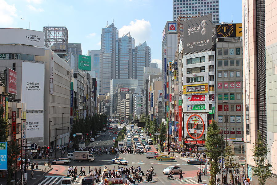
2 VIEW OF A PUBLIC SQUARE IN SHINJUKU
3 PARK IN SHINJUKU
4 NIGHT VIEW OF SHINJUKU
1 AERIAL VIEW OF SHINJUKU, TOKYO - SHOWING VARIATIONS IN TYPOLOGIES
2 VIEW OF A PUBLIC SQUARE IN SHINJUKU
3 PARK IN SHINJUKU
4 NIGHT VIEW OF SHINJUKU
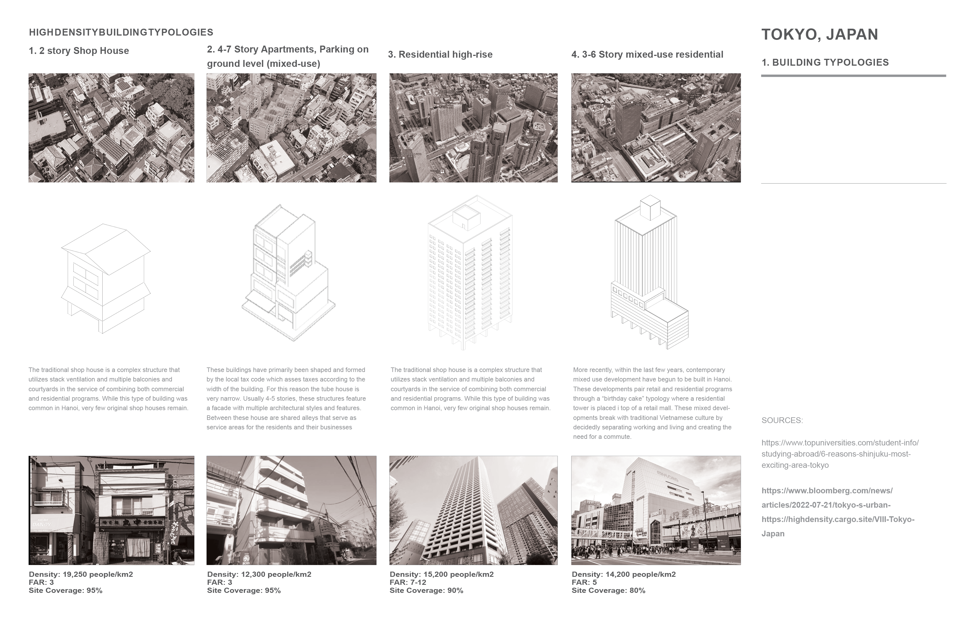
Tokyo, Japan. High Density Buildig Typologies
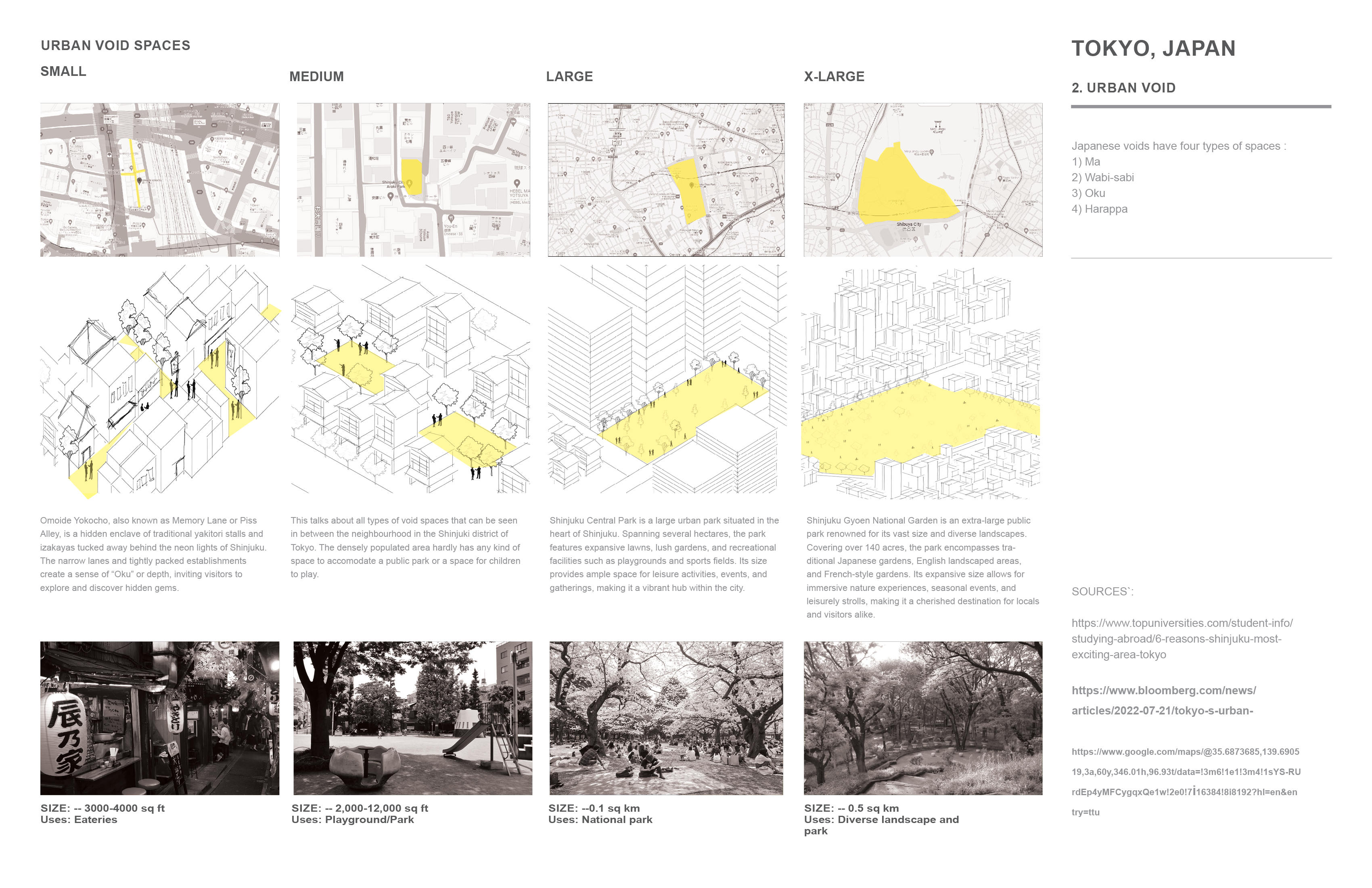
Tokyo, Japan. Urban Void Spaces
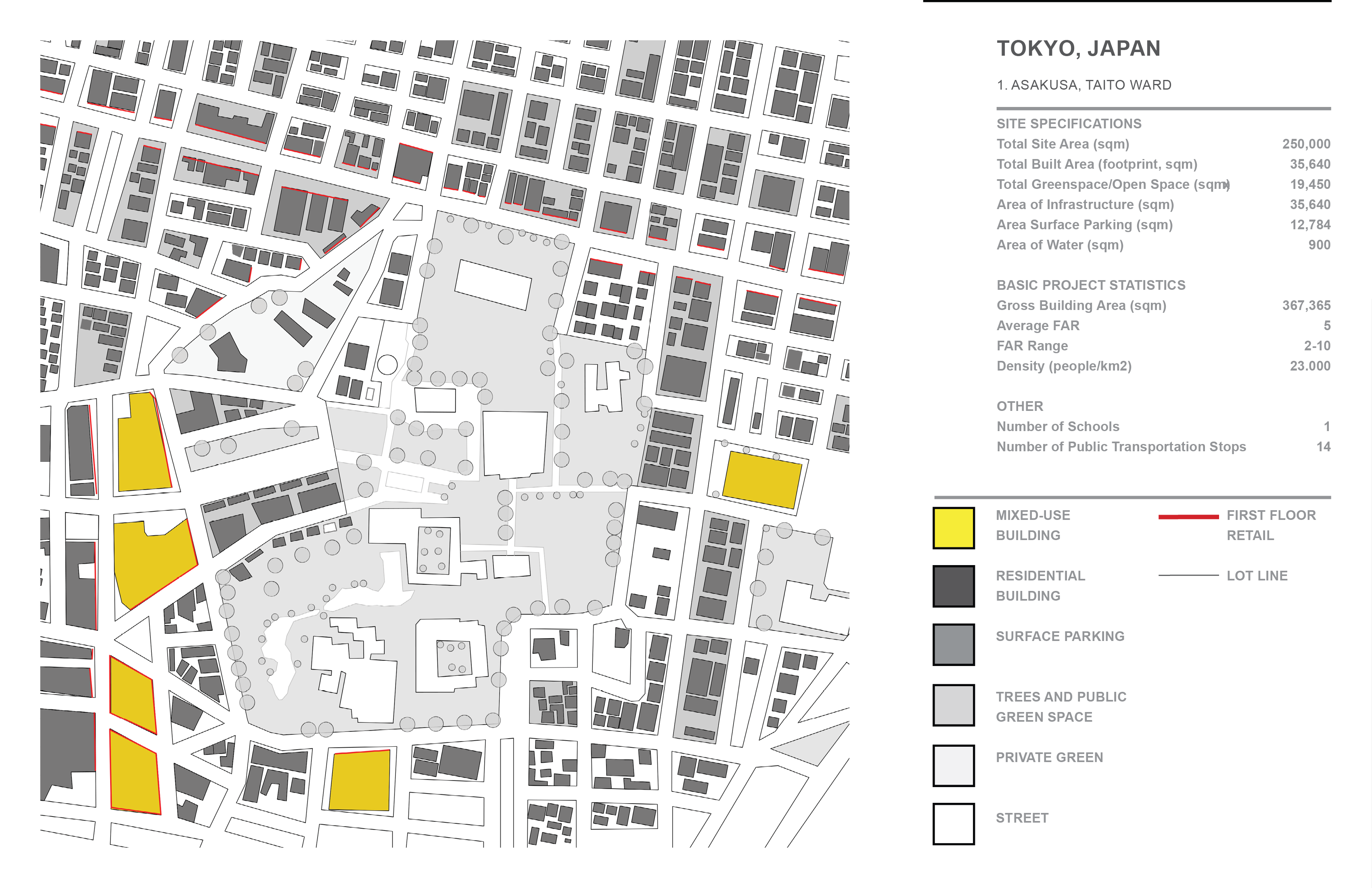
ANALYZING URBAN FABRIC
1. Asakusa, Taito Ward:

2. Shinjuku District:


3. Shimokitazawa, Setagaya ward:


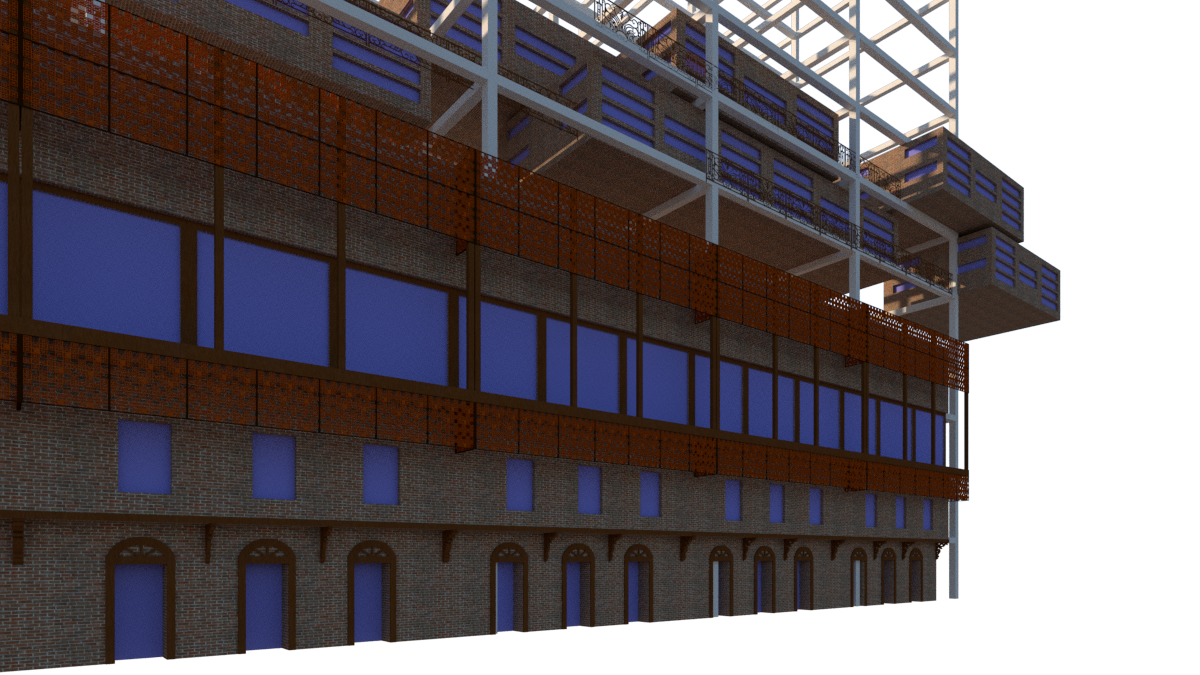
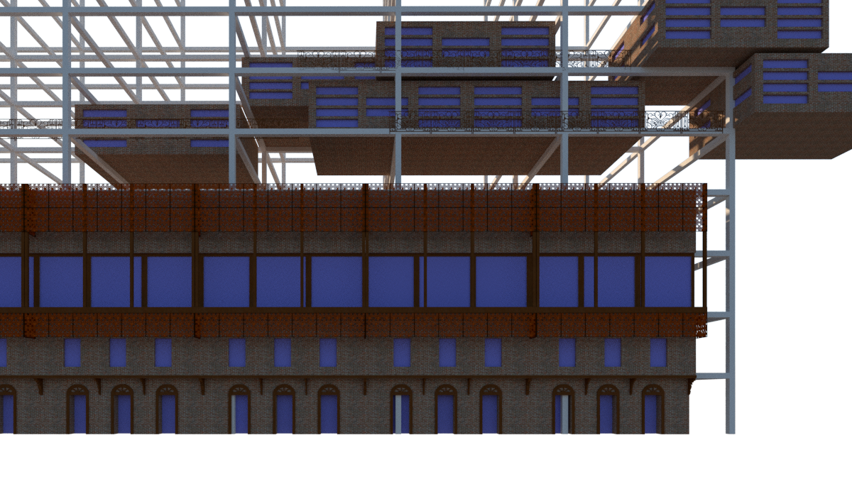
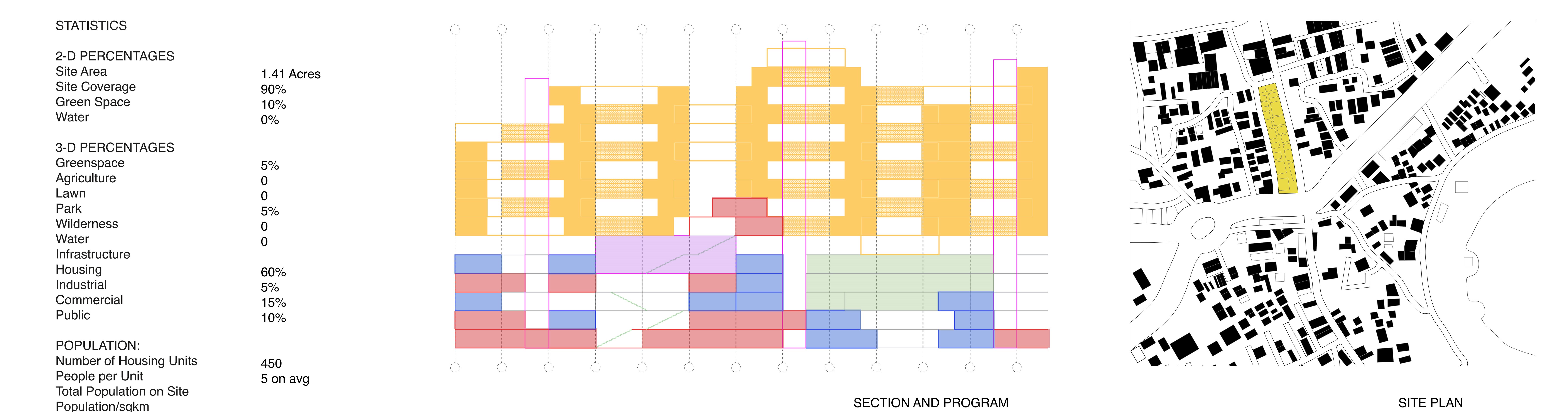
LINEAGE - Vertical City Reimagining heritage structures of Surat, Surat, Gujarat, India
NEED FOR THE DEVELOPMENT, the follwoing is a proposed develpment in Rander area, an area which houses oldest and traditional houses of the city, in future as per the population increases and infrastructure redevelopment will be required, the area will have to reimagined keeping in mind the heritage of the city and also optimizing land use in the area, Urban renewal, An increased density and Preservation of heritage. A survey was conducted which said there were people who with the time wanted to shift towards the more developed area of the city. However their were many who did not want to shift, but the government plan on developing the old and historical area of the city into a mixed use or institutional zone which would help in promoting rich heritage. Keeping that in mind, the idea is to propose something which is flexible and can be converted into multiple uses as per the requirements and also giving options to the residents to expand the house as per their needs.

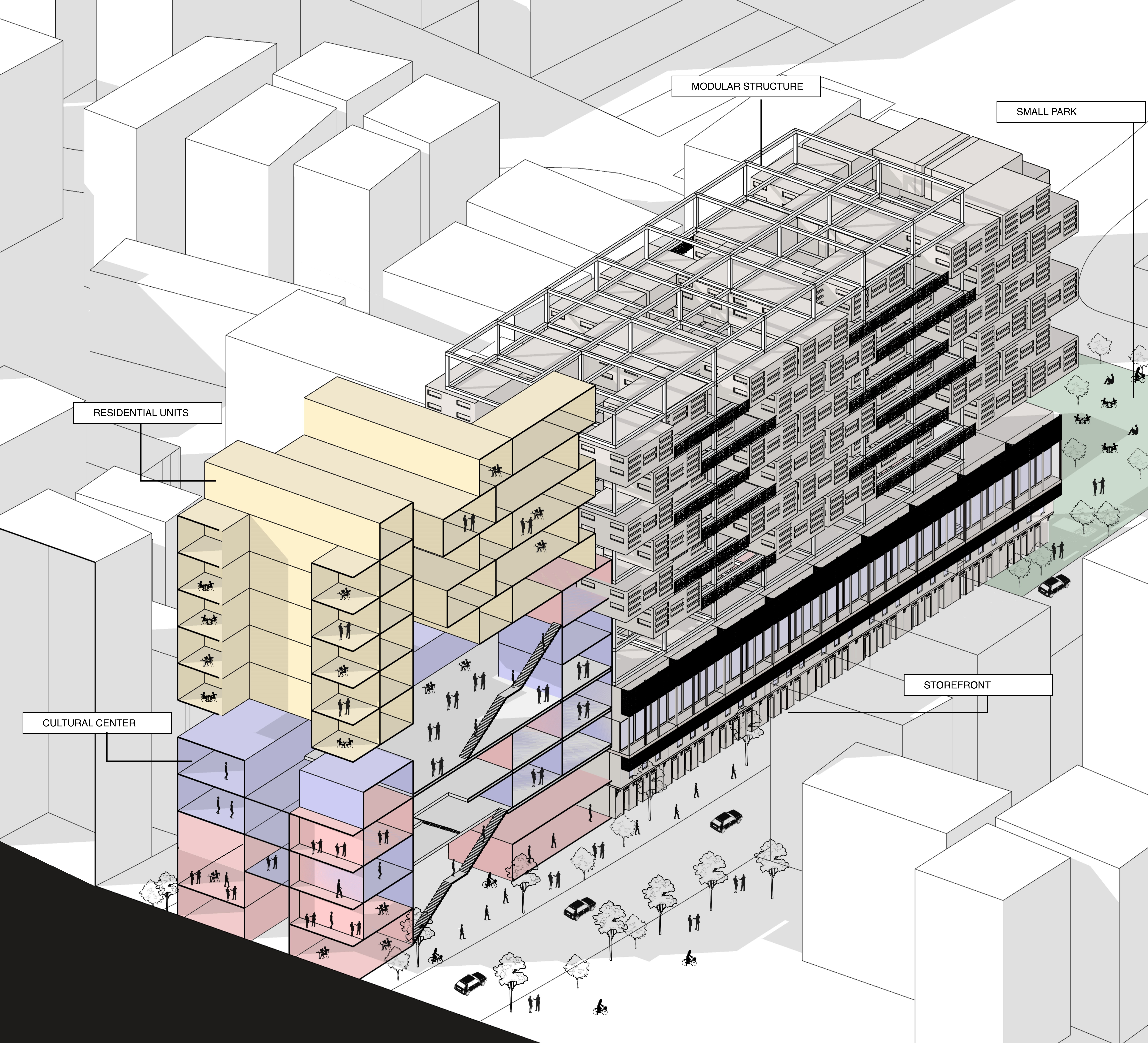
Section showing organisation of program
![]()
1.https://www.google.com/maps/
2.https://earth.google.com/
3.https://www.youtube.com/watch?v=fWt4LMzRuFo
4.https://en.wikipedia.org/wiki/Rander_Surat
5.https://en.wikipedia.org/wiki/World Heritage City
6.https://issuu.com/manavsumara2054/docs/pride_of_surat_documentation_book
7.https://wordpress.com/2014/05/28/favourite-vintage-building-in-rander/
8.https://cadmapper.com/Surat6.https://issuu.com/manavsumara2054/docs/pride_of_surat_documentation_book
7.https://wordpress.com/2014/05/28/favourite-vintage-building-in-rander/